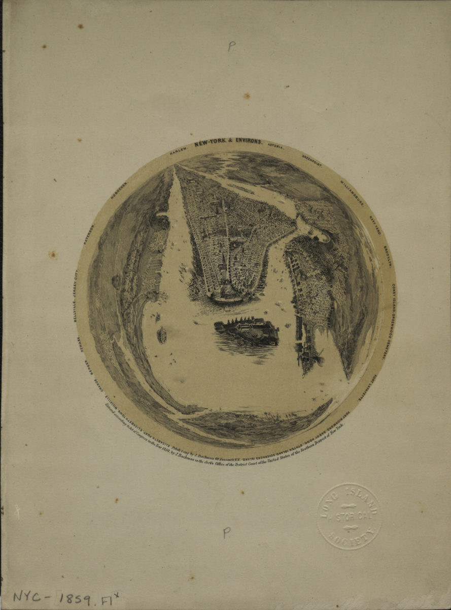
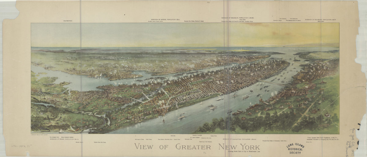
New York & environs: Astoria, Williamsburg, Navy Yard, Brooklyn, Coney Island, Greenwood Cemetery, Fort Lafayette, Fort Richmond, Sandy Hook, Staten Island, Governor’s Island, Elizabeth Port, Elizabeth Town, Millville, Orange, Newark, Bellville,
New York & environs: Astoria, Williamsburg, Navy Yard, Brooklyn, Coney Island, Greenwood Cemetery, Fort Lafayette, Fort Richmond, Sandy Hook, Staten Island, Governor’s Island, Elizabeth Port, Elizabeth Town, Millville, Orange, Newark, Bellville,
[ca. 1859]