Center for Brooklyn History
Map Collections
Search
About
Othmer Library & Archives
Submit search query
Refine 3 records
Clear filters
4
Location
Brooklyn (New York, N.Y.)
891
Fulton Ferry Historic District (New York, N.Y.)
5
New York (N.Y.)
164
Wallabout Bay (New York, N.Y.)
6
Subject
Bays
5
Landowners
434
Real property
619
Date
19th Century
945
or enter range:
from
to
Genres
Bathymetric maps
94
Cadastral maps
597
Historical maps
53
Manuscript maps
365
Pictorial maps
38
Sort by:
Date (earliest)
Date (most recent)
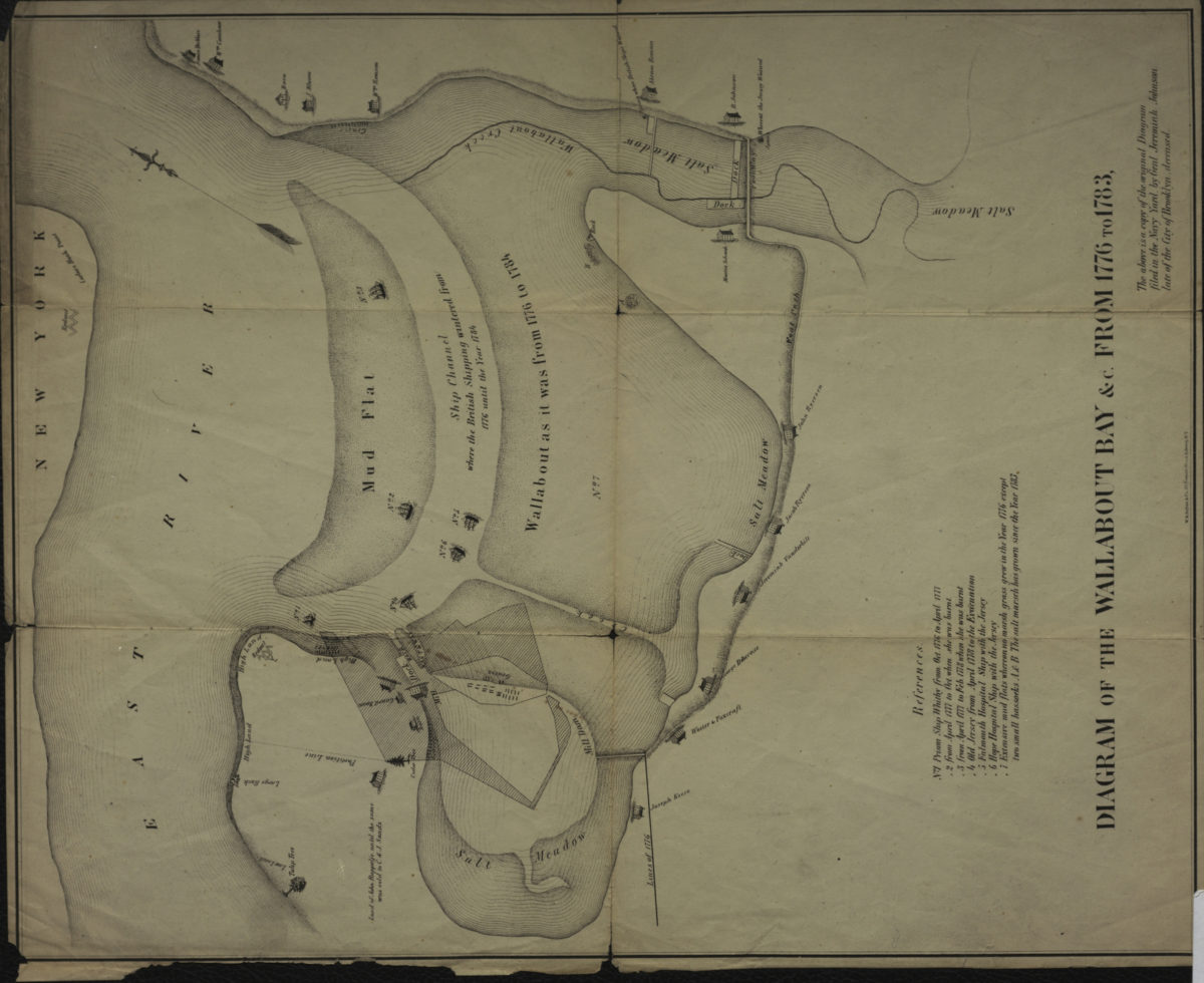
Diagram of the Wallabout Bay &c. from 1776 to 1783
Diagram of the Wallabout Bay &c. from 1776 to 1783
[18??]
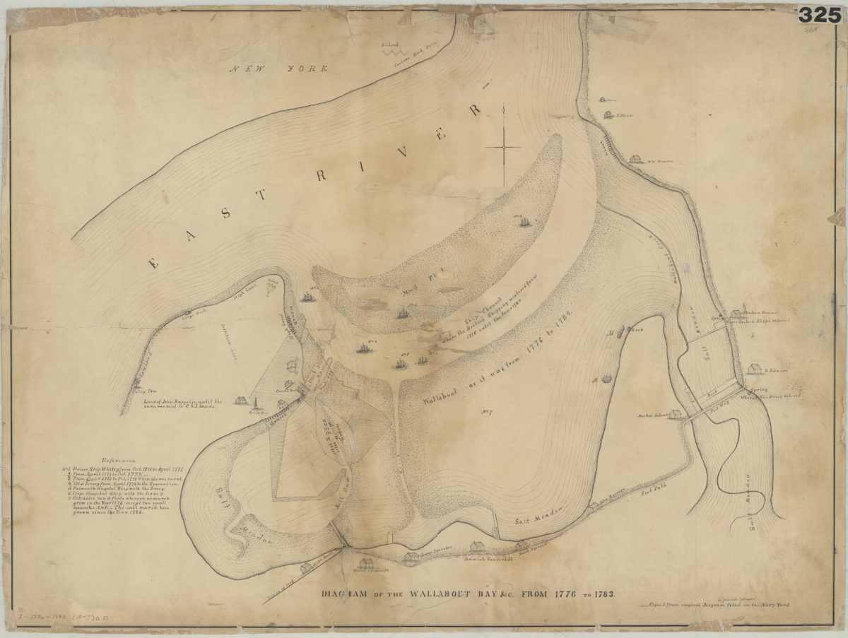
Diagram of the Wallabout Bay &c. from 1776 to 1783
Diagram of the Wallabout Bay &c. from 1776 to 1783
[18??]
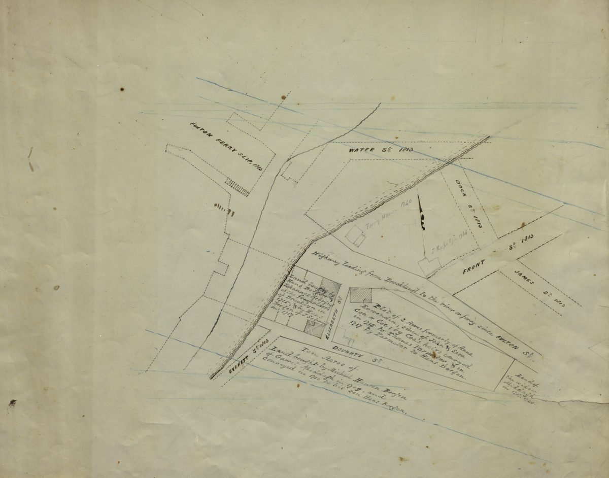
[Map of Hans Bergen’s land at Brooklyn Ferry]
[Map of Hans Bergen’s land at Brooklyn Ferry]
[ca. 1876]