Center for Brooklyn History
Map Collections
Search
About
Othmer Library & Archives
Submit search query
Refine 4 records
Clear filters
4
Location
Bedford-Stuyvesant (New York, N.Y.)
67
Boerum Hill (New York, N.Y.)
6
Brooklyn (New York, N.Y.)
891
Brooklyn Heights (New York, N.Y.)
76
Carroll Gardens (New York, N.Y.)
21
Clinton Hill (New York, N.Y.)
10
Cobble Hill (New York, N.Y.)
7
Crown Heights (New York, N.Y.)
25
Downtown Brooklyn (New York, N.Y.)
29
Fort Greene (New York, N.Y.)
22
Gowanus (New York, N.Y.)
12
Park Slope (New York, N.Y.)
16
Prospect Heights (New York, N.Y.)
16
Red Hook (New York, N.Y.)
19
Williamsburg (New York, N.Y.)
36
Subject
Auctions
32
Landowners
434
Real property
619
Streets
46
Date
19th Century
945
or enter range:
from
to
Genres
Advertisements
30
Broadsides
33
Cadastral maps
597
Map
191
Sort by:
Date (earliest)
Date (most recent)
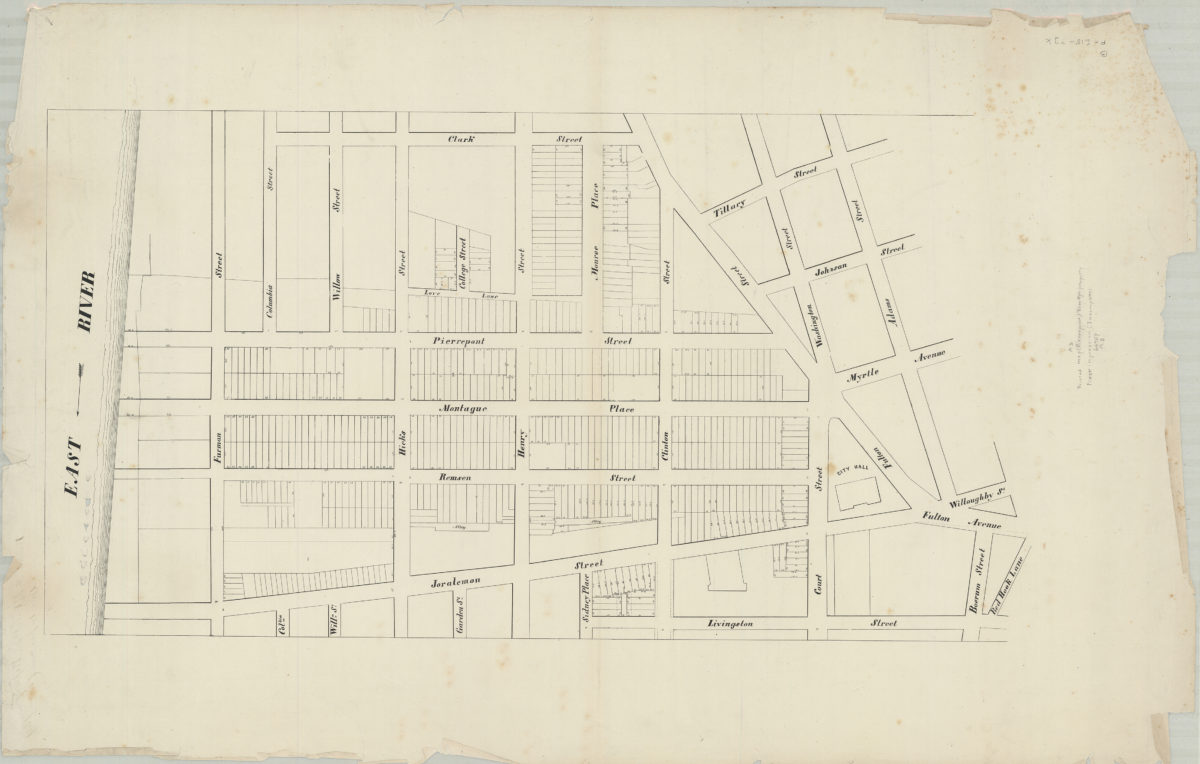
[Map of area bounded by Clark St., Adams St., Livingston St., and the East River]
[Map of area bounded by Clark St., Adams St., Livingston St., and the East River]
[18??]
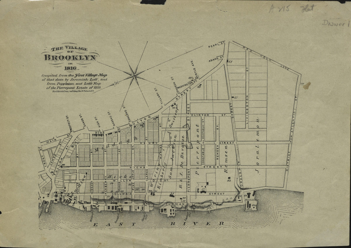
The village of Brooklyn in 1816: compiled from the First village map of that date by Jeremiah Lott and from Poppleton and Lott’s map of the Pierrepont Estate of 1819
The village of Brooklyn in 1816: compiled from the First village map of that date by Jeremiah Lott and from Poppleton and Lott’s map of the Pierrepont Estate of 1819
[18??]
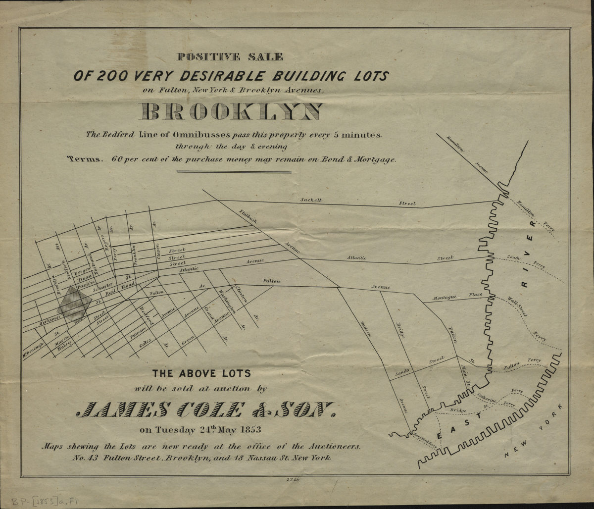
Positive sale of 200 very desirable building lots on Fulton, New York, & Brooklyn Avenues, Brooklyn
Positive sale of 200 very desirable building lots on Fulton, New York, & Brooklyn Avenues, Brooklyn
[1853]
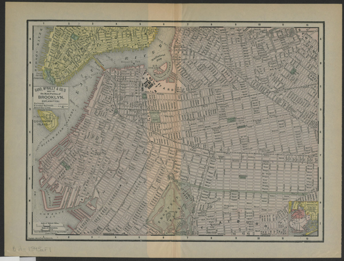
Rand, McNally & Co.’s map of the main portion of Brooklyn
Rand, McNally & Co.’s map of the main portion of Brooklyn
[1895; 1895]