Center for Brooklyn History
Map Collections
Search
About
Othmer Library & Archives
Submit search query
Refine 4 records
Clear filters
2
Location
Connecticut
7
Long Island (N.Y.)
197
New Jersey
27
New York (State)
95
New York Metropolitan Area
40
Rhode Island
2
Subject
Railroads
72
Date
19th Century
945
or enter range:
from
to
Genres
Bathymetric maps
94
Map
191
Transportation maps
120
Sort by:
Date (earliest)
Date (most recent)
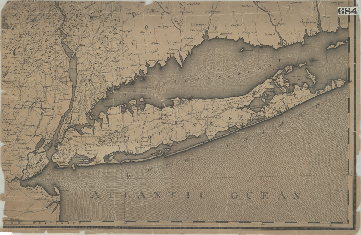
[Map of Long Island, the New York Metropolitan Area, and the southern coast of Connecticut]
[Map of Long Island, the New York Metropolitan Area, and the southern coast of Connecticut]
[18??]
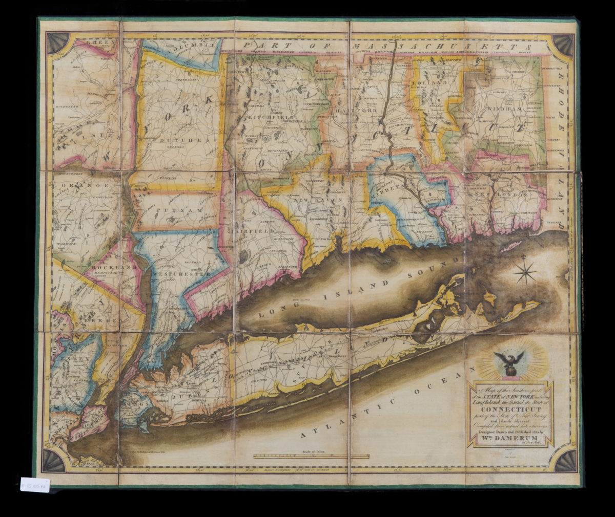
Map of the southern part of the state of New York including Long Island, the Sound, the state of Connecticut, part of the state of New Jersey and islands adjacent. Compiled from actual late surveys: designed, drawn … by Wm. Damerum
Map of the southern part of the state of New York including Long Island, the Sound, the state of Connecticut, part of the state of New Jersey and islands adjacent. Compiled from actual late surveys: designed, drawn … by Wm. Damerum
1815
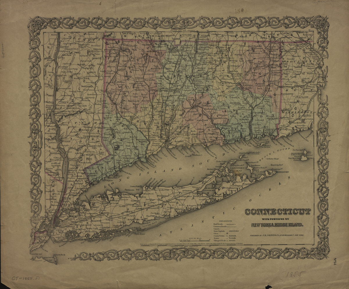
Connecticut: with portions of New York & Rhode Island
Connecticut: with portions of New York & Rhode Island
[1855]
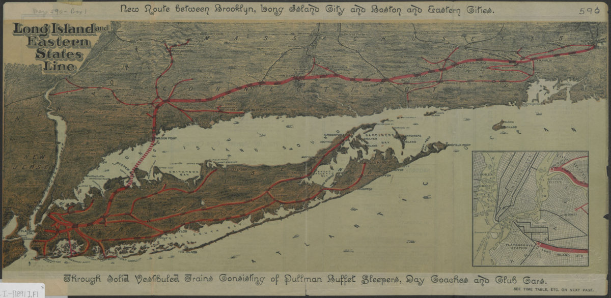
Long Island and Eastern States Line
Long Island and Eastern States Line
[1891]