Center for Brooklyn History
Map Collections
Search
About
Othmer Library & Archives
Submit search query
Refine 3 records
Clear filters
3
Location
Brooklyn (New York, N.Y.)
891
Gravesend (New York, N.Y.)
25
Midwood (New York, N.Y.)
9
Nottingham (New York, N.Y.)
2
South Greenfield (New York, N.Y.)
1
Subject
Landowners
434
Real property
619
Roads
117
Streets
46
Date
19th Century
945
or enter range:
from
to
Genres
Cadastral maps
597
Manuscript maps
365
Sort by:
Date (earliest)
Date (most recent)
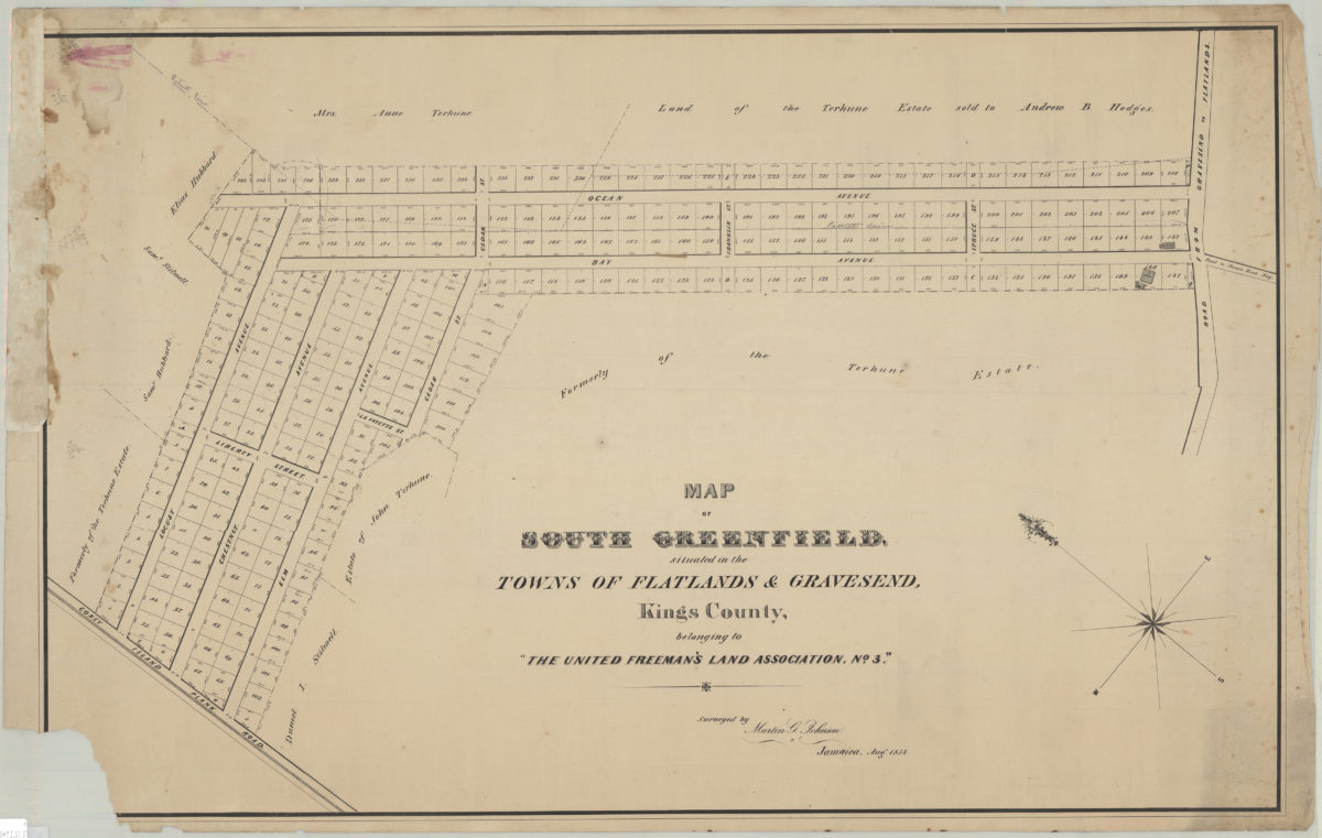
Map of South Greenfield, situated in the towns of Flatlands & Gravesend, Kings County, belonging to the United Freeman’s Land Assocation, no. 3: surveyed by Martin G. Johnson, Jamaica, Aug. 1854
Map of South Greenfield, situated in the towns of Flatlands & Gravesend, Kings County, belonging to the United Freeman’s Land Assocation, no. 3: surveyed by Martin G. Johnson, Jamaica, Aug. 1854
[1854]
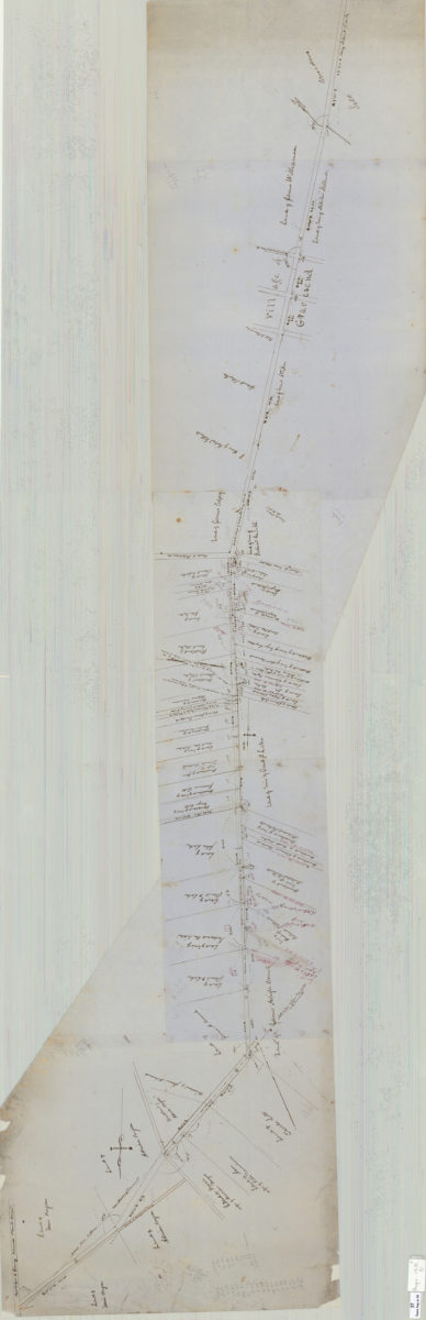
Map of route for a plank road from Coney Island Bridge Road to blacksmith shop, & therein along Wood Road. Patent line d[ivided] to mean: Teunis Bergen
Map of route for a plank road from Coney Island Bridge Road to blacksmith shop, & therein along Wood Road. Patent line d[ivided] to mean: Teunis Bergen
May 1855
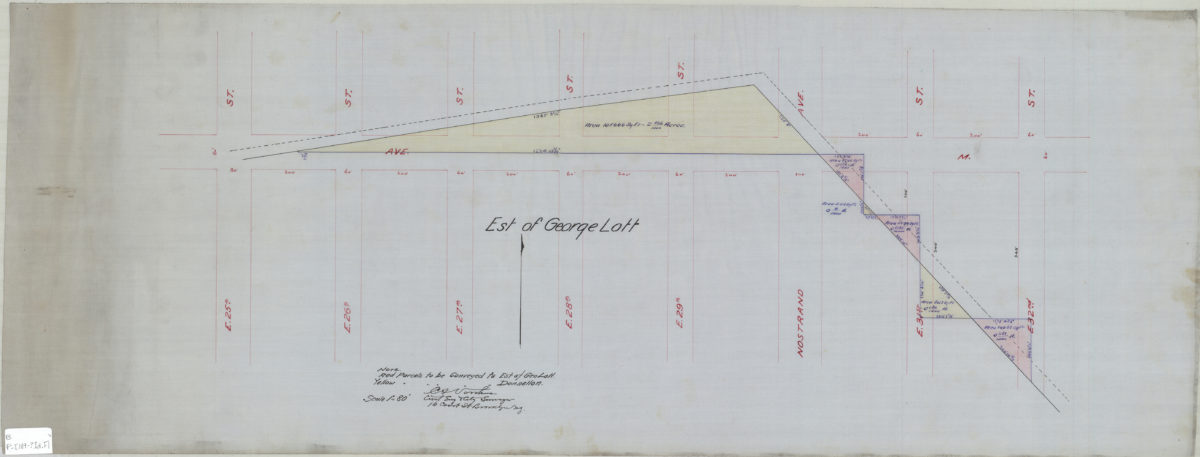
[Map showing estate of George Lott]: C.S. Voorhies, civil eng. & city surveyor
[Map showing estate of George Lott]: C.S. Voorhies, civil eng. & city surveyor
[189?]