Center for Brooklyn History
Map Collections
Search
About
Othmer Library & Archives
Submit search query
Refine 5 records
Clear filters
2
Location
Brooklyn (New York, N.Y.)
891
Long Island (N.Y.)
197
Manhattan (New York, N.Y.)
120
New York (N.Y.)
164
New York (State)
95
Southampton (N.Y.)
5
Suffolk (N.Y.)
1
United States
10
Subject
Fortification
7
Long Island, Battle of, New York, N.Y. , 1776
7
Date
19th Century
945
or enter range:
from
to
Genres
Cadastral maps
597
Map
191
Military maps
23
Sort by:
Date (earliest)
Date (most recent)
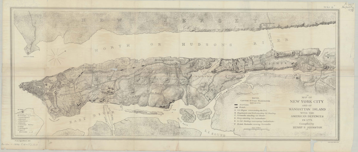
Map of New York City and of Manhattan Island with the American defences in 1776: compiled by Henry P. Johnston ; F. von Egloffstein del
Map of New York City and of Manhattan Island with the American defences in 1776: compiled by Henry P. Johnston ; F. von Egloffstein del
[18??]
Plan of the Battle of Long Island and of the Brooklyn defences, August 27th, 1776: compiled by Henry P. Johnston ; F. von Egloffstein, del
Plan of the Battle of Long Island and of the Brooklyn defences, August 27th, 1776: compiled by Henry P. Johnston ; F. von Egloffstein, del
[18??]
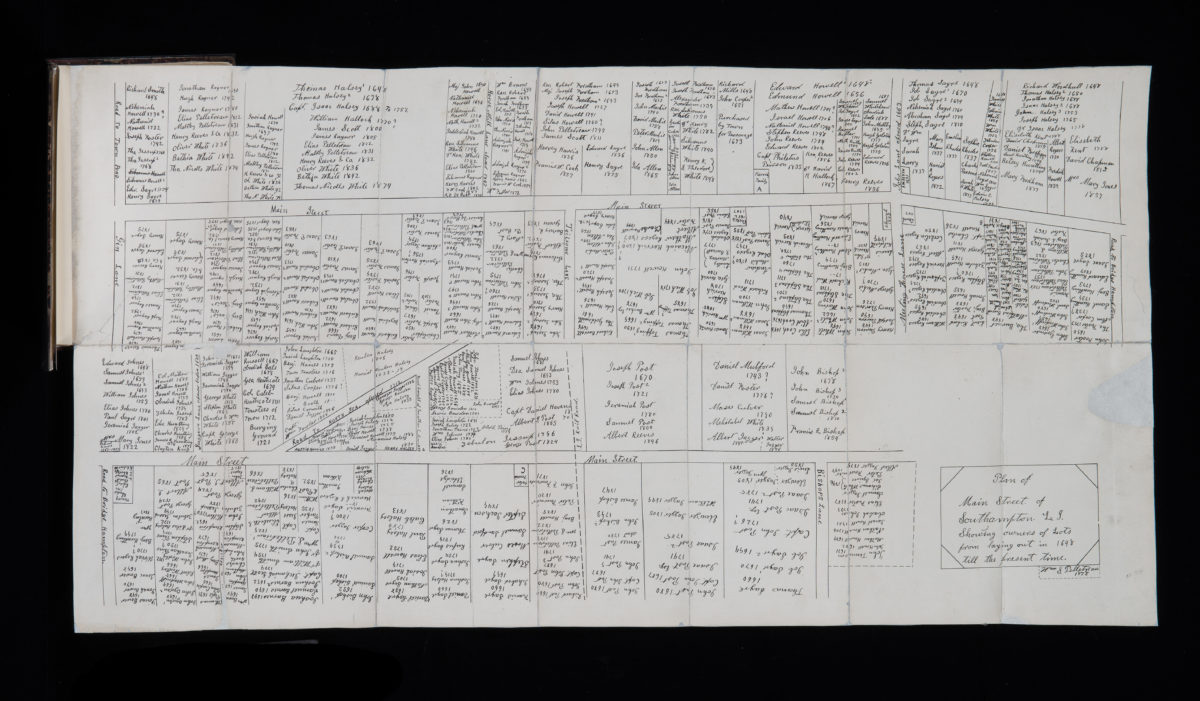
Plan of Main Street of Southampton, L.I., showing owners of lots from laying out in 1648 till the present time: by William S. Pelletreau
Plan of Main Street of Southampton, L.I., showing owners of lots from laying out in 1648 till the present time: by William S. Pelletreau
1878
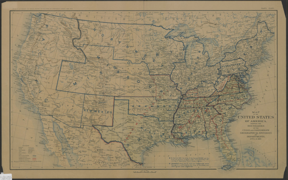
Map of the United States of America, showing the boundaries of the Union and Confederate geographical divisions and departments, April 9, 1865
Map of the United States of America, showing the boundaries of the Union and Confederate geographical divisions and departments, April 9, 1865
[188?]
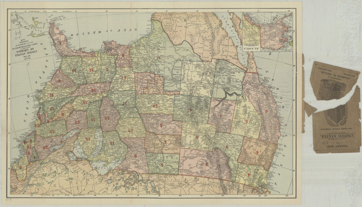
Map of the United States of America
Map of the United States of America
[1892]