Center for Brooklyn History
Map Collections
Search
About
Othmer Library & Archives
Submit search query
Refine 5 records
Clear filters
3
Location
ferries
1
Greenwich Village (New York, N.Y.)
1
Manhattan (New York, N.Y.)
120
New York (N.Y.)
164
Subject
Local transit
63
Subways
55
Date
20th Century
469
or enter range:
from
to
Genres
Historical maps
53
Pictorial maps
38
Tourist maps
55
Transportation maps
120
Sort by:
Date (earliest)
Date (most recent)
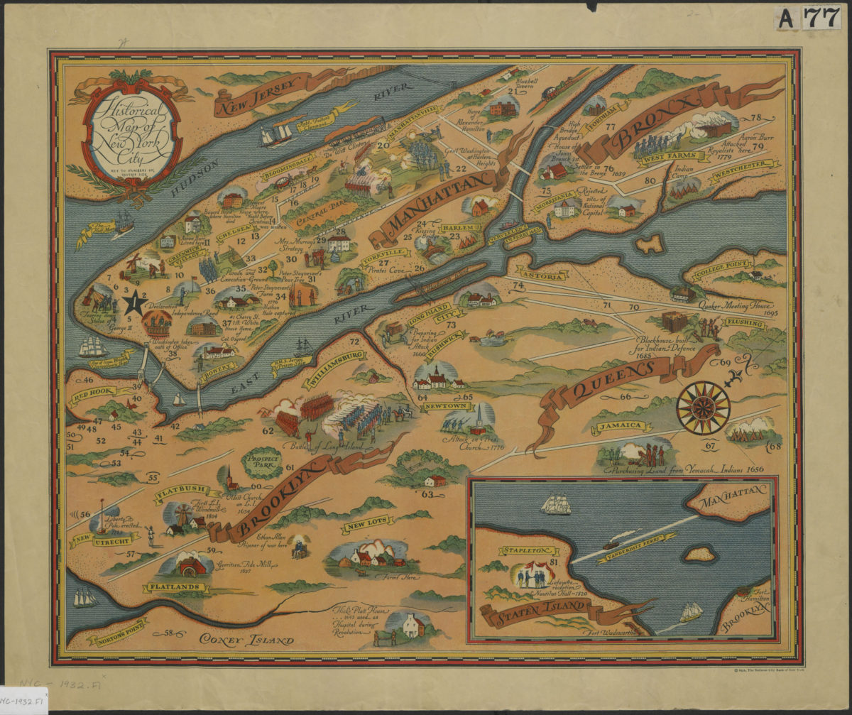
Historical map of New York City
Historical map of New York City
[ca. 1932]
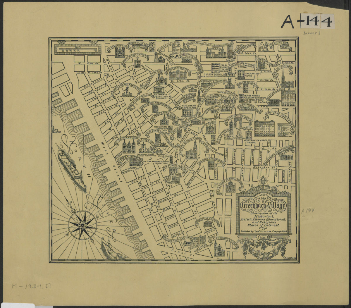
A map of Greenwich Village showing some of its historical, artistic, literary, educational, and religious places of interest
A map of Greenwich Village showing some of its historical, artistic, literary, educational, and religious places of interest
[1938; 1984]
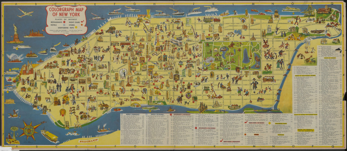
Colorgraph map of New York
Colorgraph map of New York
[ca. 1954]
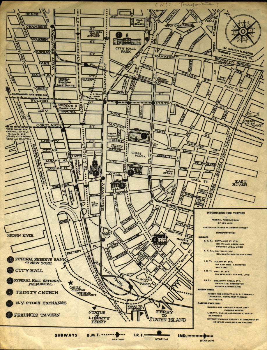
Information for visitors to Federal Reserve Bank of New York
Information for visitors to Federal Reserve Bank of New York
[1956-1966]
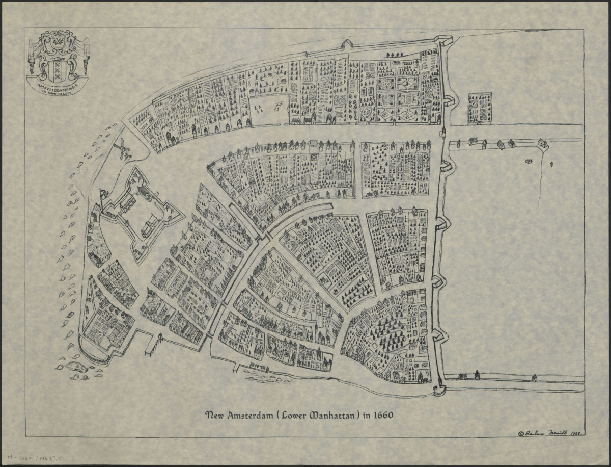
New Amsterdam (Lower Manhattan) in 1660
New Amsterdam (Lower Manhattan) in 1660
[ca. 1963]