Center for Brooklyn History
Map Collections
Search
About
Othmer Library & Archives
Submit search query
Refine 8 records
Clear filters
2
Location
Brooklyn (New York, N.Y.)
891
ferries
1
Greenwich Village (New York, N.Y.)
1
Manhattan (New York, N.Y.)
120
New York (N.Y.)
164
New York (State)
95
Wallabout Bay (New York, N.Y.)
6
Subject
Bays
5
Landowners
434
Local transit
63
Real property
619
Subways
55
Date
19th Century
945
20th Century
469
or enter range:
from
to
Genres
Early works
3
Facsimiles
1
Historical maps
53
Manuscript maps
365
Pictorial maps
38
Tourist maps
55
Transportation maps
120
Sort by:
Date (earliest)
Date (most recent)
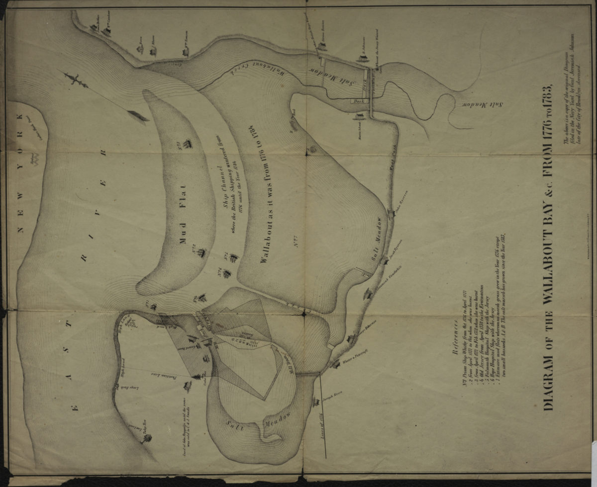
Diagram of the Wallabout Bay &c. from 1776 to 1783
Diagram of the Wallabout Bay &c. from 1776 to 1783
[18??]
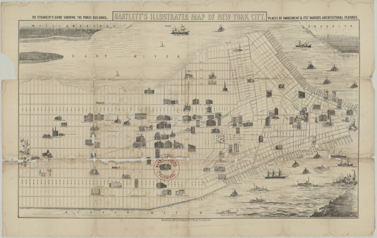
Bartlett’s illustrated map of New York City, or stranger’s guide showing the public buildings, places of amusement and its various architectural features
Bartlett’s illustrated map of New York City, or stranger’s guide showing the public buildings, places of amusement and its various architectural features
[1870]
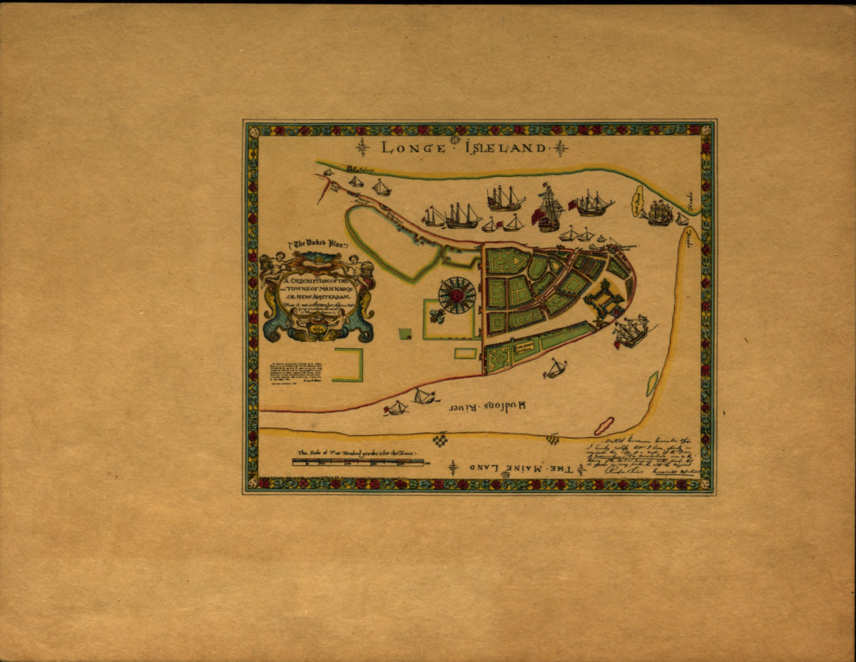
A description of the towne of Mannados or New Amsterdam: as it was in September 1661 lying in latitude 40 de. and 40 m. anno Domini 1664
A description of the towne of Mannados or New Amsterdam: as it was in September 1661 lying in latitude 40 de. and 40 m. anno Domini 1664
[1897]
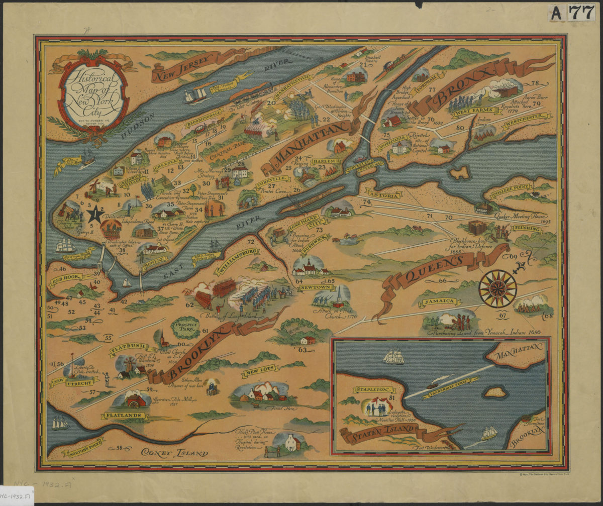
Historical map of New York City
Historical map of New York City
[ca. 1932]
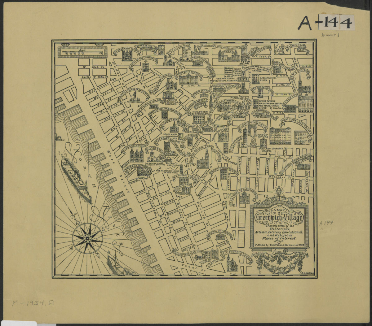
A map of Greenwich Village showing some of its historical, artistic, literary, educational, and religious places of interest
A map of Greenwich Village showing some of its historical, artistic, literary, educational, and religious places of interest
[1938; 1984]
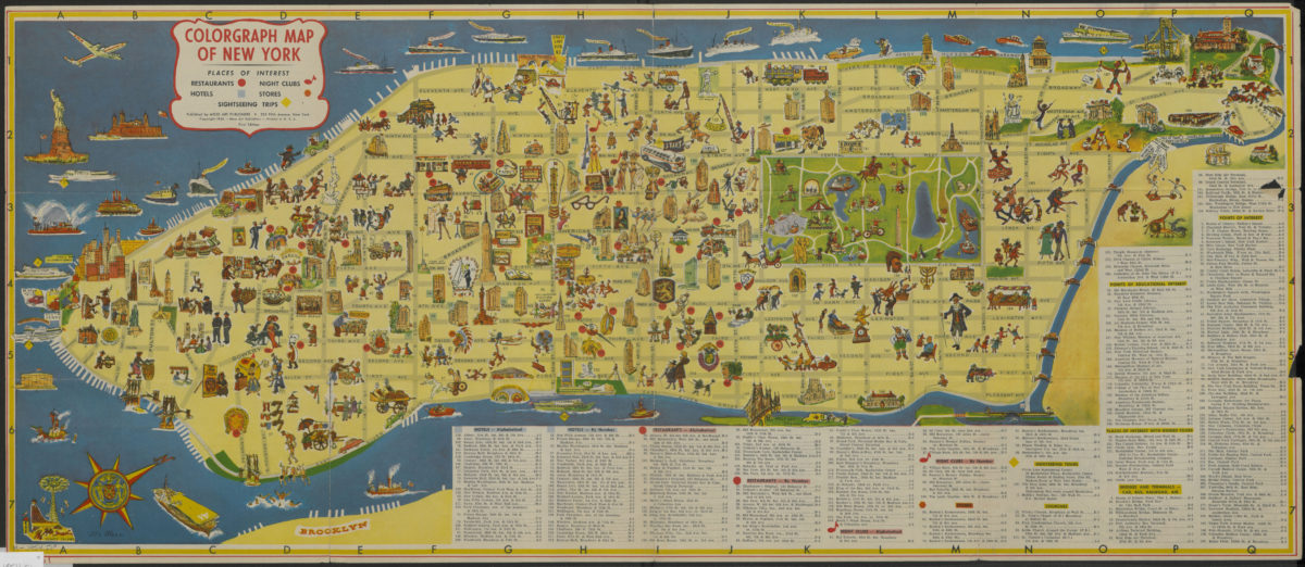
Colorgraph map of New York
Colorgraph map of New York
[ca. 1954]
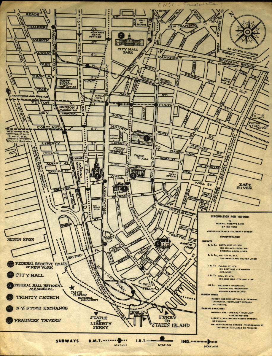
Information for visitors to Federal Reserve Bank of New York
Information for visitors to Federal Reserve Bank of New York
[1956-1966]
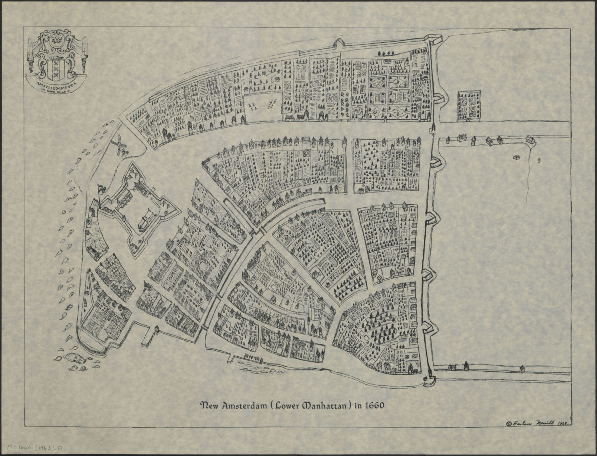
New Amsterdam (Lower Manhattan) in 1660
New Amsterdam (Lower Manhattan) in 1660
[ca. 1963]