Center for Brooklyn History
Map Collections
Search
About
Othmer Library & Archives
Submit search query
Refine 4 records
Clear filters
3
Location
Brooklyn (New York, N.Y.)
891
New York (N.Y.)
164
Queens (New York, N.Y.)
83
Subject
Electric railroads
5
Local transit
63
Postal codes
4
Railroads, Elevated
24
Street addresses
11
Street railroads
8
Streets
46
Subways
55
Date
20th Century
469
or enter range:
from
to
Genres
Road maps
83
Transportation maps
120
Sort by:
Date (earliest)
Date (most recent)
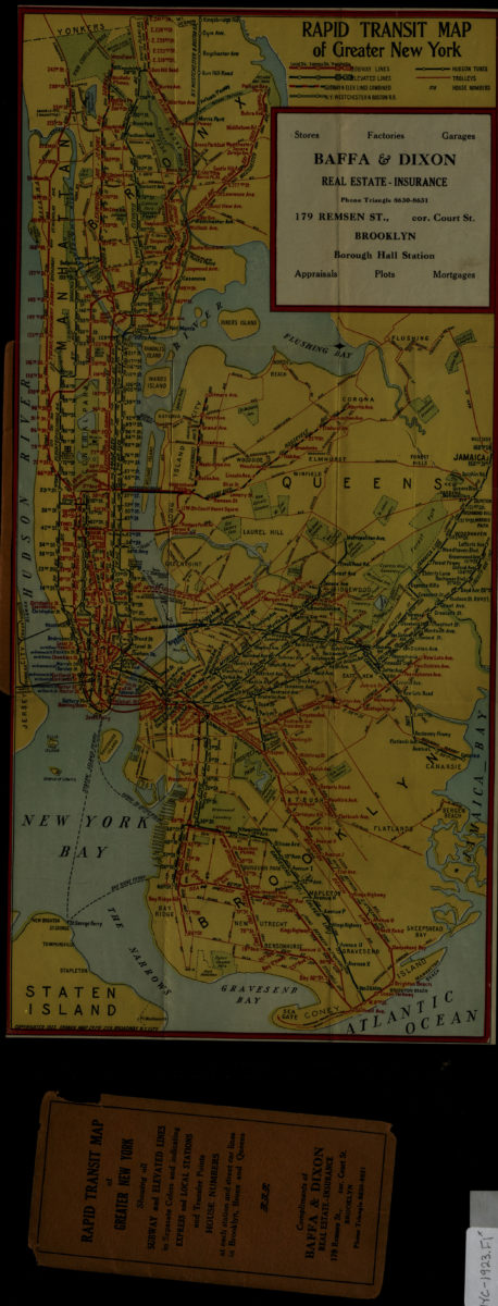
Rapid transit map of greater New York: Ohman Map Co
Rapid transit map of greater New York: Ohman Map Co
1923
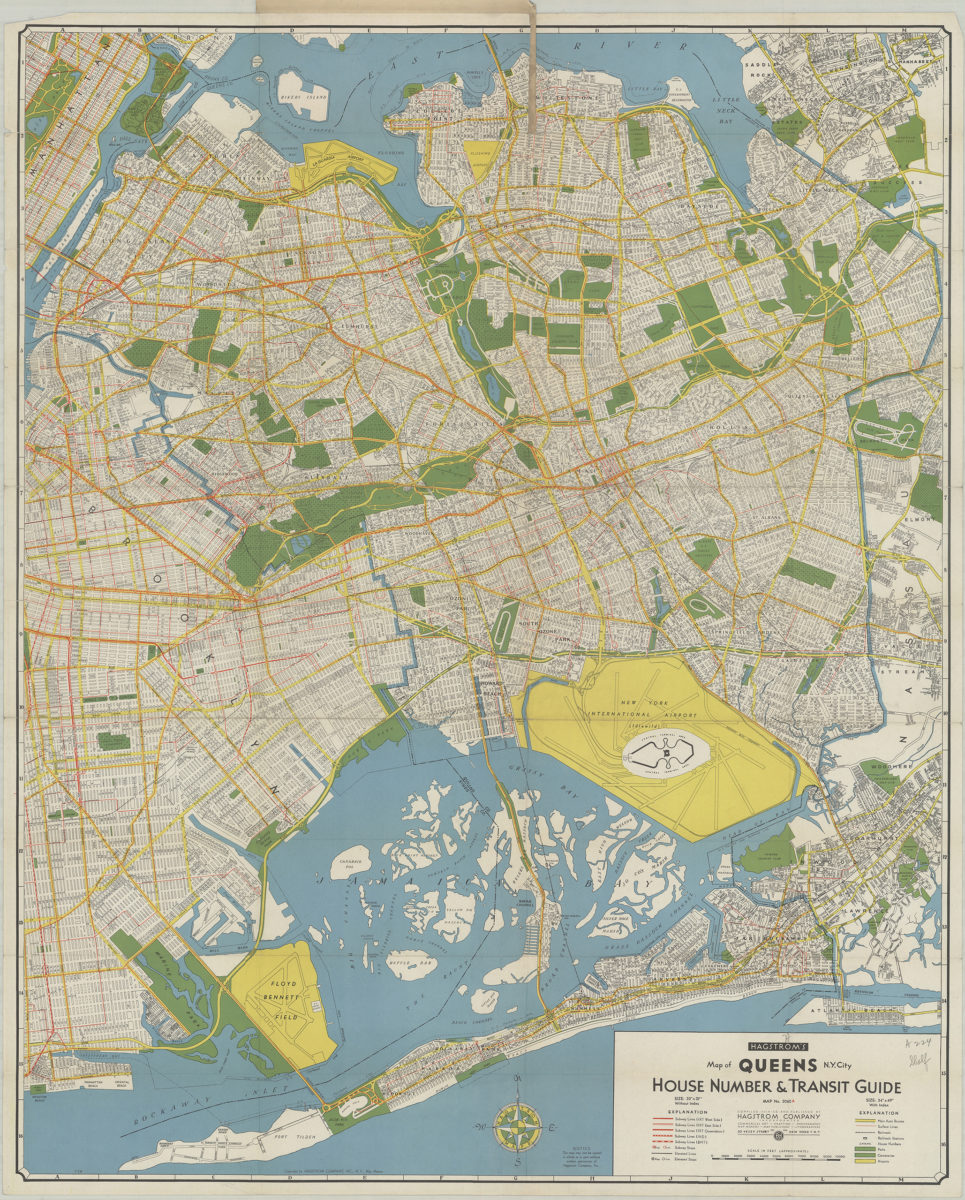
Hagstrom’s map of Queens N.Y. City: house number & transit guide: compiled, printed, and published by Hagstrom Company Incorporated
Hagstrom’s map of Queens N.Y. City: house number & transit guide: compiled, printed, and published by Hagstrom Company Incorporated
[1948]
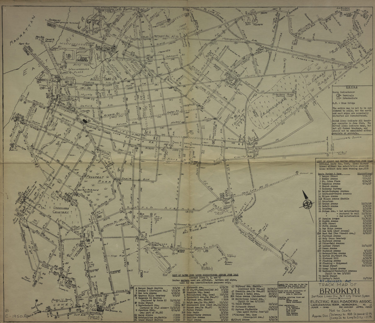
Track map of Brooklyn, Surface Lines Division, N.Y. City Transit System: Electric Railroaders Association
Track map of Brooklyn, Surface Lines Division, N.Y. City Transit System: Electric Railroaders Association
1950
Hagstrom’s map of Brooklyn, New York City: house number and transit guide: compiled, printed, and published by Hagstrom Company Incorporated
Hagstrom’s map of Brooklyn, New York City: house number and transit guide: compiled, printed, and published by Hagstrom Company Incorporated
[1950; 1947]