Center for Brooklyn History
Map Collections
Search
About
Othmer Library & Archives
Submit search query
Refine 5 records
Clear filters
2
Location
Brooklyn (New York, N.Y.)
891
Coney Island (New York, N.Y.)
22
East Flatbush (New York, N.Y.)
23
Jamaica Bay (N.Y.)
5
Manhattan (New York, N.Y.)
120
Queens (New York, N.Y.)
83
Williamsburg (New York, N.Y.)
36
Subject
Bridges
13
City planning
7
Elevated highways
1
ferries
32
Local transit
63
Real property
619
Subways
55
Tunnels
16
Date
19th Century
945
20th Century
469
or enter range:
from
to
Genres
Aerial views
15
Cadastral maps
597
Transportation maps
120
Sort by:
Date (earliest)
Date (most recent)
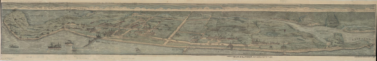
[View of Coney Island]: drawn by A. Deetjen
[View of Coney Island]: drawn by A. Deetjen
[ca. 1879]
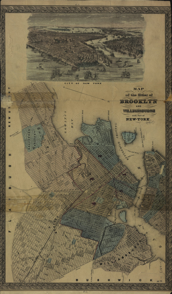
Map of the cities of Brooklyn and Williamsburgh with part of New York
Map of the cities of Brooklyn and Williamsburgh with part of New York
[189?]
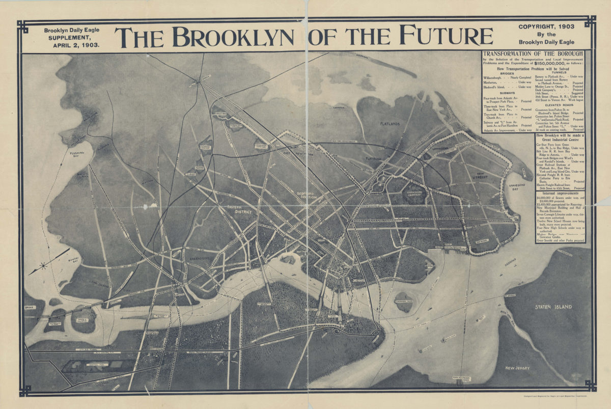
The Brooklyn of the future: Brooklyn Daily Eagle supplement, April 2, 1903
The Brooklyn of the future: Brooklyn Daily Eagle supplement, April 2, 1903
[1903; 1903]
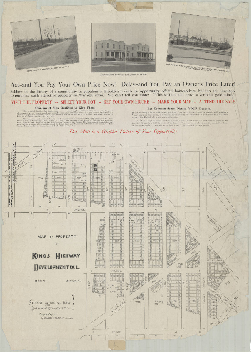
Map of property of Kings Highway Developmental Co. Inc.: situated in the 32nd Ward of the Borough of Brooklyn, N.Y. City: computed Sept. 1915 by Francis P. Murphy, City Surveyor
Map of property of Kings Highway Developmental Co. Inc.: situated in the 32nd Ward of the Borough of Brooklyn, N.Y. City: computed Sept. 1915 by Francis P. Murphy, City Surveyor
1915
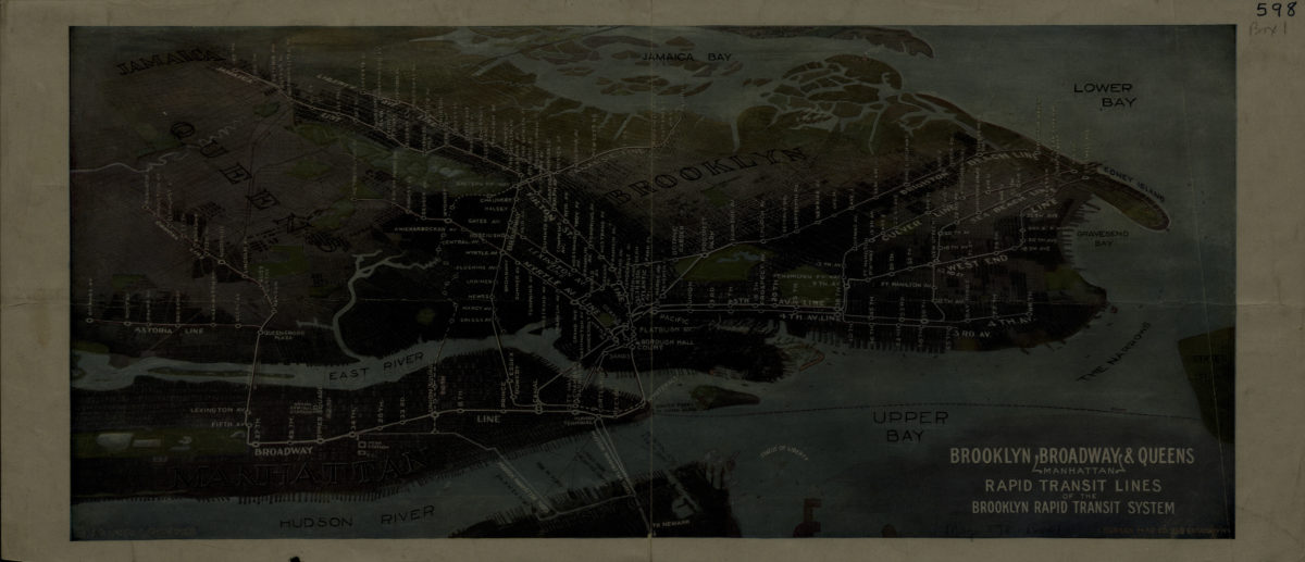
Brooklyn, Broadway (Manhattan), Queens rapid transit lines of the Brooklyn Rapid Transit System: Harry A. Chandler
Brooklyn, Broadway (Manhattan), Queens rapid transit lines of the Brooklyn Rapid Transit System: Harry A. Chandler
[1916-1924]