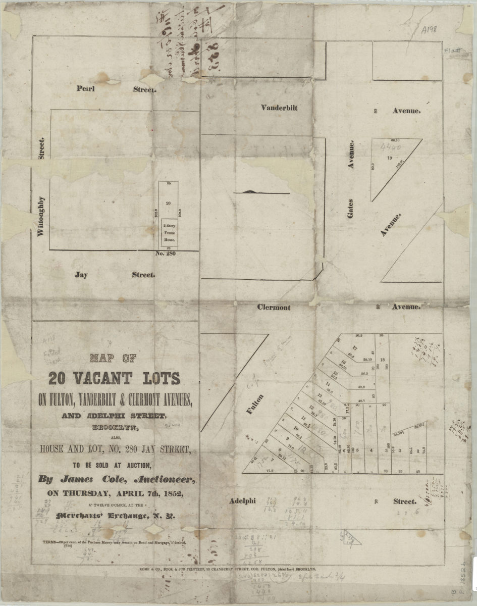
Map of 20 vacant lots on Fulton, Vanderbilt, & Clermont Avenues, and Adelphi Street, Brooklyn, also, house and lot, no. 280 Jay Street, to be sold at auction by James Cole, auctioneer, on Thursday, April 7th, 1852
Map of 20 vacant lots on Fulton, Vanderbilt, & Clermont Avenues, and Adelphi Street, Brooklyn, also, house and lot, no. 280 Jay Street, to be sold at auction by James Cole, auctioneer, on Thursday, April 7th, 1852
[1852]