Center for Brooklyn History
Map Collections
Search
About
Othmer Library & Archives
Submit search query
Refine 4 records
Clear filters
3
Location
Atlantic Basin (New York, N.Y.)
3
Brooklyn (New York, N.Y.)
891
Carroll Gardens (New York, N.Y.)
21
Erie Basin (New York, N.Y.)
2
Gowanus Canal (New York, N.Y.)
5
Red Hook (New York, N.Y.)
19
Subject
Landowners
434
Real property
619
Watersheds
5
Date
19th Century
945
or enter range:
from
to
Genres
Cadastral maps
597
Manuscript maps
365
Sort by:
Date (earliest)
Date (most recent)
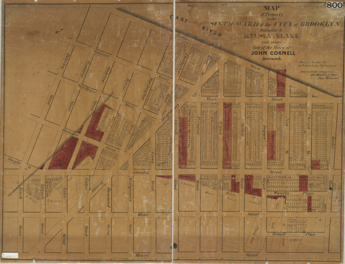
Map of property in the Sixth Ward of the city of Brooklyn belonging to Kelsey, Blake and others late of the heirs of John Cornell, deceased: surveyed, January 1838 by Tolford & Day, city surveyors
Map of property in the Sixth Ward of the city of Brooklyn belonging to Kelsey, Blake and others late of the heirs of John Cornell, deceased: surveyed, January 1838 by Tolford & Day, city surveyors
[1838]
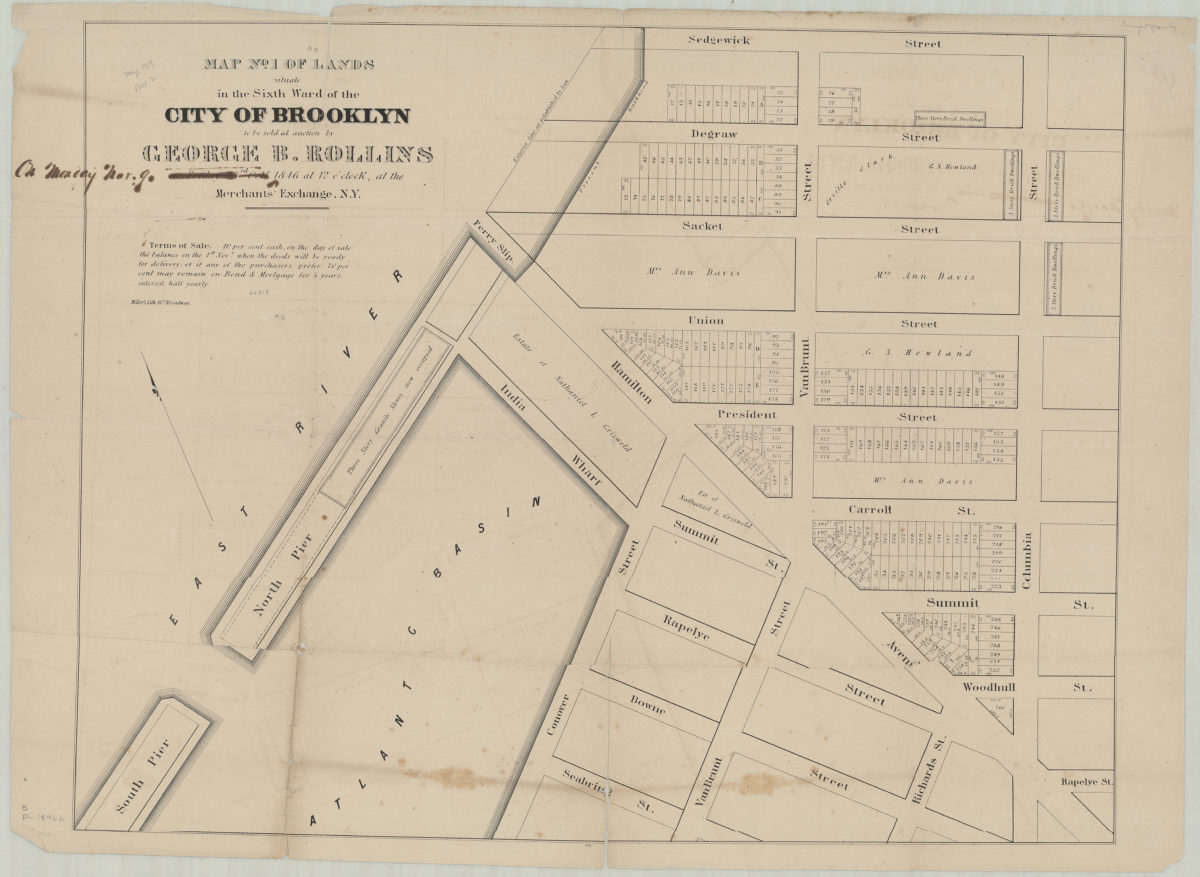
Map no. 1 of lands situate[d] in the Sixth Ward of the city of Brooklyn, to be sold at auction by George B. Rollins on Friday, 23rd Oct., 1846, at 12 o’clock at the Merchants’ Exchange, N.Y.
Map no. 1 of lands situate[d] in the Sixth Ward of the city of Brooklyn, to be sold at auction by George B. Rollins on Friday, 23rd Oct., 1846, at 12 o’clock at the Merchants’ Exchange, N.Y.
1846
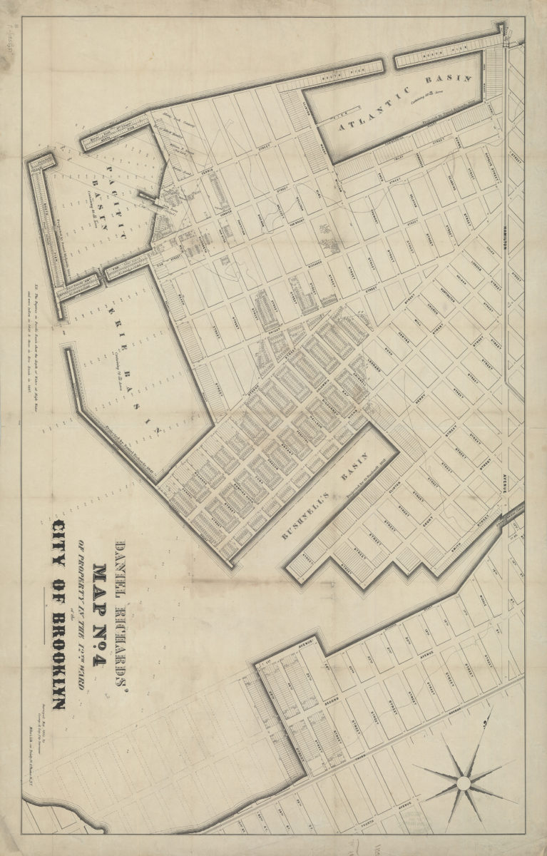
Daniel Richards’ map no. 4 of property in the 12th Ward of the city of Brooklyn: surveyed May, 1855, by George H. Day, city surveyor
Daniel Richards’ map no. 4 of property in the 12th Ward of the city of Brooklyn: surveyed May, 1855, by George H. Day, city surveyor
[1855]
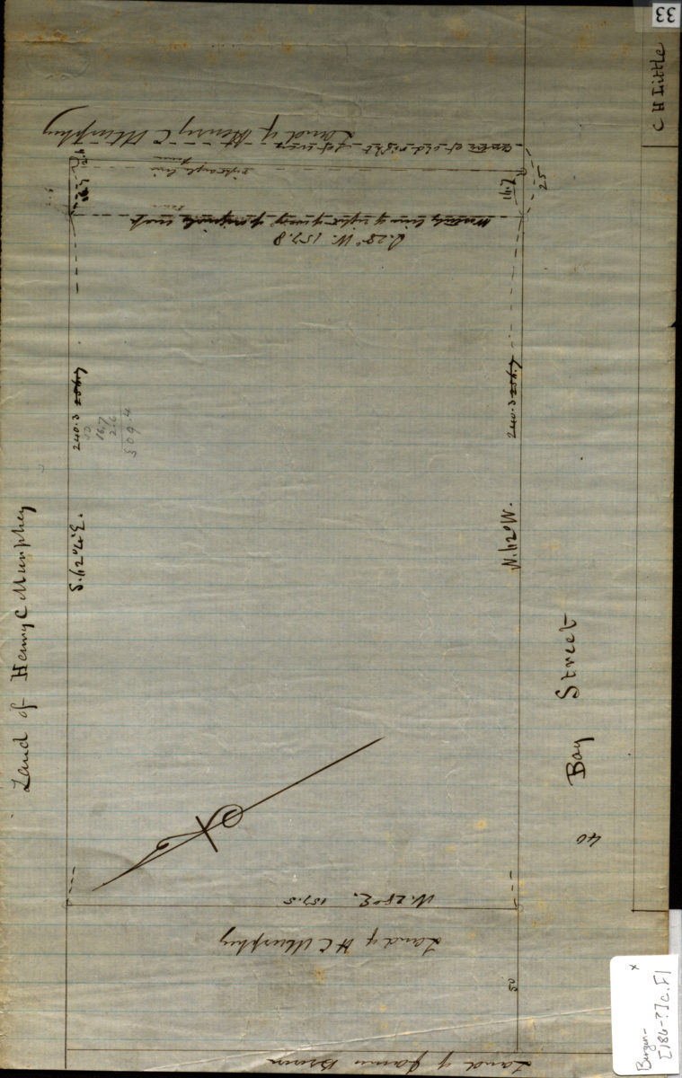
[Map of Bay St.].
[Map of Bay St.].
[186?]