Center for Brooklyn History
Map Collections
Search
About
Othmer Library & Archives
Submit search query
Refine 3 records
Clear filters
3
Location
Brooklyn (New York, N.Y.)
891
Fort Greene (New York, N.Y.)
22
Subject
Land grants
12
Landowners
434
Real property
619
Date
19th Century
945
or enter range:
from
to
Genres
Cadastral maps
597
Manuscript maps
365
Sort by:
Date (earliest)
Date (most recent)
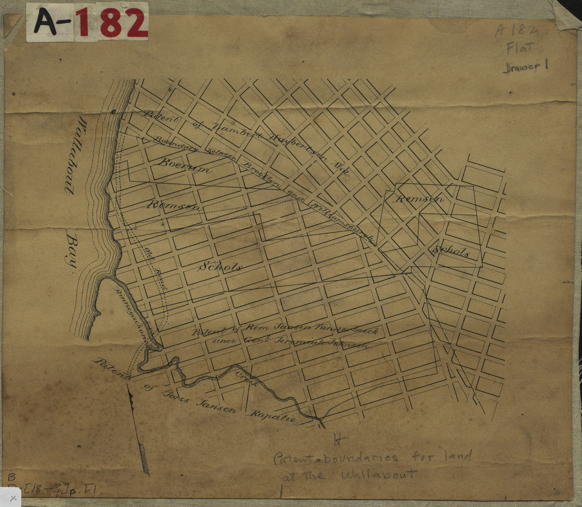
[Map showing land patents near Wallabout Bay]
[Map showing land patents near Wallabout Bay]
[18??]
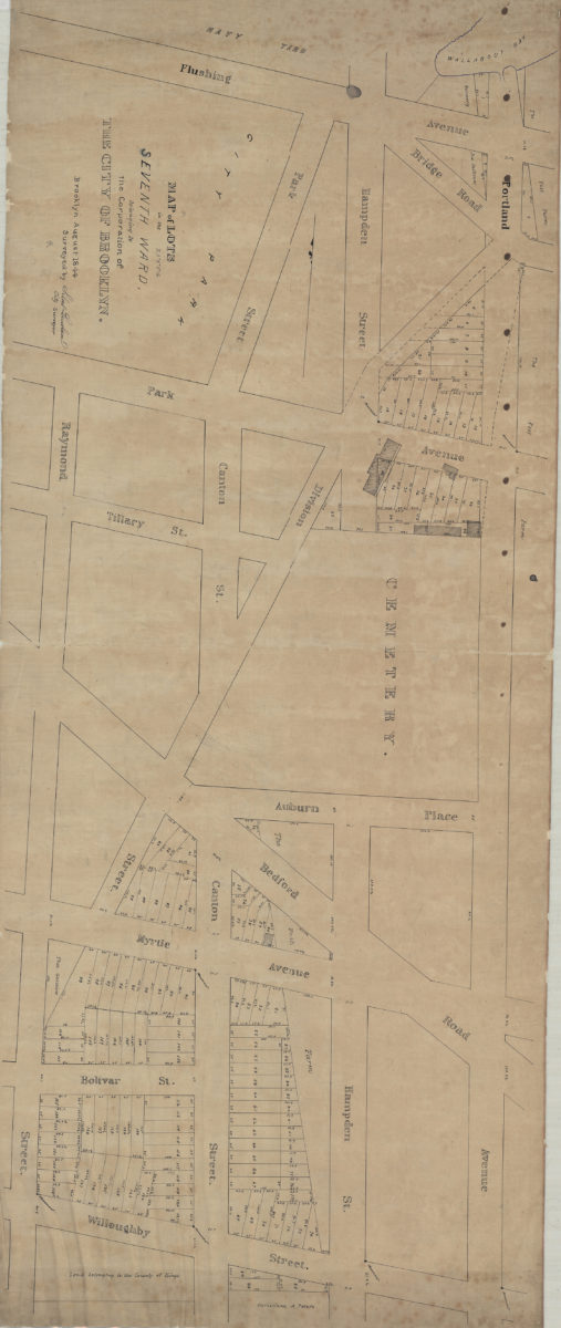
Map of lots in the Seventh Ward belonging to the Corporation of the City of Brooklyn: surveyed by Silas Ludlam, city surveyor
Map of lots in the Seventh Ward belonging to the Corporation of the City of Brooklyn: surveyed by Silas Ludlam, city surveyor
August 1844
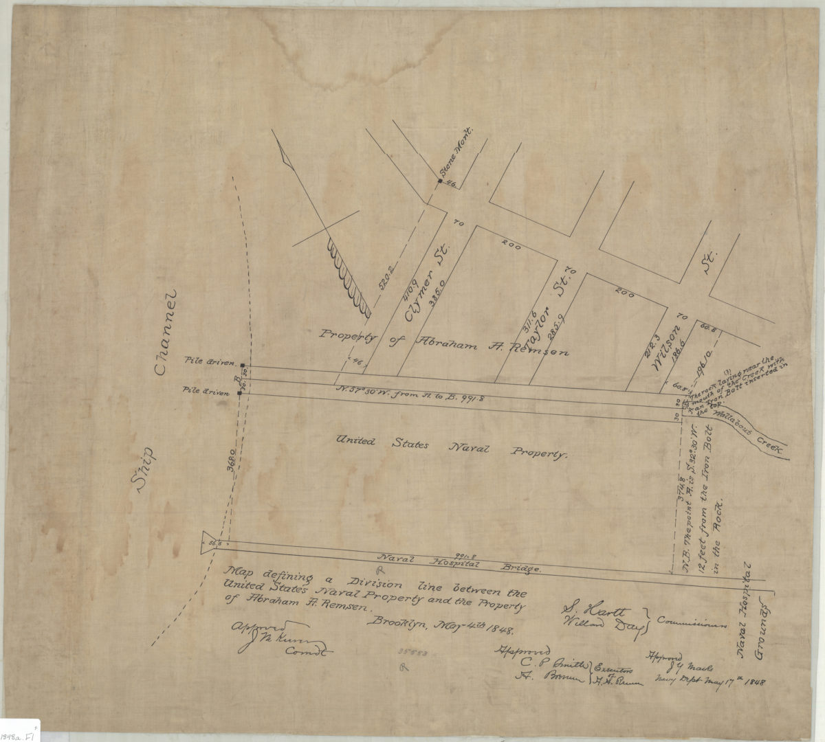
Map defining a division line between the United States Naval Property and the property of Abraham A. Remsen
Map defining a division line between the United States Naval Property and the property of Abraham A. Remsen
May 4, 1848