Center for Brooklyn History
Map Collections
Search
About
Othmer Library & Archives
Submit search query
Refine 7 records
Clear filters
2
Location
Brooklyn (New York, N.Y.)
891
Fort Washington (New York, N.Y.)
2
Long Island (N.Y.)
197
Manhattan (New York, N.Y.)
120
New York (N.Y.)
164
New York (State)
95
Washington Heights (New York, N.Y.)
2
Subject
ferries
32
Landowners
434
Manuscript Maps
2
Piers
25
Date
19th Century
945
20th Century
469
or enter range:
from
to
Genres
Early works
3
Facsimiles
1
Historical maps
53
Manuscript maps
365
Pictorial maps
38
Sort by:
Date (earliest)
Date (most recent)
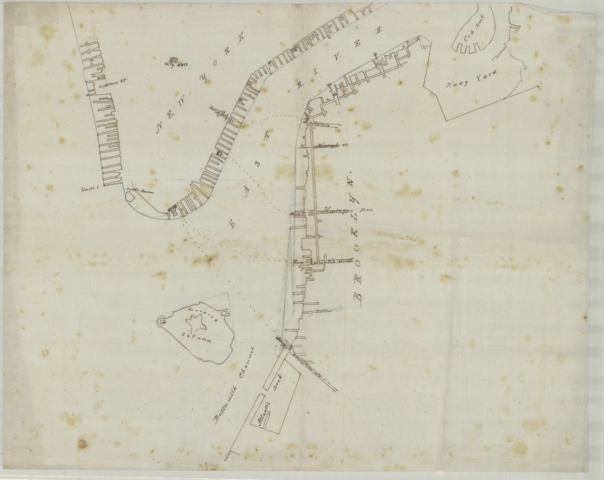
[Map of northwest Brooklyn and Lower Manhattan]
[Map of northwest Brooklyn and Lower Manhattan]
[18??]
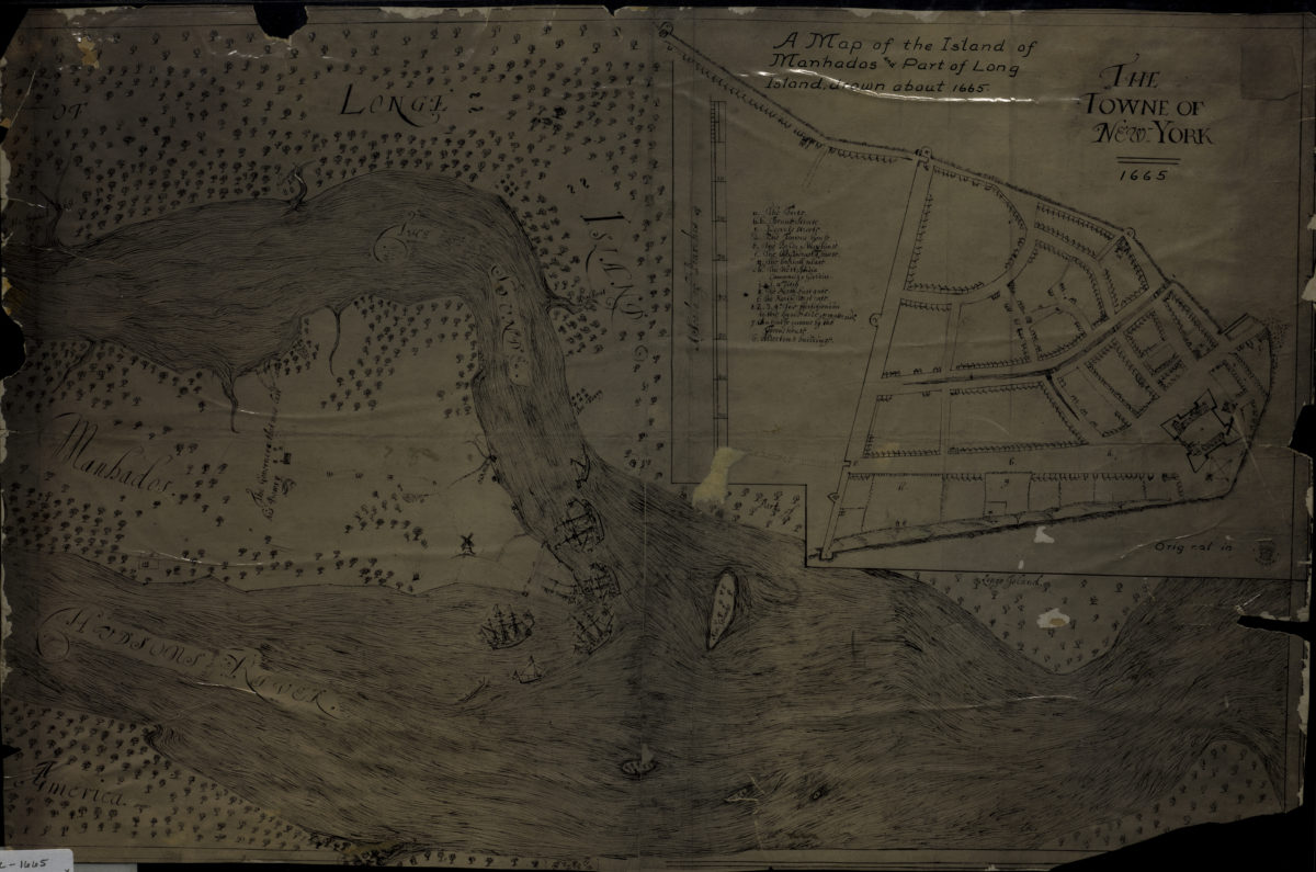
A map of the island of Manhados and part of Long Island, drawn about 1665
A map of the island of Manhados and part of Long Island, drawn about 1665
[18??]
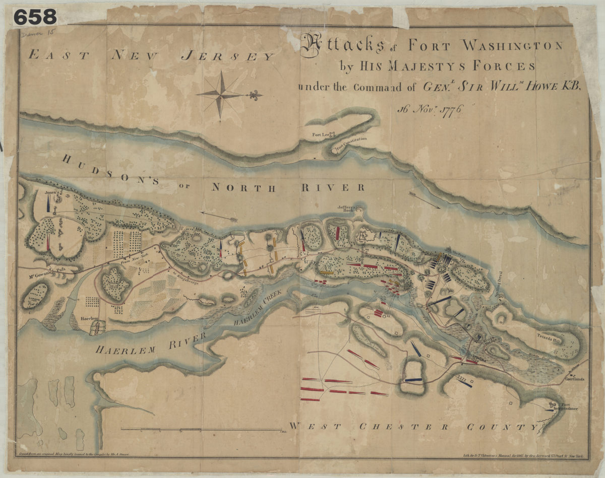
Attacks of Fort Washington by His Majesty’s forces: under the command of Genl. Sir Willm Howe K.B. 16 Novr. 1776
Attacks of Fort Washington by His Majesty’s forces: under the command of Genl. Sir Willm Howe K.B. 16 Novr. 1776
[1861]
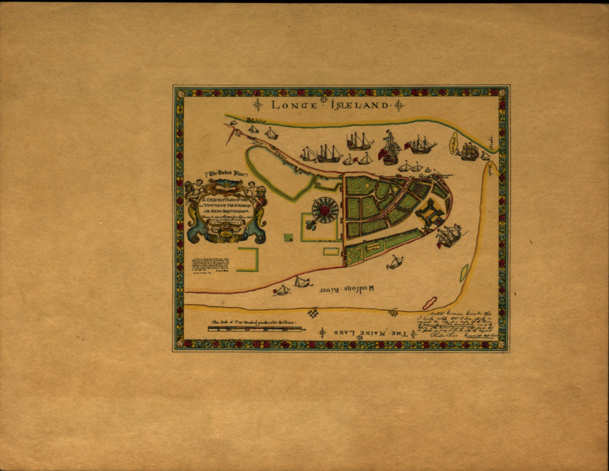
A description of the towne of Mannados or New Amsterdam: as it was in September 1661 lying in latitude 40 de. and 40 m. anno Domini 1664
A description of the towne of Mannados or New Amsterdam: as it was in September 1661 lying in latitude 40 de. and 40 m. anno Domini 1664
[1897]
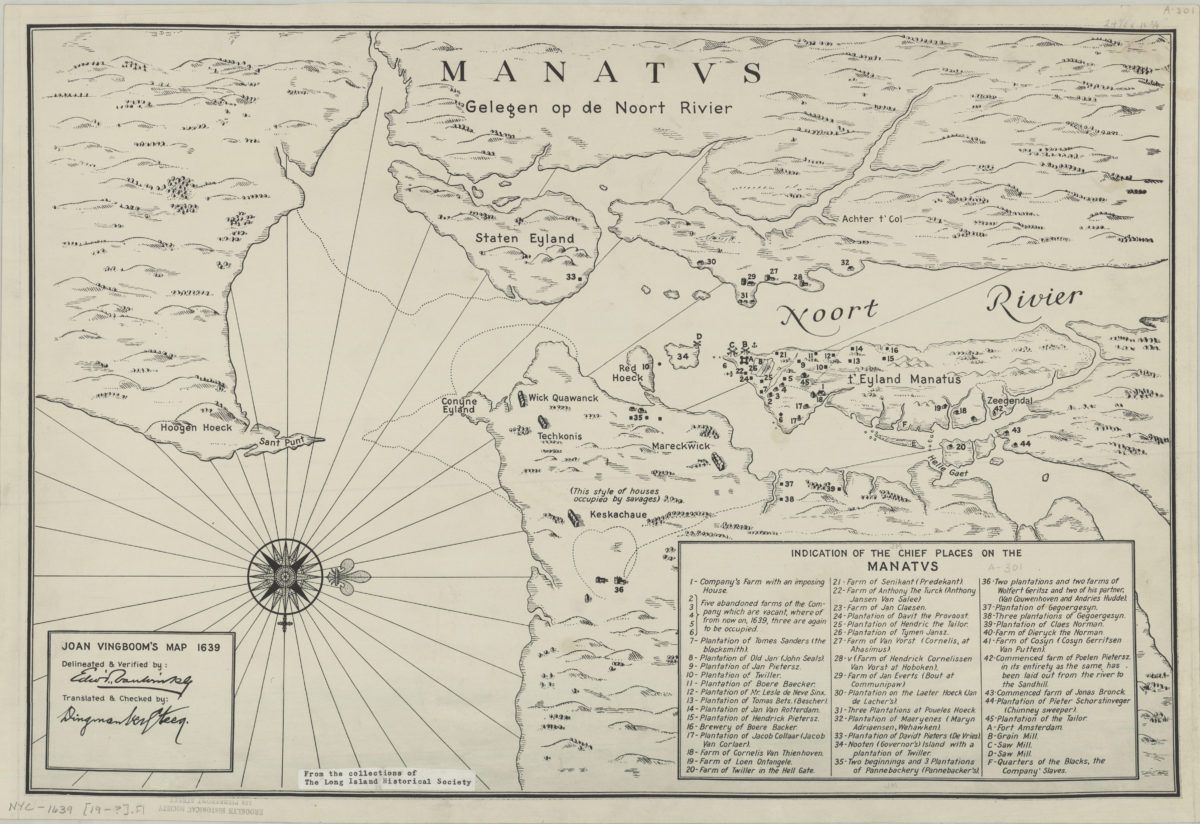
Joan Vingboom’s map 1639
Joan Vingboom’s map 1639
[19??]
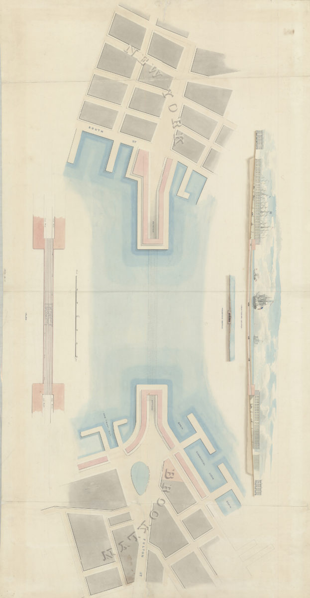
[Watercolor plan for proposed tunnel between Brooklyn and Manhattan connecting Fulton Street in Brooklyn and South Street in Manhattan]
[Watercolor plan for proposed tunnel between Brooklyn and Manhattan connecting Fulton Street in Brooklyn and South Street in Manhattan]
1978
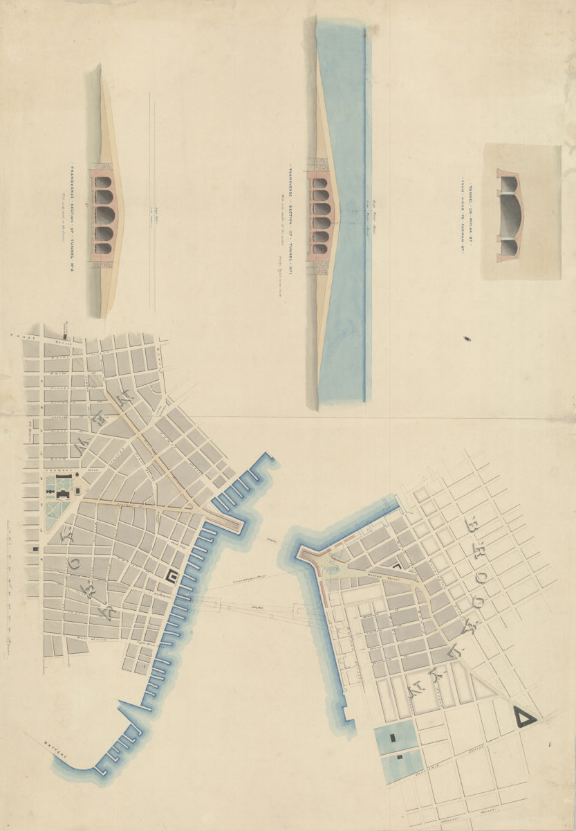
[Watercolor plan for proposed tunnel between Manhattan and Brooklyn on Poplar Street connecting Hicks Street and Furman Street]
[Watercolor plan for proposed tunnel between Manhattan and Brooklyn on Poplar Street connecting Hicks Street and Furman Street]
1978