Center for Brooklyn History
Map Collections
Search
About
Othmer Library & Archives
Submit search query
Refine 5 records
Clear filters
3
Location
East Elmhurst (New York, N.Y.)
2
Long Island City (New York, N.Y.)
8
Newtown (Queens County, N.Y.)
4
Queens (New York, N.Y.)
83
Rockaway Beach (New York, N.Y.)
1
Subject
Landowners
434
Real property
619
Date
19th Century
945
or enter range:
from
to
Genres
Cadastral maps
597
Manuscript maps
365
Sort by:
Date (earliest)
Date (most recent)
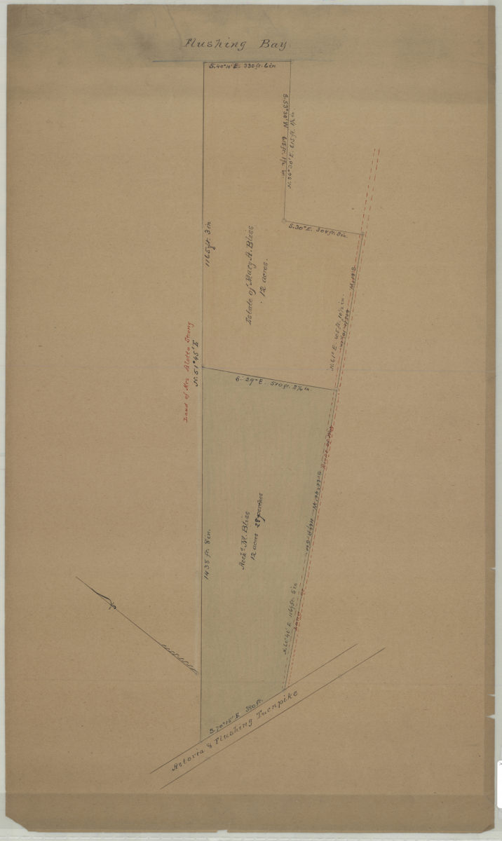
[Map of property between Astoria & Flushing Turnpike and Flushing Bay]
[Map of property between Astoria & Flushing Turnpike and Flushing Bay]
[18??]
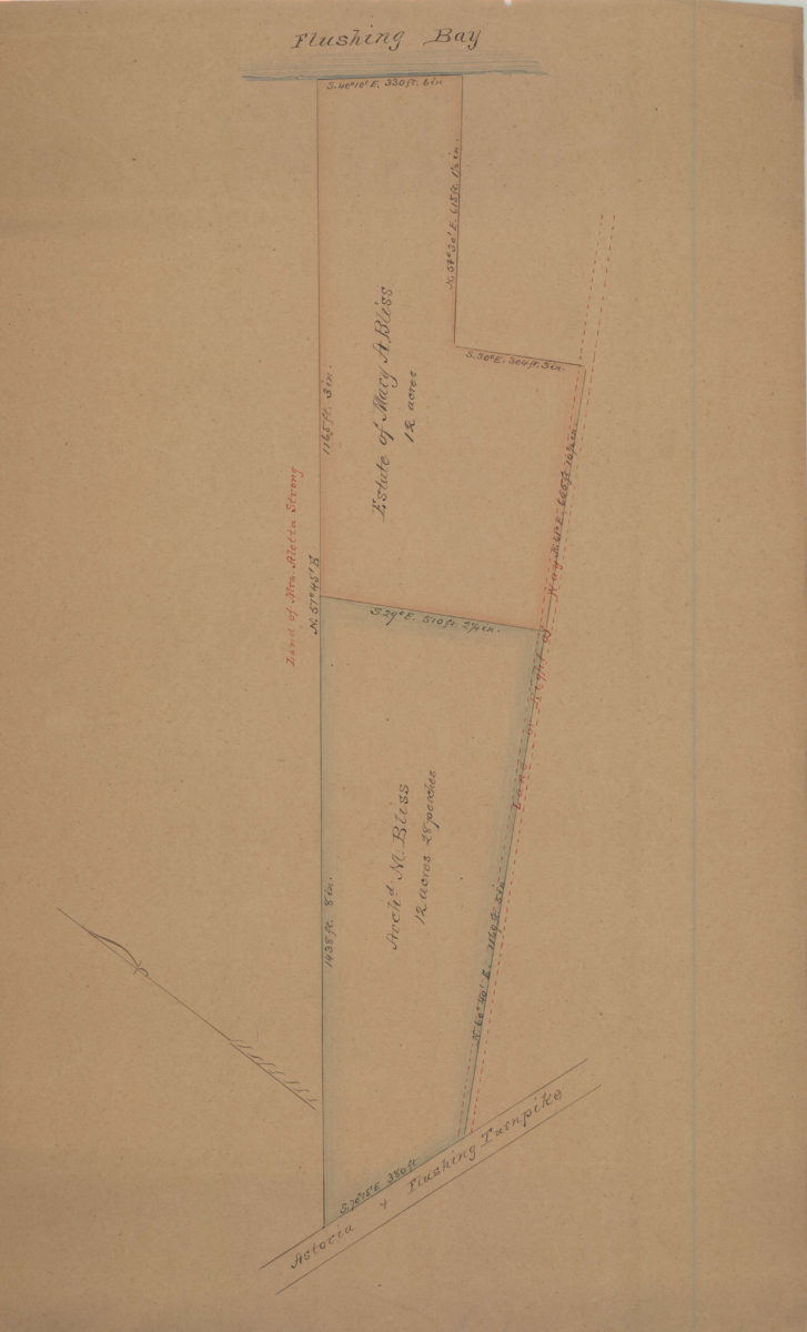
[Map of property between Astoria & Flushing Turnpike and Flushing Bay]
[Map of property between Astoria & Flushing Turnpike and Flushing Bay]
[18??]
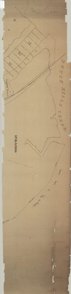
[Map of land near Dutch Kills Creek]
[Map of land near Dutch Kills Creek]
[18??]
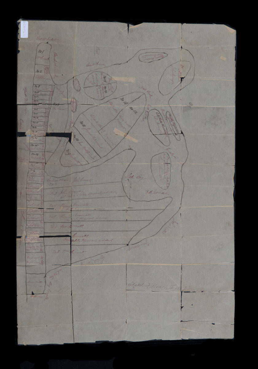
Sketch of beach lots & marsh
Sketch of beach lots & marsh
[18??]
Partition map of the farm of the late Thomas S. Payntar, dec., in Newtown, Queens County, L.I.: as divided among his heirs by Jacob Mott, Peter Hulst, and Jacob Burroughs, commissioners in partition appointed by the Supreme Court:
Partition map of the farm of the late Thomas S. Payntar, dec., in Newtown, Queens County, L.I.: as divided among his heirs by Jacob Mott, Peter Hulst, and Jacob Burroughs, commissioners in partition appointed by the Supreme Court:
August 1864