Center for Brooklyn History
Map Collections
Search
About
Othmer Library & Archives
Submit search query
Refine 2 records
Clear filters
2
Location
Brooklyn (New York, N.Y.)
891
Red Hook (New York, N.Y.)
19
Subject
Landowners
434
Real property
619
Date
19th Century
945
or enter range:
from
to
Genres
Cadastral maps
597
Manuscript maps
365
Sort by:
Date (earliest)
Date (most recent)
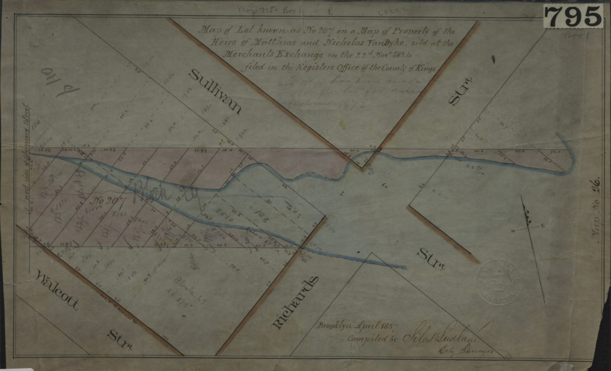
Map of lot known as No. 207 on a Map of property of the heirs of Matthias and Nicholas Van Byke, sold at the Merchants Exchange on the 22d Novr. 1834, filed in the Register’s Office of the County of Kings: compiled by Silas Ludlam, city surveyor
Map of lot known as No. 207 on a Map of property of the heirs of Matthias and Nicholas Van Byke, sold at the Merchants Exchange on the 22d Novr. 1834, filed in the Register’s Office of the County of Kings: compiled by Silas Ludlam, city surveyor
April 1857
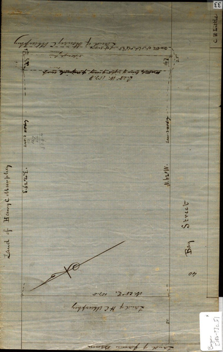
[Map of Bay St.].
[Map of Bay St.].
[186?]