Center for Brooklyn History
Map Collections
Search
About
Othmer Library & Archives
Submit search query
Refine 7 records
Clear filters
3
Location
Brooklyn (New York, N.Y.)
891
Jersey City (N.J.)
4
Manhattan (New York, N.Y.)
120
New York (N.Y.)
164
Queens (New York, N.Y.)
83
Subject
Buildings
12
Canals
15
Church property
1
ferries
32
Fills (Earthwork)
4
Fire alarms
4
Fire protection districts
2
Landforms
15
Piers
25
Ponds
6
Railroads
72
Rivers
16
School districts
4
Schools
1
Streets
46
Wetlands
6
Date
19th Century
945
or enter range:
from
to
Genres
Map
191
Sort by:
Date (earliest)
Date (most recent)
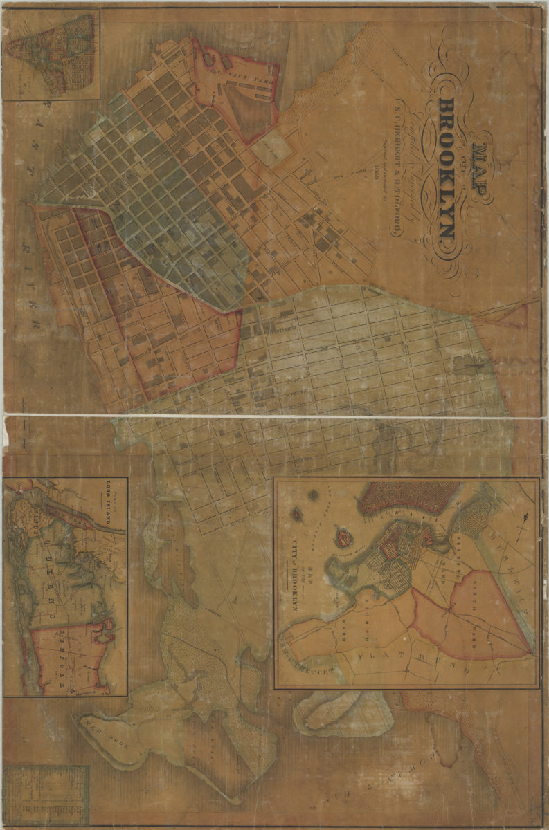
Map of the City of Brooklyn: compiled & surveyed by S.C. Herbert & R. Tolford
Map of the City of Brooklyn: compiled & surveyed by S.C. Herbert & R. Tolford
1835
City & County map of New-York, Brooklyn, Williamsburgh, Jersey City and the adjacent waters: by J.H. Colton
City & County map of New-York, Brooklyn, Williamsburgh, Jersey City and the adjacent waters: by J.H. Colton
1852; [ca. 1845]
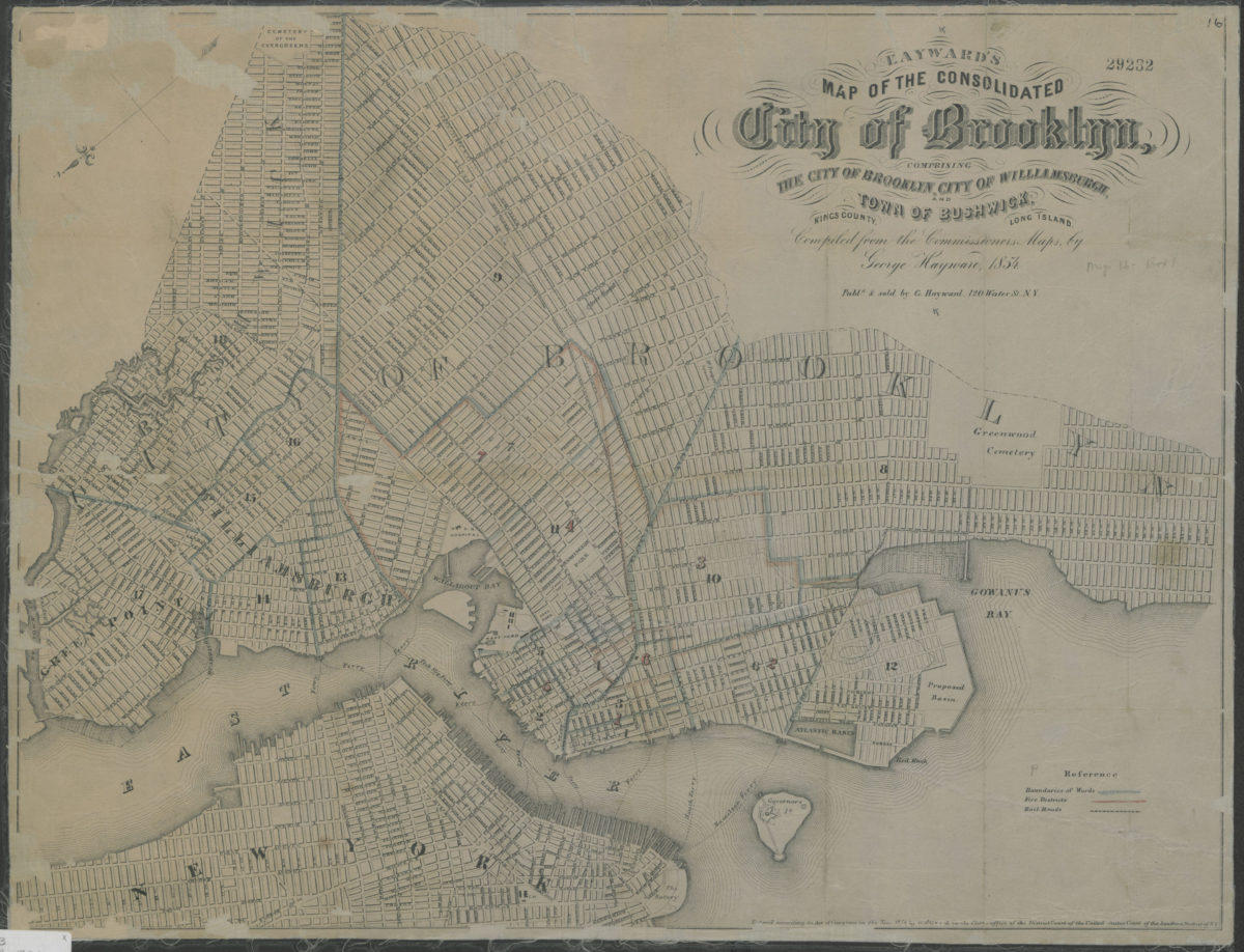
Map of the consolidated City of Brooklyn: comprising the City of Brooklyn, City of Williamsburgh and Town of Bushwick, Kings County, Long Island: compiled from the Commissioners maps by George Hayward
Map of the consolidated City of Brooklyn: comprising the City of Brooklyn, City of Williamsburgh and Town of Bushwick, Kings County, Long Island: compiled from the Commissioners maps by George Hayward
1854
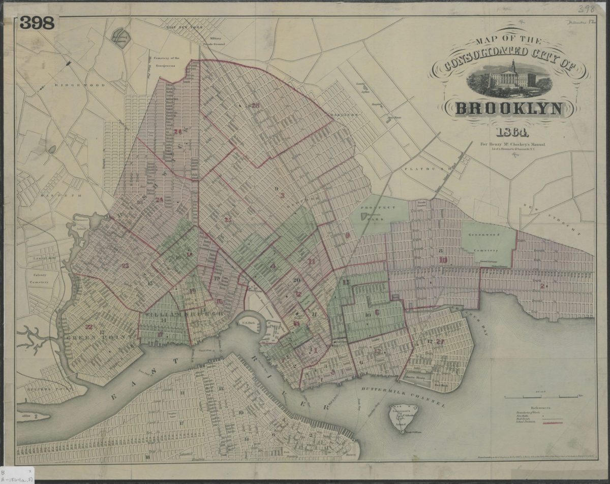
Map of the consolidated City of Brooklyn
Map of the consolidated City of Brooklyn
1864
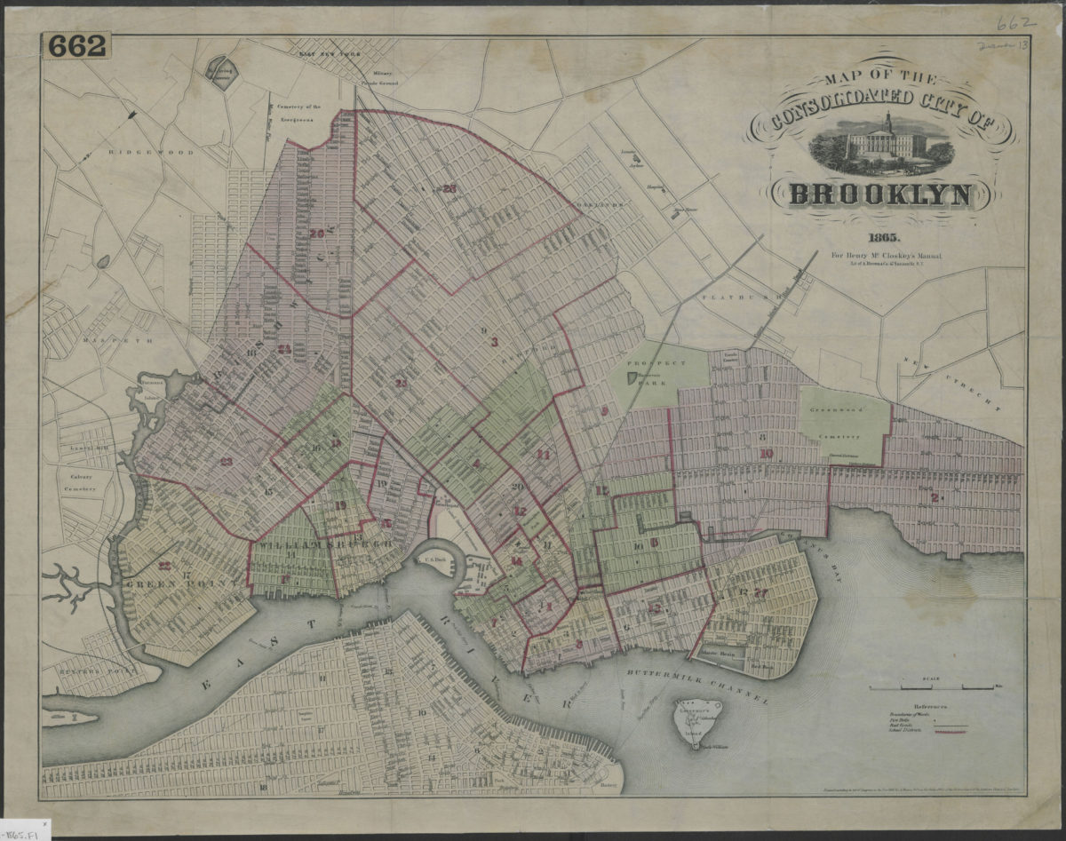
Map of the consolidated City of Brooklyn
Map of the consolidated City of Brooklyn
1865
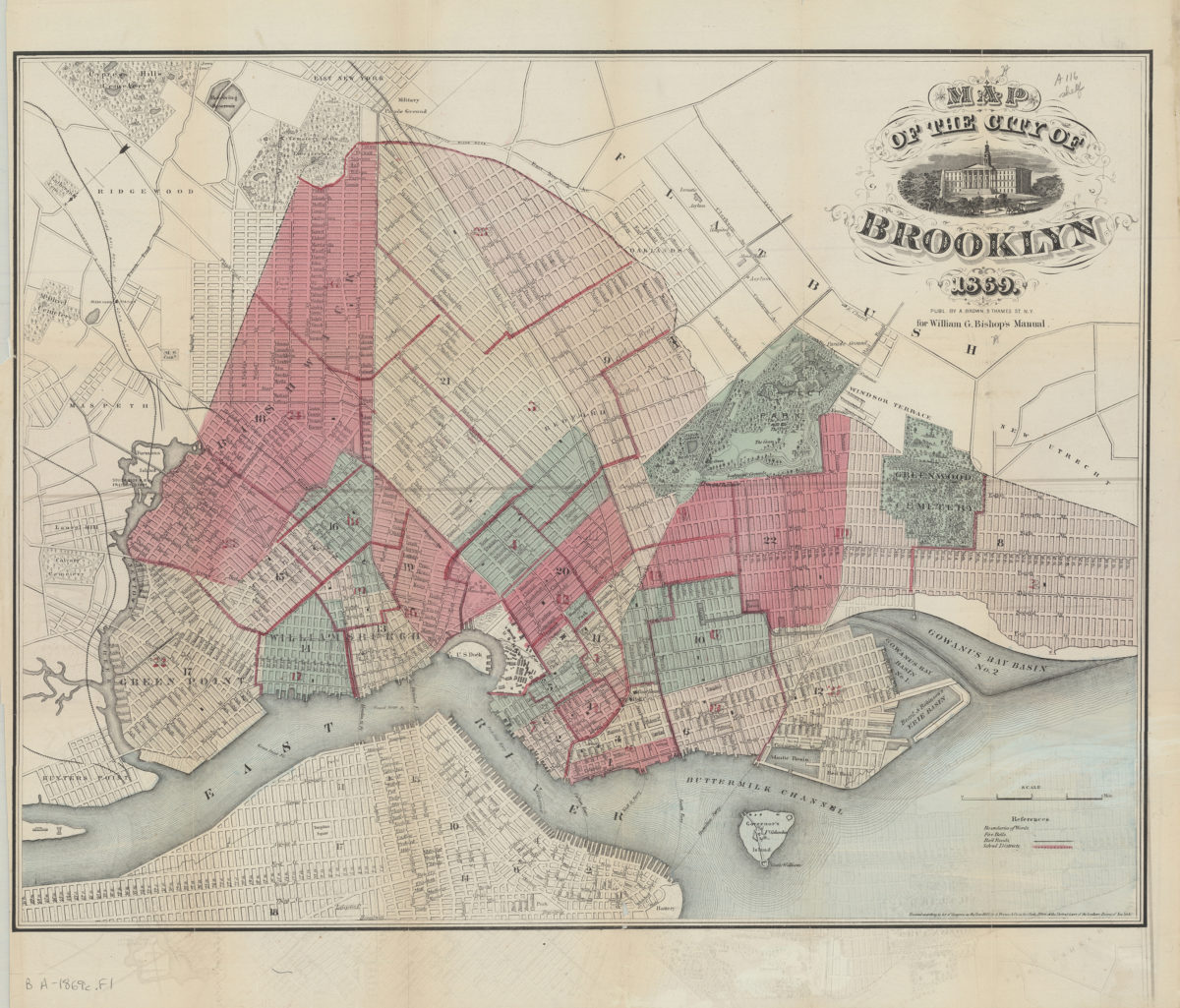
Map of the City of Brooklyn
Map of the City of Brooklyn
1869
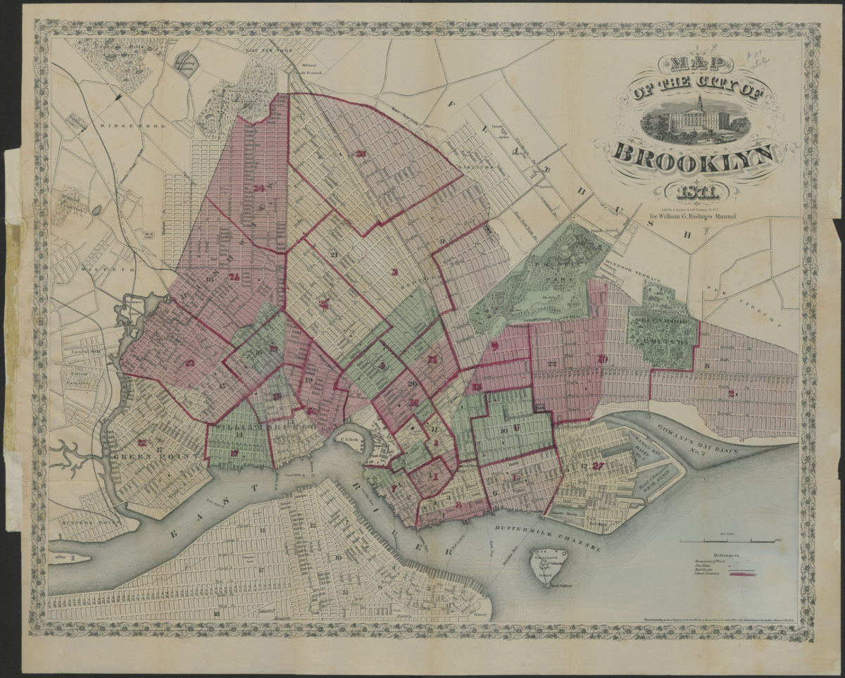
Map of the City of Brooklyn
Map of the City of Brooklyn
1871