Center for Brooklyn History
Map Collections
Search
About
Othmer Library & Archives
Submit search query
Refine 5 records
Clear filters
2
Location
Bedford-Stuyvesant (New York, N.Y.)
67
Boerum Hill (New York, N.Y.)
6
Brooklyn (New York, N.Y.)
891
Brooklyn Heights (New York, N.Y.)
76
Carroll Gardens (New York, N.Y.)
21
Clinton Hill (New York, N.Y.)
10
Cobble Hill (New York, N.Y.)
7
Crown Heights (New York, N.Y.)
25
Downtown Brooklyn (New York, N.Y.)
29
Fort Greene (New York, N.Y.)
22
Gowanus (New York, N.Y.)
12
Greenpoint (New York, N.Y.)
38
Jersey City (N.J.)
4
Manhattan (New York, N.Y.)
120
New York (N.Y.)
164
New York Metropolitan Area
40
Park Slope (New York, N.Y.)
16
Prospect Heights (New York, N.Y.)
16
Red Hook (New York, N.Y.)
19
Williamsburg (New York, N.Y.)
36
Subject
ferries
32
Piers
25
Streets
46
Date
19th Century
945
20th Century
469
or enter range:
from
to
Genres
Map
191
Sort by:
Date (earliest)
Date (most recent)
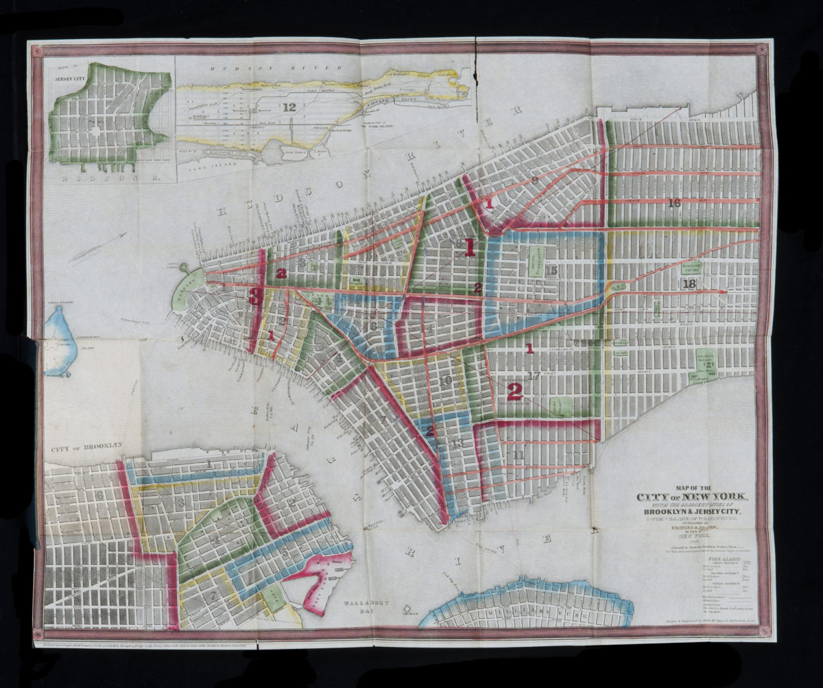
A map of the city and county of New York, with the adjacent cities of Brooklyn and Jersey City and the village of Williamsburg: with a street directory of the city of New York
A map of the city and county of New York, with the adjacent cities of Brooklyn and Jersey City and the village of Williamsburg: with a street directory of the city of New York
1848
A map of the city and county of New York: with the adjacent cities of Brooklyn and Jersey City, and the village of Williamsburg : with a street directory of the city of New York
1853
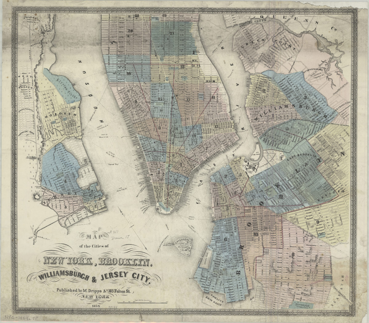
Map of the cities of New York, Brooklyn, Williamsburgh & Jersey City
Map of the cities of New York, Brooklyn, Williamsburgh & Jersey City
1854
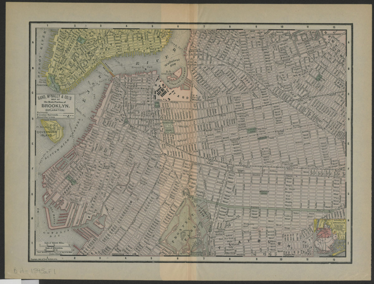
Rand, McNally & Co.’s map of the main portion of Brooklyn
Rand, McNally & Co.’s map of the main portion of Brooklyn
[1895; 1895]
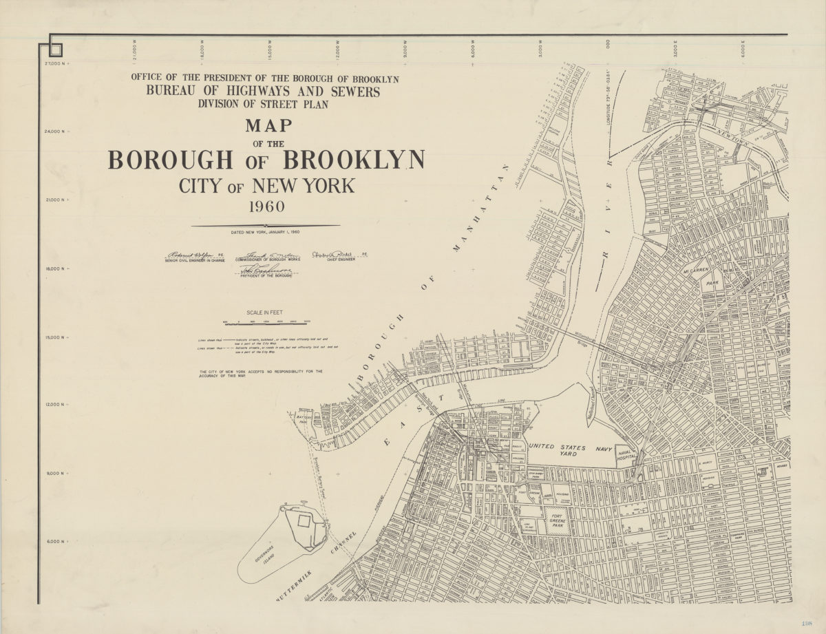
Map of the Borough of Brooklyn, City of New York, 1960
Map of the Borough of Brooklyn, City of New York, 1960
1960