Center for Brooklyn History
Map Collections
Search
About
Othmer Library & Archives
Submit search query
Refine 2 records
Clear filters
2
Location
New York (N.Y.)
164
New York (State)
95
New York Region
5
Subject
Date
18th Century
12
20th Century
469
or enter range:
from
to
Genres
Early maps
35
Historical maps
53
Military maps
23
Topographic maps
70
Sort by:
Date (earliest)
Date (most recent)
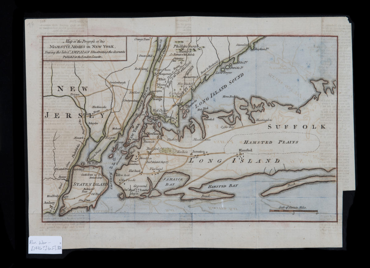
Map of the progress of His Majesty’s armies in New York, during the late campaign: illustrating the accounts published in the London Gazette
Map of the progress of His Majesty’s armies in New York, during the late campaign: illustrating the accounts published in the London Gazette
[1776]
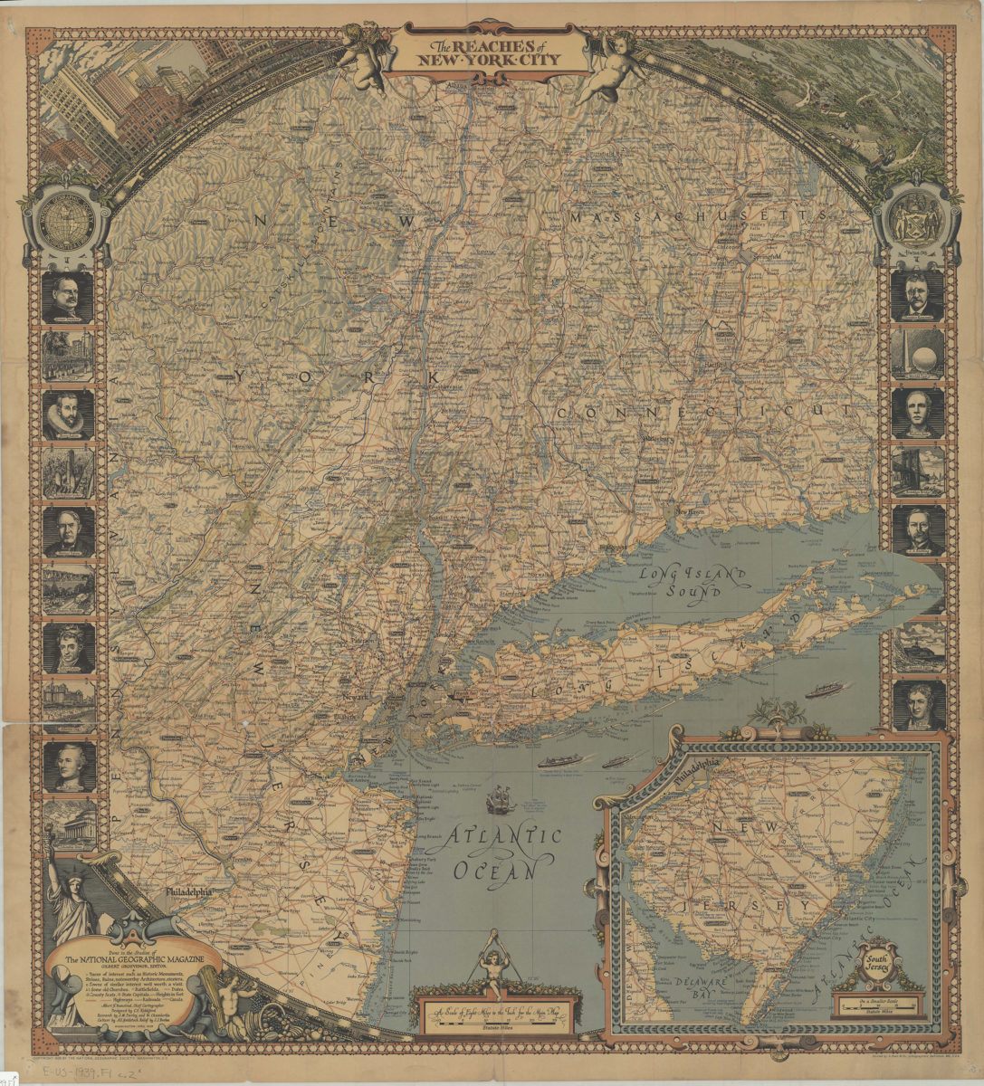
The reaches of New York City: done in the studios of the National Geographic Magazine ; Gilbert Grosvenor, ed. ; Albert H. Bumstead, chief cartographer ; designed by C.E. Riddiford ; research by J.M. Darley and W. Chamberlin
The reaches of New York City: done in the studios of the National Geographic Magazine ; Gilbert Grosvenor, ed. ; Albert H. Bumstead, chief cartographer ; designed by C.E. Riddiford ; research by J.M. Darley and W. Chamberlin
1939