Center for Brooklyn History
Map Collections
Search
About
Othmer Library & Archives
Submit search query
Refine 4 records
Clear filters
2
Location
Bay Ridge (New York, N.Y.)
108
Brooklyn (New York, N.Y.)
891
Sunset Park (New York, N.Y.)
53
Subject
Land grants
12
Landowners
434
Real property
619
Riparian rights
13
Submerged lands
17
Date
19th Century
945
or enter range:
from
to
Genres
Cadastral maps
597
Manuscript maps
365
Sort by:
Date (earliest)
Date (most recent)
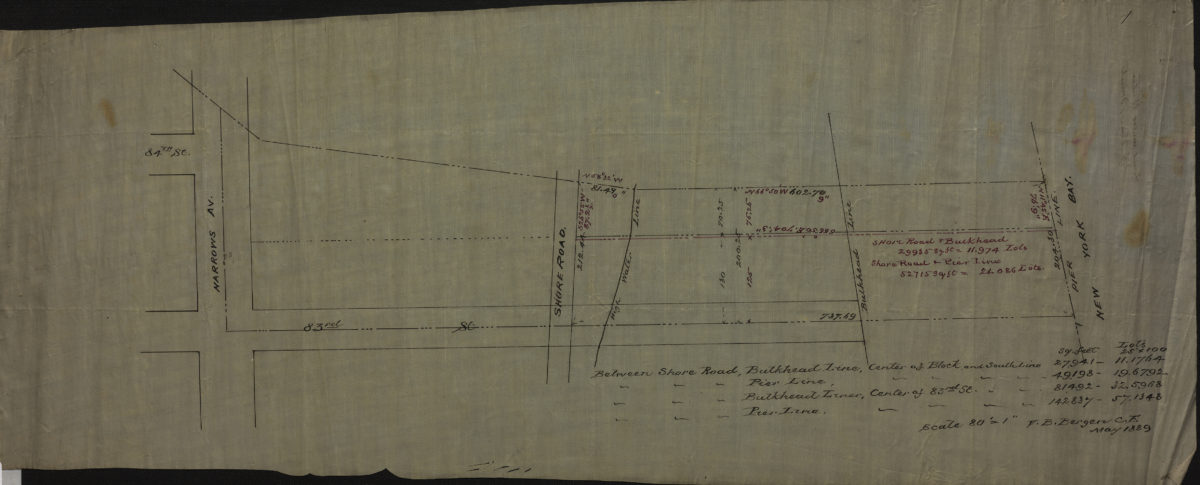
Land under water, J. Van Brunt: V.B. Bergen, C.E.
Land under water, J. Van Brunt: V.B. Bergen, C.E.
May 1889
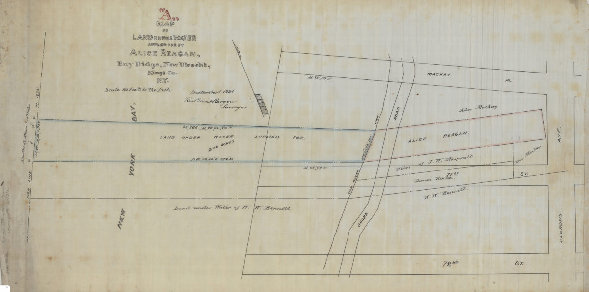
Map “A” of land under water applied for by Alice Reagan, Bay Ridge, New Utrecht, Kings Co., N.Y.: Van Brunt Bergen, surveyor
Map “A” of land under water applied for by Alice Reagan, Bay Ridge, New Utrecht, Kings Co., N.Y.: Van Brunt Bergen, surveyor
September 1, 1891
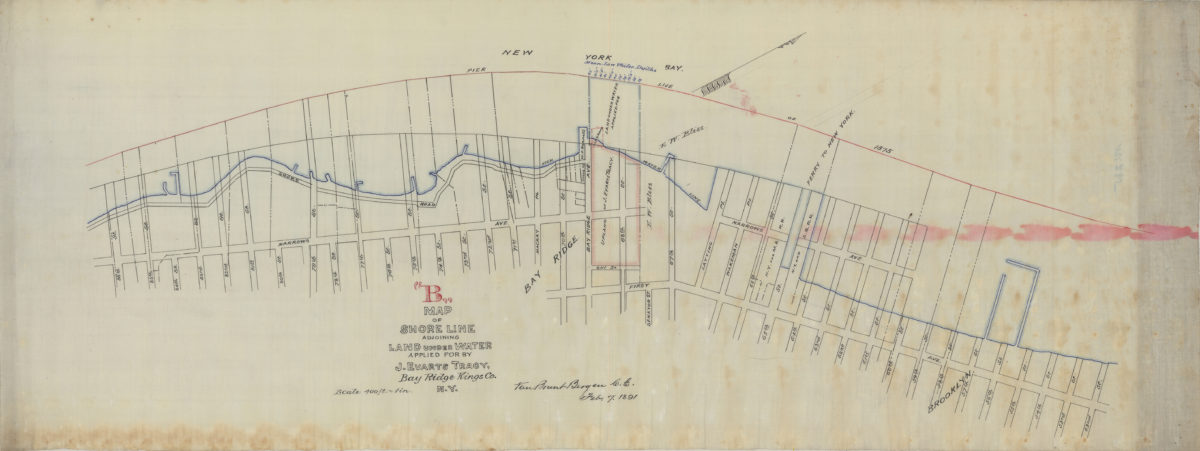
Map “B” of shore line adjoining land under water applied for by J. Evarts Tracy, Bay Ridge, Kings Co., N.Y.: Van Brunt Bergen, C.E.
Map “B” of shore line adjoining land under water applied for by J. Evarts Tracy, Bay Ridge, Kings Co., N.Y.: Van Brunt Bergen, C.E.
February 7, 1891
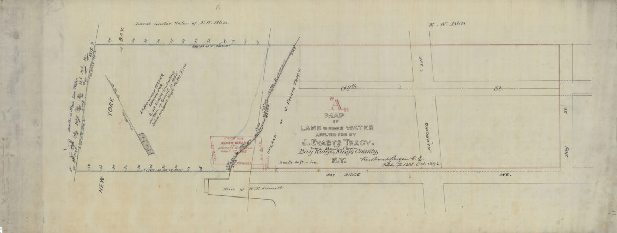
Map “A” of land under water applied for by J. Evarts Tracy and Mary Helen Brown, Bay Ridge, Kings County, N.Y.: Van Brunt Bergen, C.E.
Map “A” of land under water applied for by J. Evarts Tracy and Mary Helen Brown, Bay Ridge, Kings County, N.Y.: Van Brunt Bergen, C.E.
October 1892