Center for Brooklyn History
Map Collections
Search
About
Othmer Library & Archives
Submit search query
Refine 3 records
Clear filters
2
Location
Brooklyn (New York, N.Y.)
891
Brooklyn Heights (New York, N.Y.)
76
DUMBO Historic District (New York, N.Y.)
7
Fort Brooklyn (New York, N.Y.)
1
Manhattan (New York, N.Y.)
120
New York (N.Y.)
164
Subject
Fortification
7
Date
19th Century
945
or enter range:
from
to
Genres
Historical maps
53
Map
191
Military maps
23
Sort by:
Date (earliest)
Date (most recent)
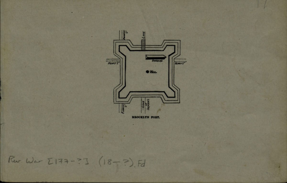
Brooklyn fort
Brooklyn fort
[18??]
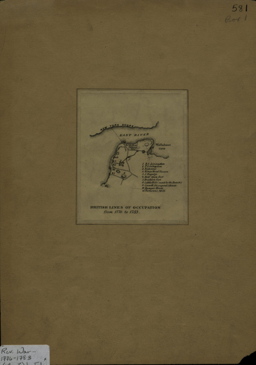
British lines of occupation from 1776 to 1783
British lines of occupation from 1776 to 1783
[18??]
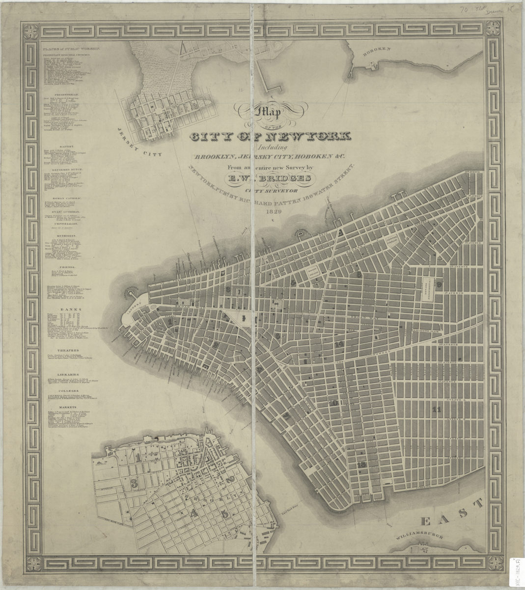
Map of the city of New York: including Brooklyn, Jersey City, Hoboken &c. : from an entire new survey: by E.W. Bridges, city surveyor
Map of the city of New York: including Brooklyn, Jersey City, Hoboken &c. : from an entire new survey: by E.W. Bridges, city surveyor
1829