Center for Brooklyn History
Map Collections
Search
About
Othmer Library & Archives
Submit search query
Refine 3 records
Clear filters
2
Location
Brooklyn (New York, N.Y.)
891
East New York (New York, N.Y.)
16
Jamaica Bay (N.Y.)
5
Manhattan (New York, N.Y.)
120
New York (N.Y.)
164
Subject
Bulkheads
1
Railroads
72
Shorelines
3
Waterfronts
5
Waterways
2
Date
19th Century
945
20th Century
469
or enter range:
from
to
Genres
Map
191
Physical maps
4
Thematic maps
60
Sort by:
Date (earliest)
Date (most recent)
New map of that part of the city of New York south from 20th Street on the Hudson & 35th Street on the East River: showing the position of Greenwich, Washington and West Streets on the Hudson River, and Pearl, Water, Front, Cherry & Tompkins Sts
New map of that part of the city of New York south from 20th Street on the Hudson & 35th Street on the East River: showing the position of Greenwich, Washington and West Streets on the Hudson River, and Pearl, Water, Front, Cherry & Tompkins Sts
[1862]
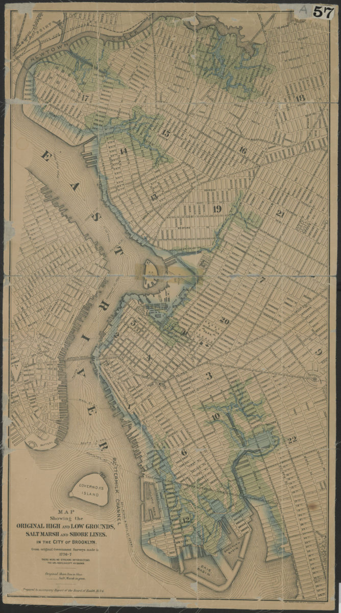
Map showing the original high and low grounds, salt marsh and shore lines in the city of Brooklyn: from original government surveys made in 1776-7
Map showing the original high and low grounds, salt marsh and shore lines in the city of Brooklyn: from original government surveys made in 1776-7
[1876]
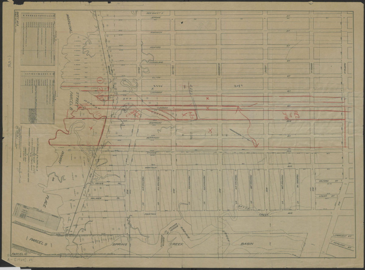
Part of parcel 8 and parcel 9 of damage map in the matter of acquiring title to property required for the improvement of the water front and harbor of the City of New York on Jamaica Bay, City of New York
Part of parcel 8 and parcel 9 of damage map in the matter of acquiring title to property required for the improvement of the water front and harbor of the City of New York on Jamaica Bay, City of New York
1929