Center for Brooklyn History
Map Collections
Search
About
Othmer Library & Archives
Submit search query
Refine 3 records
Clear filters
2
Location
Bergen Beach (New York, N.Y.)
3
Brooklyn (New York, N.Y.)
891
Canarsie (New York, N.Y.)
18
East Flatbush (New York, N.Y.)
23
Flatlands (New York, N.Y.)
19
Marine Park (New York, N.Y.)
5
Mill Basin (New York, N.Y.)
3
Subject
Indians of North America
6
Landowners
434
Real property
619
Date
20th Century
469
or enter range:
from
to
Genres
Historical maps
53
Pictorial maps
38
Sort by:
Date (earliest)
Date (most recent)
A conjectural plan of the three flats called by the Indians Keskateuw and by the Dutch Amersfort or the Village of Amersfort: made solely to elucidate the text-matter of this book and not purporting to determine what any of the flats comprised
A conjectural plan of the three flats called by the Indians Keskateuw and by the Dutch Amersfort or the Village of Amersfort: made solely to elucidate the text-matter of this book and not purporting to determine what any of the flats comprised
[1924; 1924]
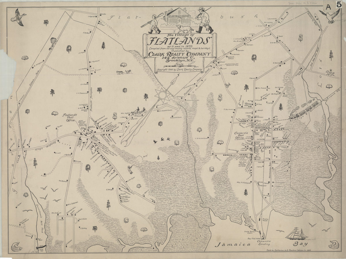
The village of Flatlands as it was in 1870: compiled from old and musty records, maps, & surveys: done by Catherine and E. Theodore Nelson
The village of Flatlands as it was in 1870: compiled from old and musty records, maps, & surveys: done by Catherine and E. Theodore Nelson
[ca. 1944]
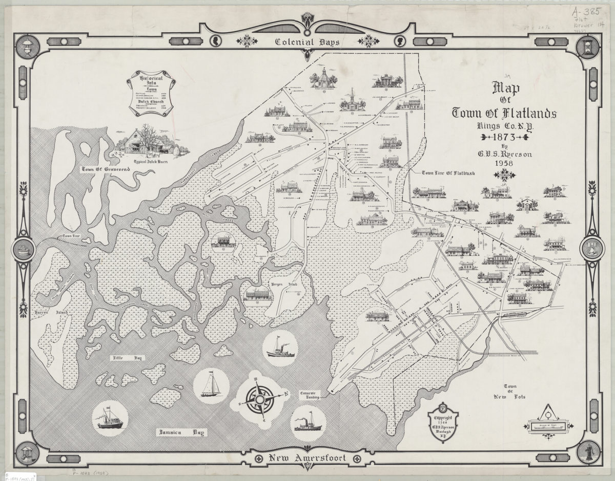
Map of town of Flatlands, Kings Co., N.Y. 1873: by G.V.S. Ryerson
Map of town of Flatlands, Kings Co., N.Y. 1873: by G.V.S. Ryerson
1958; [ca. 1960]