Center for Brooklyn History
Map Collections
Search
About
Othmer Library & Archives
Submit search query
Refine 4 records
Clear filters
2
Location
Brooklyn (New York, N.Y.)
891
Gravesend (New York, N.Y.)
25
Midwood (New York, N.Y.)
9
Nottingham (New York, N.Y.)
2
South Greenfield (New York, N.Y.)
1
Subject
Landowners
434
Real property
619
Roads
117
Streets
46
Date
19th Century
945
or enter range:
from
to
Genres
Cadastral maps
597
Manuscript maps
365
Sort by:
Date (earliest)
Date (most recent)
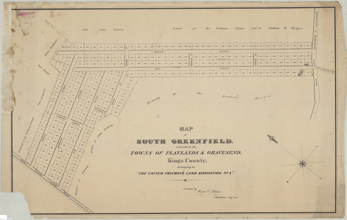
Map of South Greenfield, situated in the towns of Flatlands & Gravesend, Kings County, belonging to the United Freeman’s Land Assocation, no. 3: surveyed by Martin G. Johnson, Jamaica, Aug. 1854
Map of South Greenfield, situated in the towns of Flatlands & Gravesend, Kings County, belonging to the United Freeman’s Land Assocation, no. 3: surveyed by Martin G. Johnson, Jamaica, Aug. 1854
[1854]
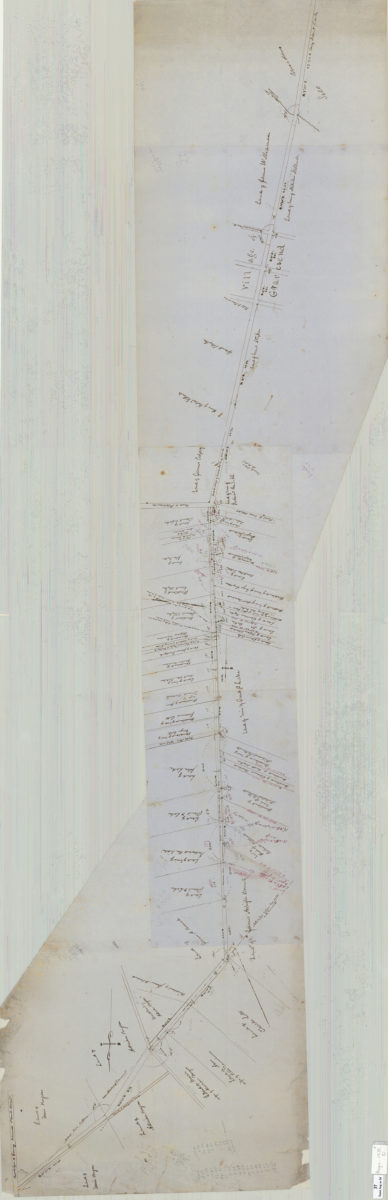
Map of route for a plank road from Coney Island Bridge Road to blacksmith shop, & therein along Wood Road. Patent line d[ivided] to mean: Teunis Bergen
Map of route for a plank road from Coney Island Bridge Road to blacksmith shop, & therein along Wood Road. Patent line d[ivided] to mean: Teunis Bergen
May 1855
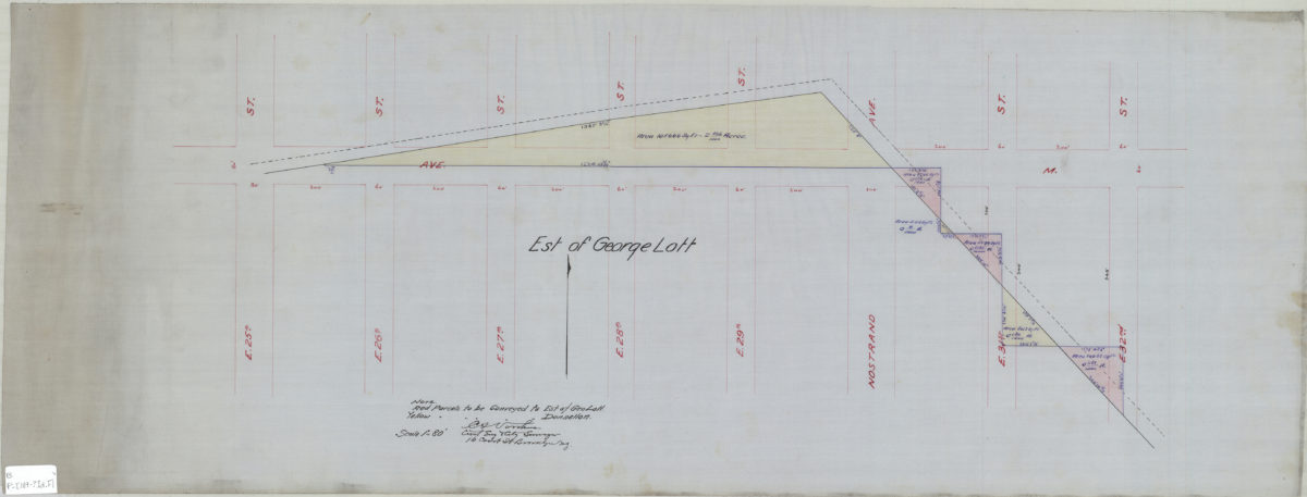
[Map showing estate of George Lott]: C.S. Voorhies, civil eng. & city surveyor
[Map showing estate of George Lott]: C.S. Voorhies, civil eng. & city surveyor
[189?]
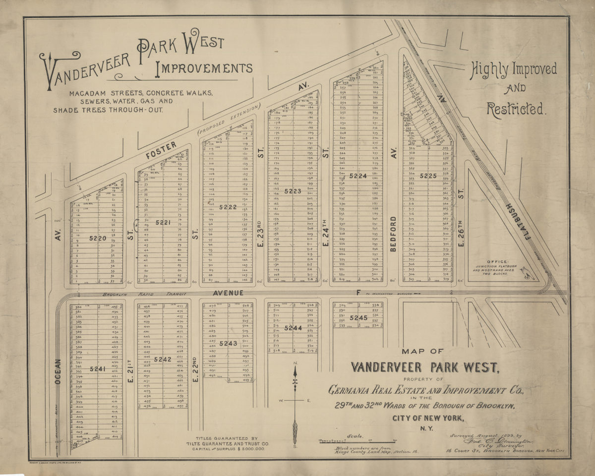
Map of Vanderveer Park West, property of Germania Real Estate and Improvement Co., in the 29th and 32nd Wards of the borough of Brooklyn, city of New York, N.Y.: surveyed August, 1899, by Fred. C. Dennington, city surveyor
Map of Vanderveer Park West, property of Germania Real Estate and Improvement Co., in the 29th and 32nd Wards of the borough of Brooklyn, city of New York, N.Y.: surveyed August, 1899, by Fred. C. Dennington, city surveyor
[1899]