Center for Brooklyn History
Map Collections
Search
About
Othmer Library & Archives
Submit search query
Refine 3 records
Clear filters
2
Location
Essex County (N.J.)
4
Hudson County (N.J.)
3
Middlesex County (N.J.)
4
New Jersey
27
New York (N.Y.)
164
New York (State)
95
New York Harbor (N.Y. and N.J.)
16
Union County (N.J.)
1
Westchester County (N.Y.)
11
Subject
Buildings
12
ferries
32
Landowners
434
Real property
619
Wetlands
6
Date
18th Century
12
19th Century
945
or enter range:
from
to
Genres
Bathymetric maps
94
Cadastral maps
597
Early maps
35
Early works
3
Topographic maps
70
Sort by:
Date (earliest)
Date (most recent)
A plan of the city of New-York & its environs: to Greenwich, on the North or Hudsons River, and to Crown Point, on the East or Sound River, shewing the several streets, publick buildings, docks, fort & battery,
A plan of the city of New-York & its environs: to Greenwich, on the North or Hudsons River, and to Crown Point, on the East or Sound River, shewing the several streets, publick buildings, docks, fort & battery,
1775
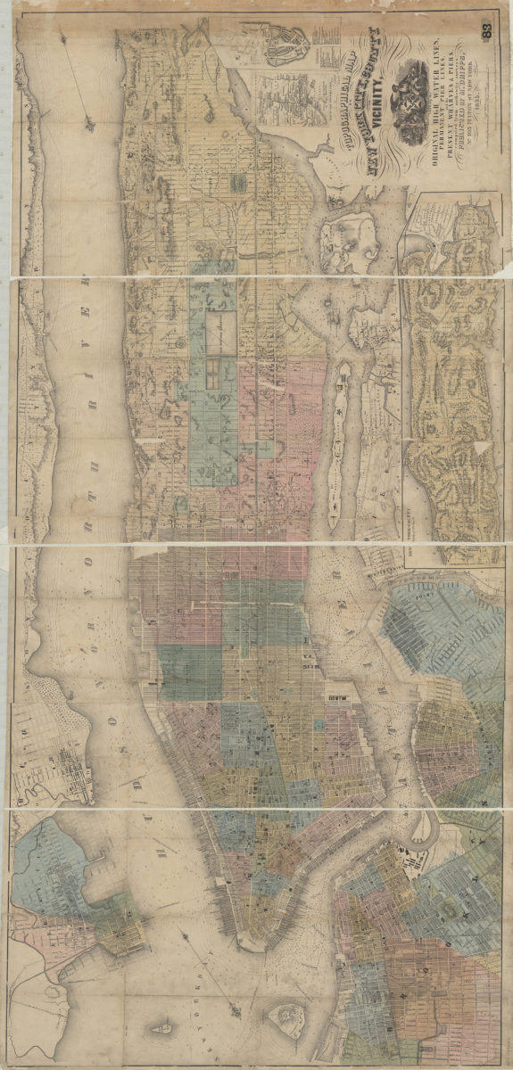
Topographical map of New York City, County and vicinity showing the original high water lines, permanent pier lines, and the present wharves & piers: compiled from authentic surveys
Topographical map of New York City, County and vicinity showing the original high water lines, permanent pier lines, and the present wharves & piers: compiled from authentic surveys
1855
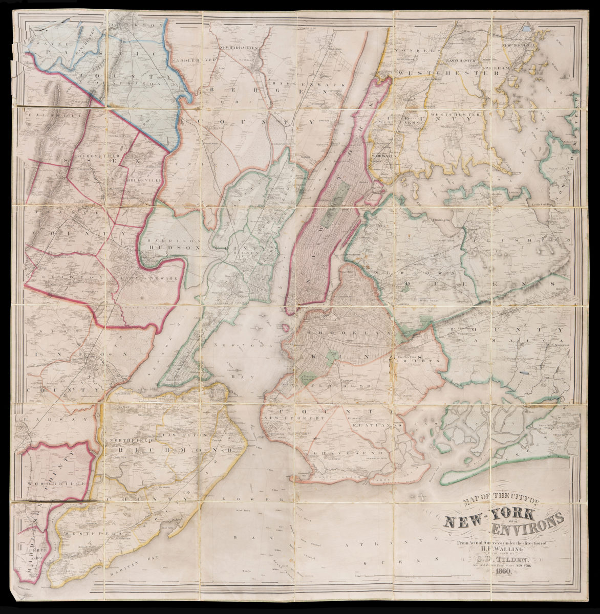
Map of the City of New-York and it’s environs: from actual surveys under the direction of H.F. Walling
Map of the City of New-York and it’s environs: from actual surveys under the direction of H.F. Walling
1860