Center for Brooklyn History
Map Collections
Search
About
Othmer Library & Archives
Submit search query
Refine 5 records
Clear filters
2
Location
Brooklyn (New York, N.Y.)
891
Jersey City (N.J.)
4
Manhattan (New York, N.Y.)
120
New Jersey
27
New York (N.Y.)
164
Queens (New York, N.Y.)
83
Subject
Buildings
12
Canals
15
ferries
32
Fills (Earthwork)
4
Local transit
63
Piers
25
Railroads
72
Rivers
16
Roads
117
Streets
46
Wetlands
6
Date
19th Century
945
20th Century
469
21th Century
66
or enter range:
from
to
Genres
Bathymetric maps
94
Map
191
Road maps
83
Transportation maps
120
Sort by:
Date (earliest)
Date (most recent)
City & County map of New-York, Brooklyn, Williamsburgh, Jersey City and the adjacent waters: by J.H. Colton
City & County map of New-York, Brooklyn, Williamsburgh, Jersey City and the adjacent waters: by J.H. Colton
1852; [ca. 1845]
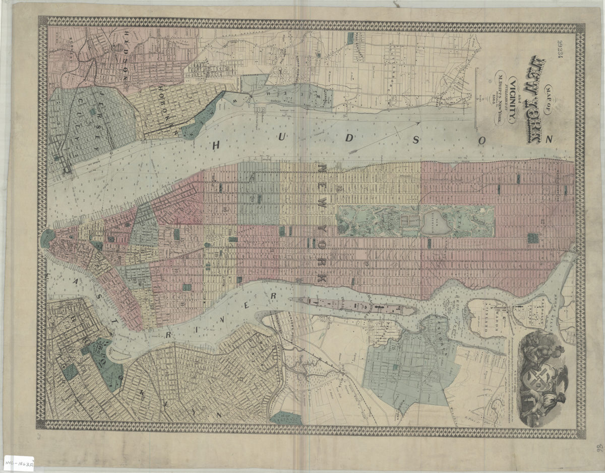
Map of New York and vicinity
Map of New York and vicinity
1863
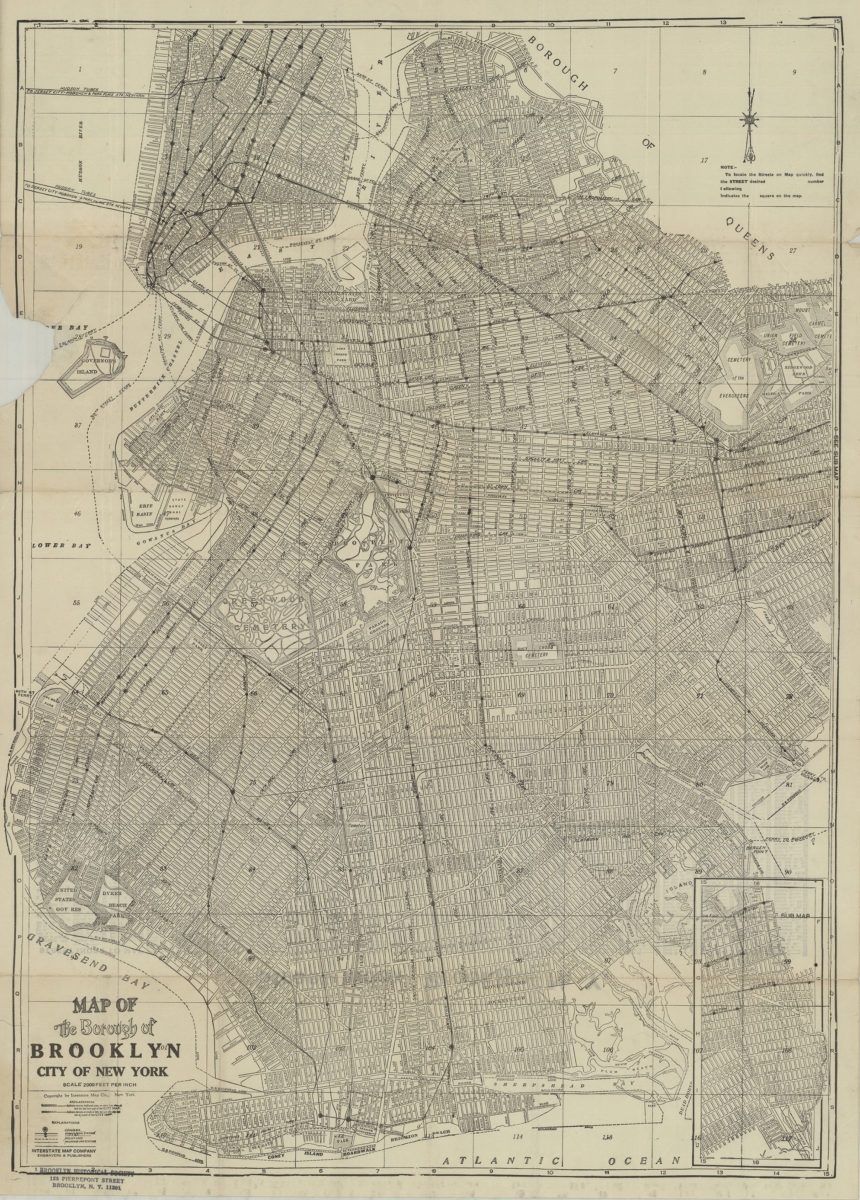
Map of the Borough of Brooklyn, City of New York
Map of the Borough of Brooklyn, City of New York
[19??]
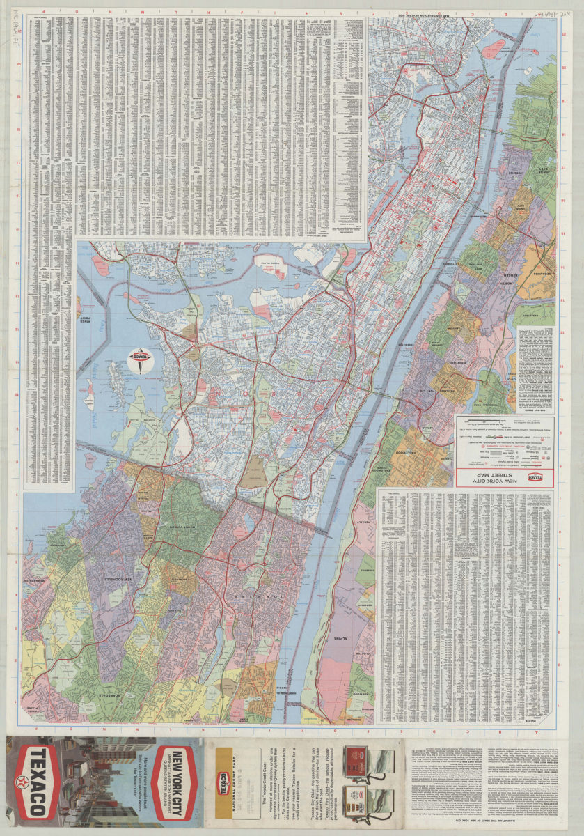
Texaco New York City street map
Texaco New York City street map
[1969; 1969]
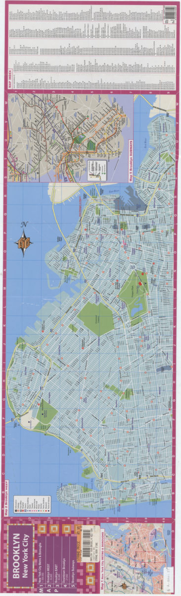
Brooklyn, New York City
Brooklyn, New York City
[ca. 2001]