Center for Brooklyn History
Map Collections
Search
About
Othmer Library & Archives
Submit search query
Refine 5 records
Clear filters
2
Location
Bronx (New York, N.Y.)
10
Brooklyn (New York, N.Y.)
891
Far Rockaway (New York, N.Y.)
2
Long Island (N.Y.)
197
Nassau County (N.Y.)
24
New York (State)
95
Queens (New York, N.Y.)
83
Subject
Local transit
63
Railroads, Elevated
24
Roads
117
Street addresses
11
Streets
46
Subways
55
Date
20th Century
469
or enter range:
from
to
Genres
Bathymetric maps
94
Road maps
83
Topographic maps
70
Sort by:
Date (earliest)
Date (most recent)
Hagstrom’s map of Queens (New York City): house-number and subway guide: compiled, printed, and published by Hagstrom Map Company, map makers and publishers
Hagstrom’s map of Queens (New York City): house-number and subway guide: compiled, printed, and published by Hagstrom Map Company, map makers and publishers
[1928]
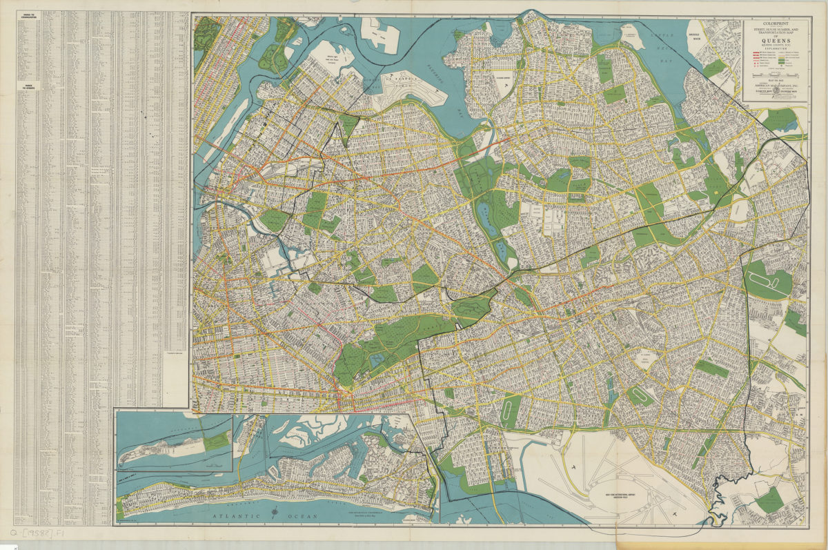
Colorprint street, house number and transportation map of Queens: (Queens County, N.Y.): American Map Company
Colorprint street, house number and transportation map of Queens: (Queens County, N.Y.): American Map Company
[1958]
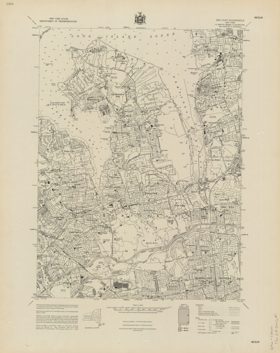
Sea Cliff quadrangle, New York
Sea Cliff quadrangle, New York
[1968]
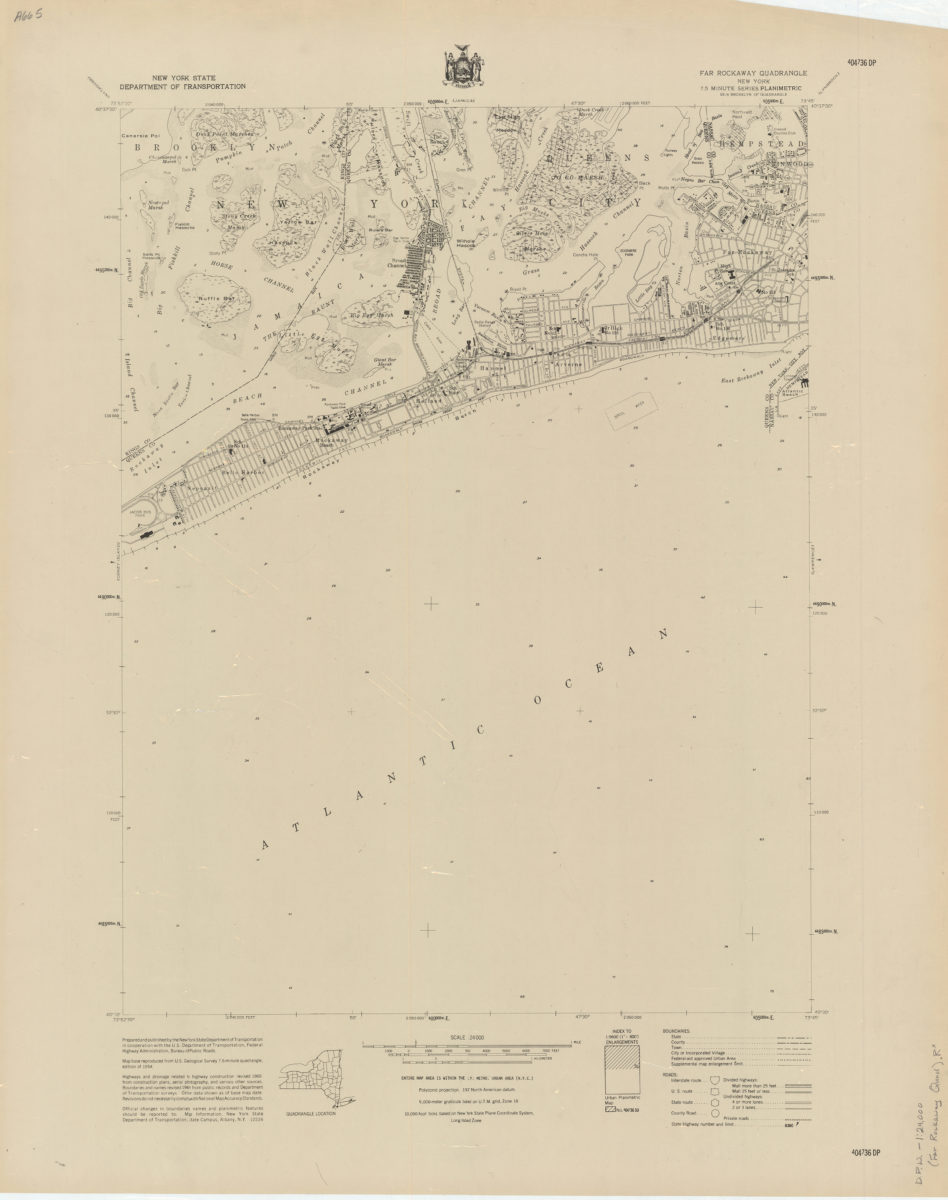
Far Rockaway quadrangle, New York
Far Rockaway quadrangle, New York
[1969]
Flushing quadrangle, New York
Flushing quadrangle, New York
[1969]