Center for Brooklyn History
Map Collections
Search
About
Othmer Library & Archives
Submit search query
Refine 5 records
Clear filters
2
Location
Brooklyn (New York, N.Y.)
891
Croton Aqueduct (N.Y.)
3
Manhattan (New York, N.Y.)
120
New York (N.Y.)
164
New York (State)
95
Subject
Aqueducts
3
Buildings
12
Church property
1
Fills (Earthwork)
4
Fortification
7
Landforms
15
Piers
25
Ponds
6
Reservoirs
2
Rivers
16
Roads
117
Schools
1
Wetlands
6
Date
19th Century
945
20th Century
469
or enter range:
from
to
Genres
Bathymetric maps
94
Early maps
35
Historical maps
53
Map
191
Pictorial works
1
Sort by:
Date (earliest)
Date (most recent)
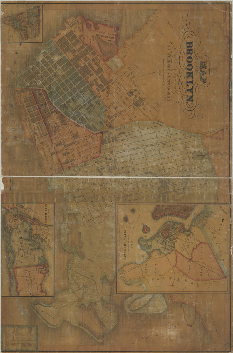
Map of the City of Brooklyn: compiled & surveyed by S.C. Herbert & R. Tolford
Map of the City of Brooklyn: compiled & surveyed by S.C. Herbert & R. Tolford
1835
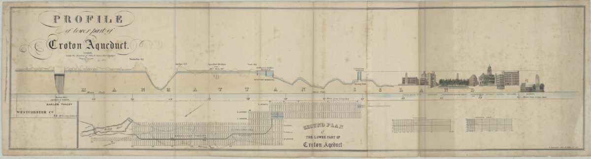
Profile of lower part of Croton Aqueduct: compiled under the direction of John B. Jervis by Theophilus Schramke. Ground plan of the lower part of Croton Aqueduct
Profile of lower part of Croton Aqueduct: compiled under the direction of John B. Jervis by Theophilus Schramke. Ground plan of the lower part of Croton Aqueduct
[1846]
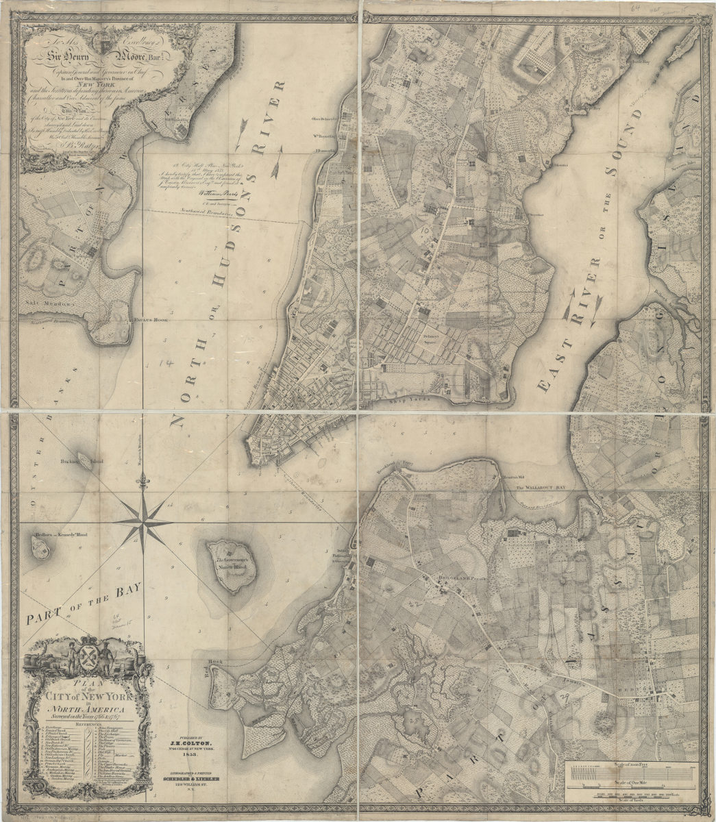
Plan of the city of New York in North America: surveyed in the years 1766 & 1767: B. Ratzer ; Thos. Kitchin sculpt
Plan of the city of New York in North America: surveyed in the years 1766 & 1767: B. Ratzer ; Thos. Kitchin sculpt
1853
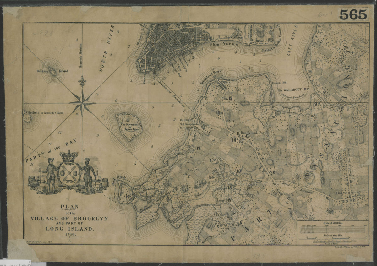
Plan of the village of Brooklyn and part of Long Island 1766
Plan of the village of Brooklyn and part of Long Island 1766
[1864]
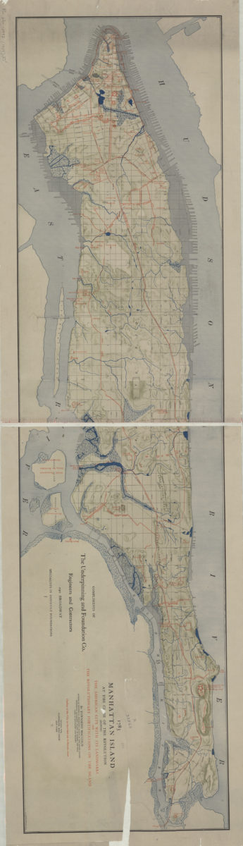
1783 Manhattan Island at the close of the Revolution: showing the American city with its landmarks and the Revolutionary fortifictions on the island: by Townsend Mac Coun
1783 Manhattan Island at the close of the Revolution: showing the American city with its landmarks and the Revolutionary fortifictions on the island: by Townsend Mac Coun
[ca. 1909]