Center for Brooklyn History
Map Collections
Search
About
Othmer Library & Archives
Submit search query
Refine 9 records
Clear filters
4
Location
Bronx (New York, N.Y.)
10
Brooklyn (New York, N.Y.)
891
Hempstead (N.Y.)
13
Manhattan (New York, N.Y.)
120
Nassau County (N.Y.)
24
Queens (New York, N.Y.)
83
Staten Island (N.Y.)
10
Westchester County (N.Y.)
11
Subject
Bus lines
20
Bus travel
22
Central business districts
10
ferries
32
Local transit
63
Railroads
72
Date
20th Century
469
or enter range:
from
to
Genres
Tourist maps
55
Transportation maps
120
Sort by:
Date (earliest)
Date (most recent)
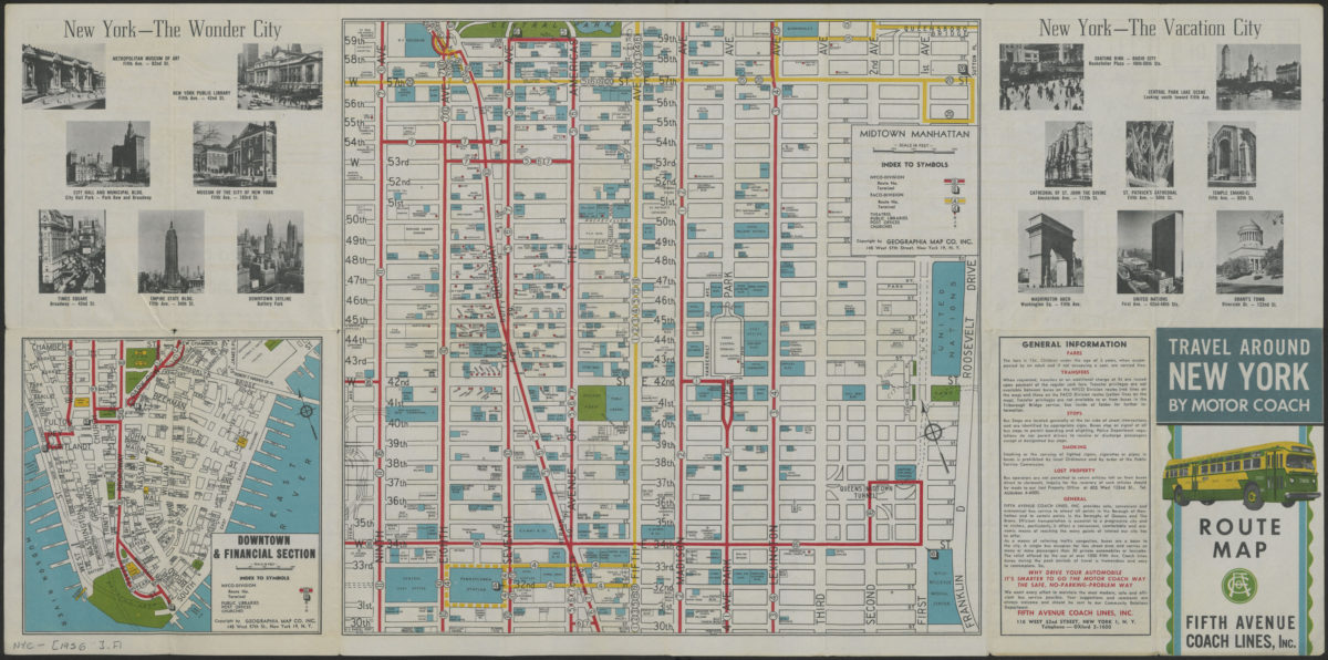
Travel around New York by motorcoach: route map, Fifth Avenue Coach Lines, Inc
Travel around New York by motorcoach: route map, Fifth Avenue Coach Lines, Inc
[1956-1962]
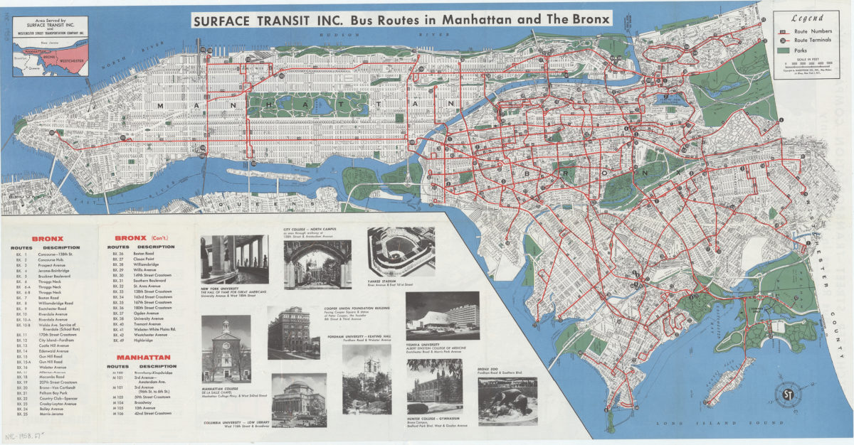
Travel around Manhattan, the Bronx New York City, and Westchester County, New York: route map : Service Transit Inc. and Westchester Street Transportation Company Inc
Travel around Manhattan, the Bronx New York City, and Westchester County, New York: route map : Service Transit Inc. and Westchester Street Transportation Company Inc
[1958]
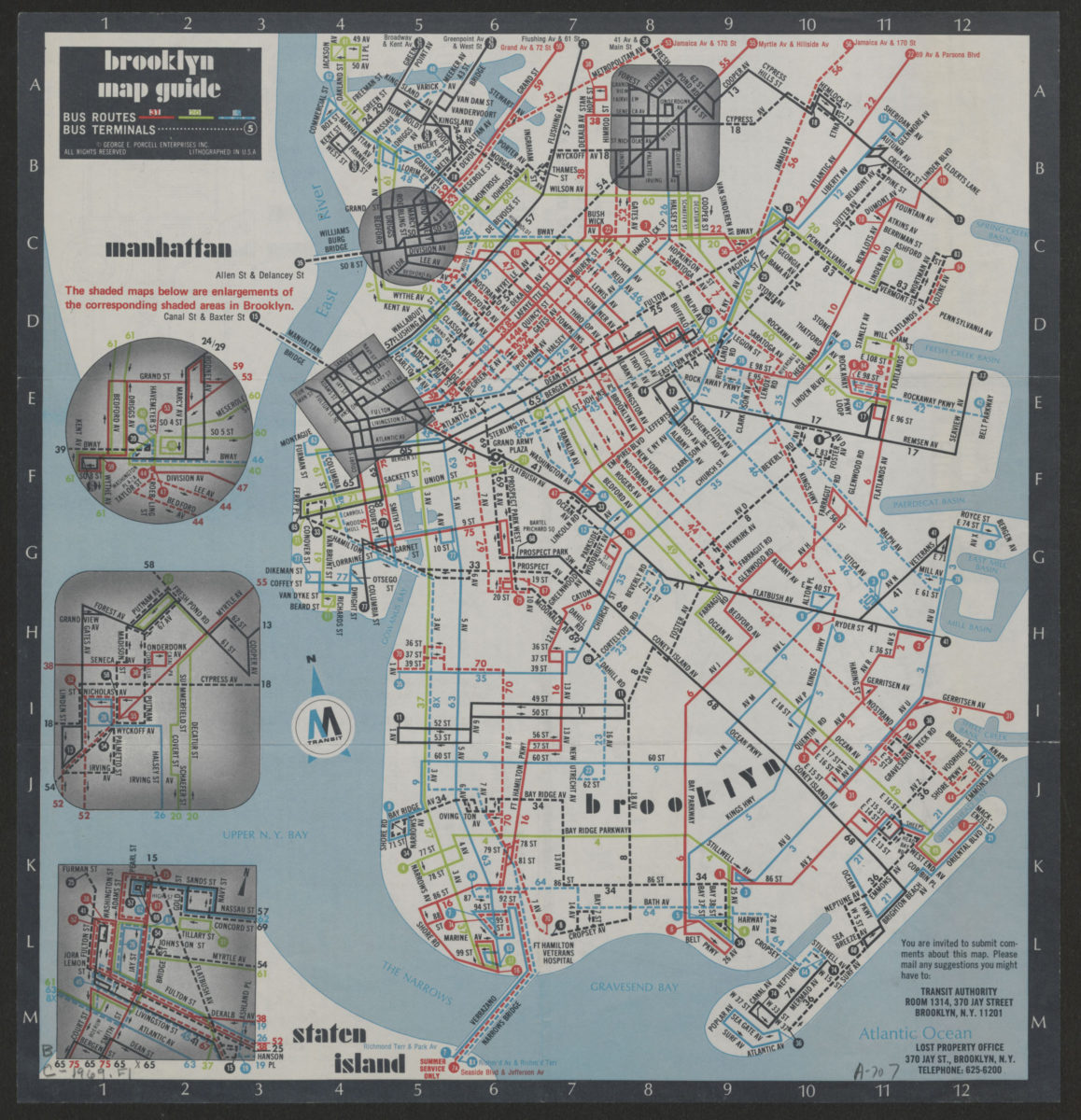
Brooklyn Staten Island bus map: M Transit
Brooklyn Staten Island bus map: M Transit
[ca. 1969]
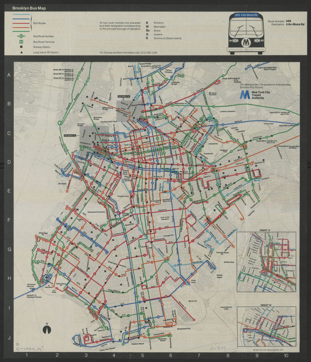
Brooklyn bus map
Brooklyn bus map
[ca. 1974]
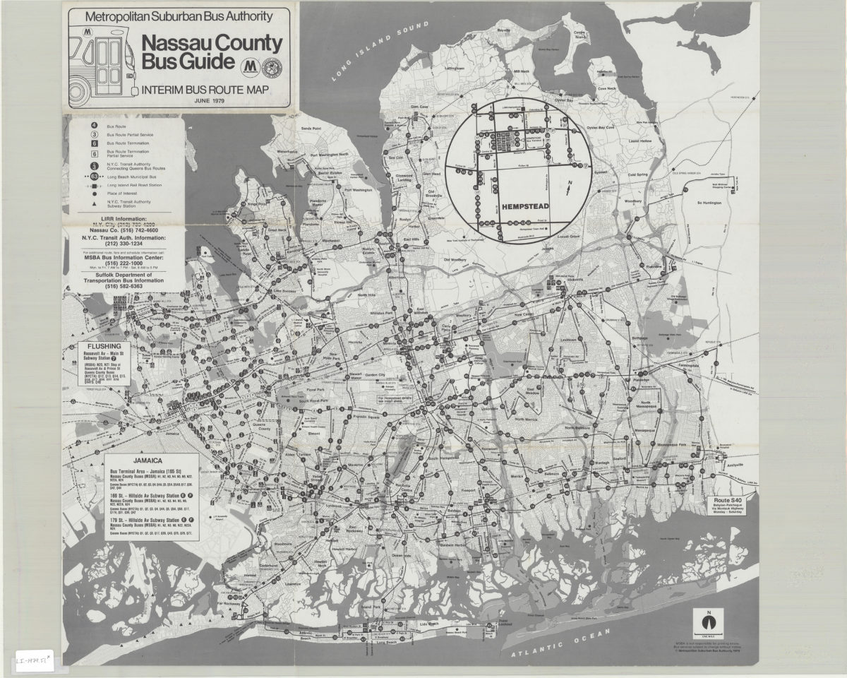
Nassau County bus guide: interim bus route map: Metropolitan Suburban Bus Authority
Nassau County bus guide: interim bus route map: Metropolitan Suburban Bus Authority
1979;c1979
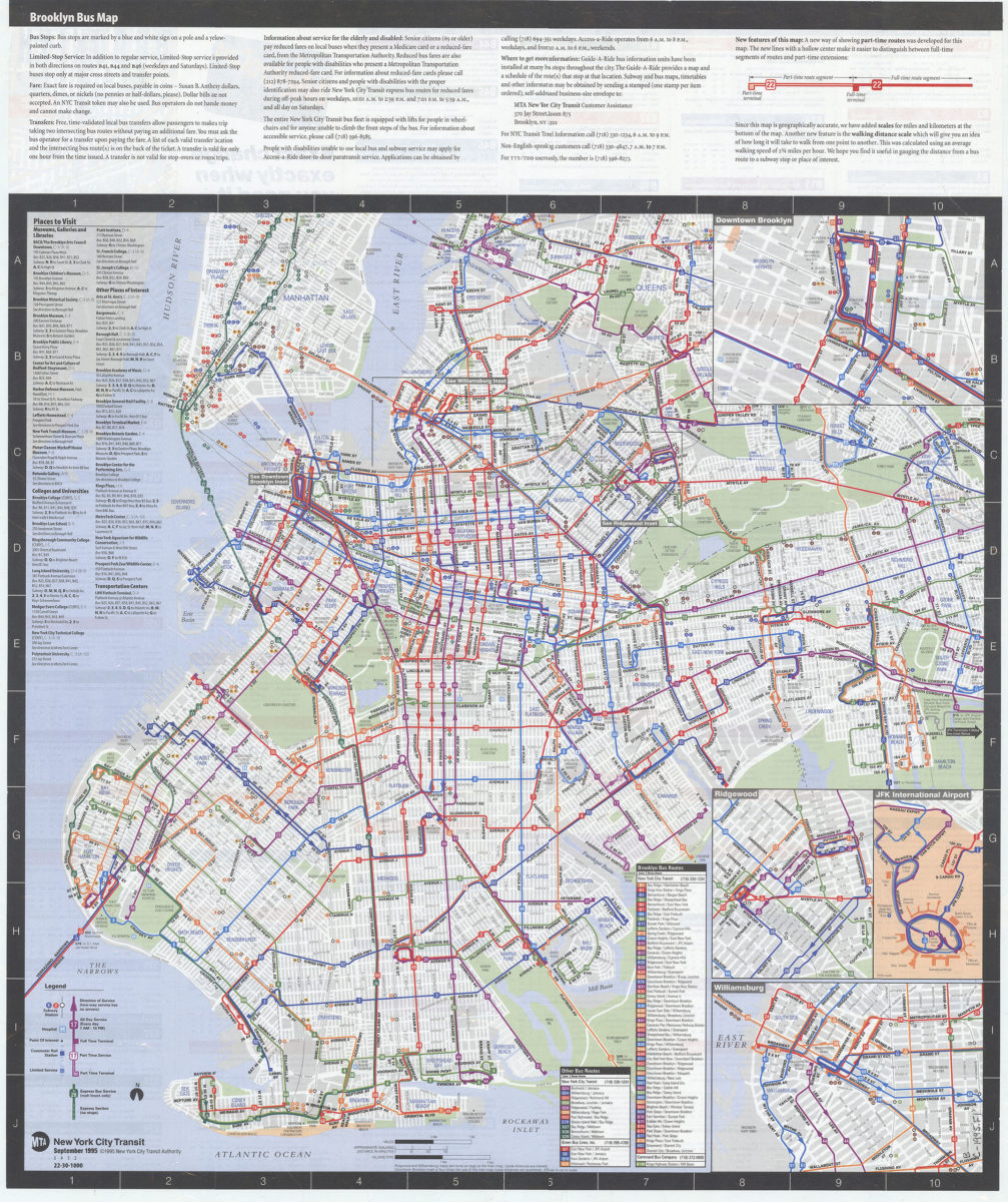
Brooklyn bus map: updated for fall service changes: MTA, New York City Transit
Brooklyn bus map: updated for fall service changes: MTA, New York City Transit
[ca. 1995]
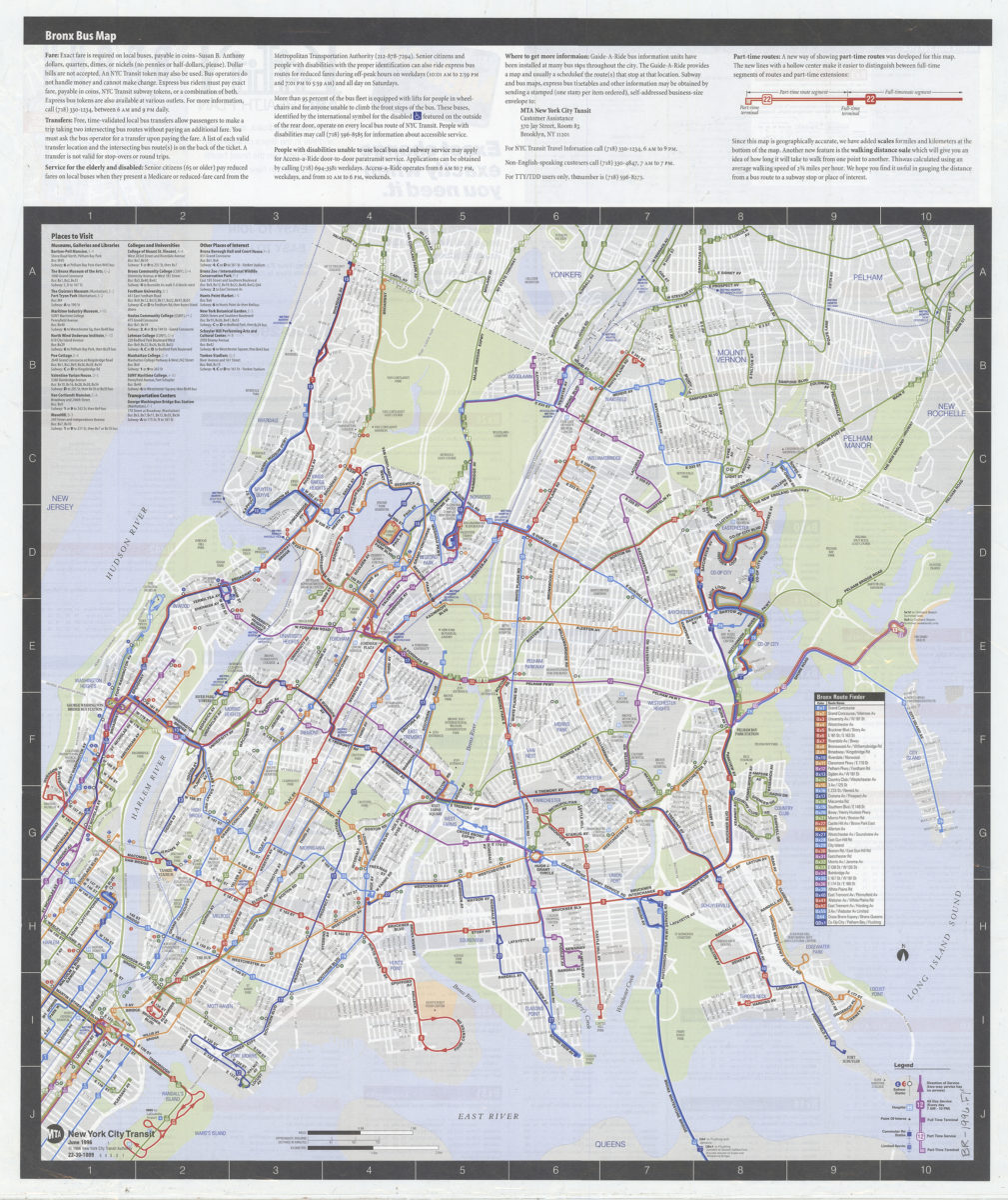
Bronx bus map: MTA, New York City Transit
Bronx bus map: MTA, New York City Transit
[ca. 1996]
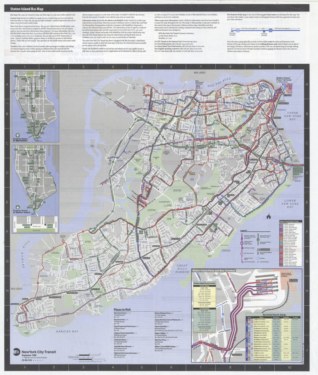
Staten Island bus map: MTA, New York City Transit
Staten Island bus map: MTA, New York City Transit
[ca. 1996]
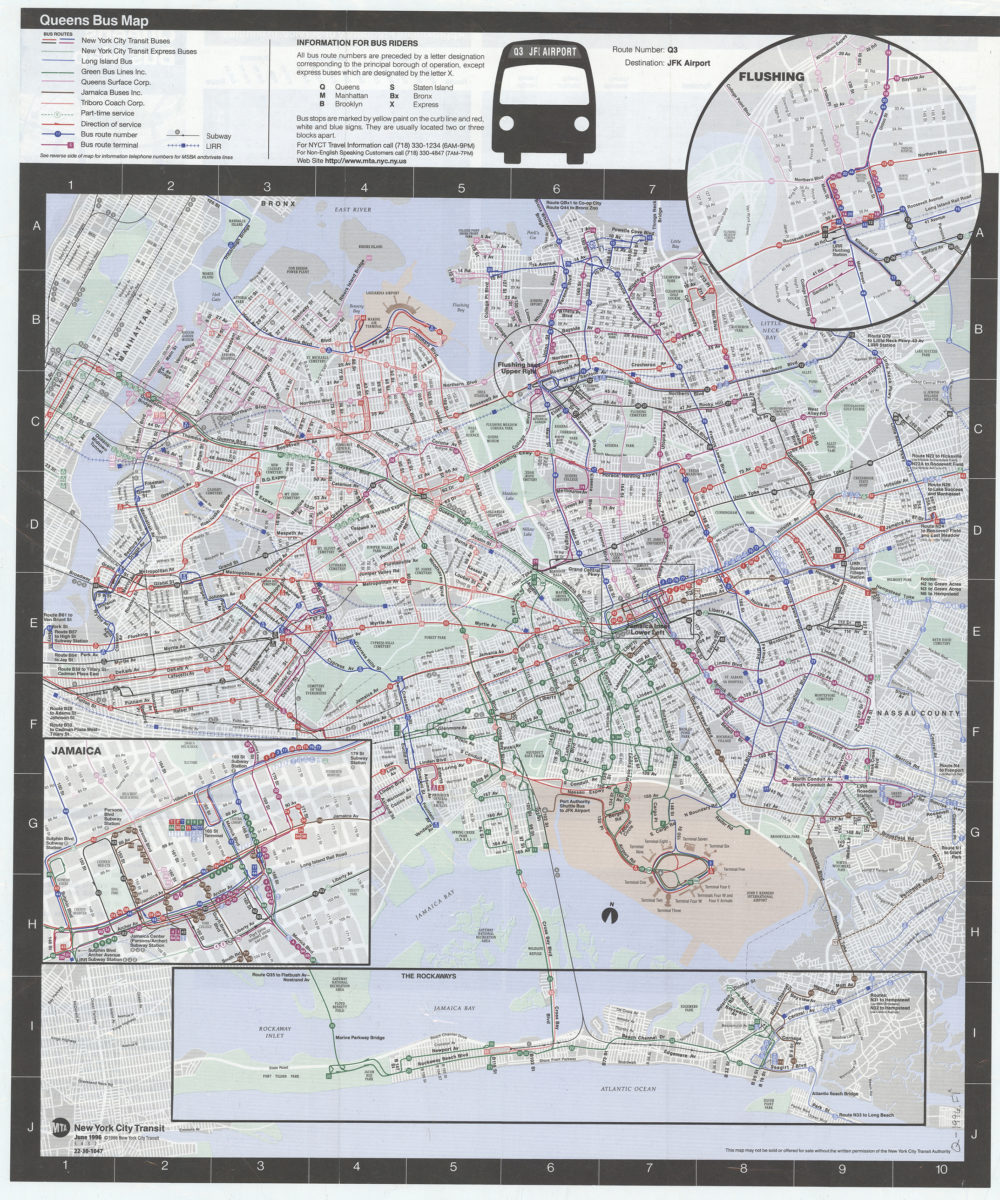
Queens bus map: MTA, New York City Transit
Queens bus map: MTA, New York City Transit
[ca. 1996]