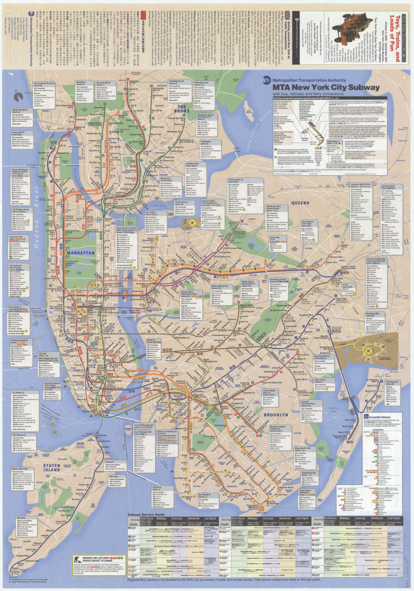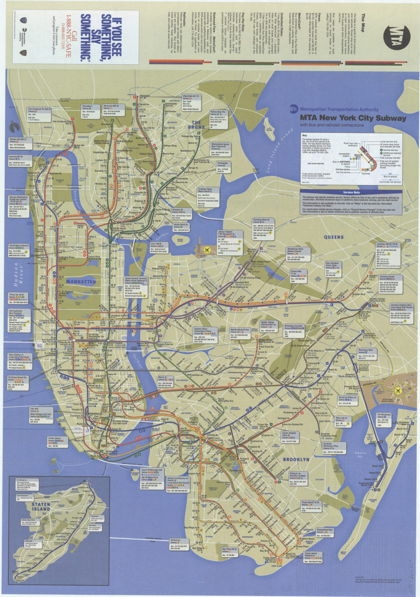
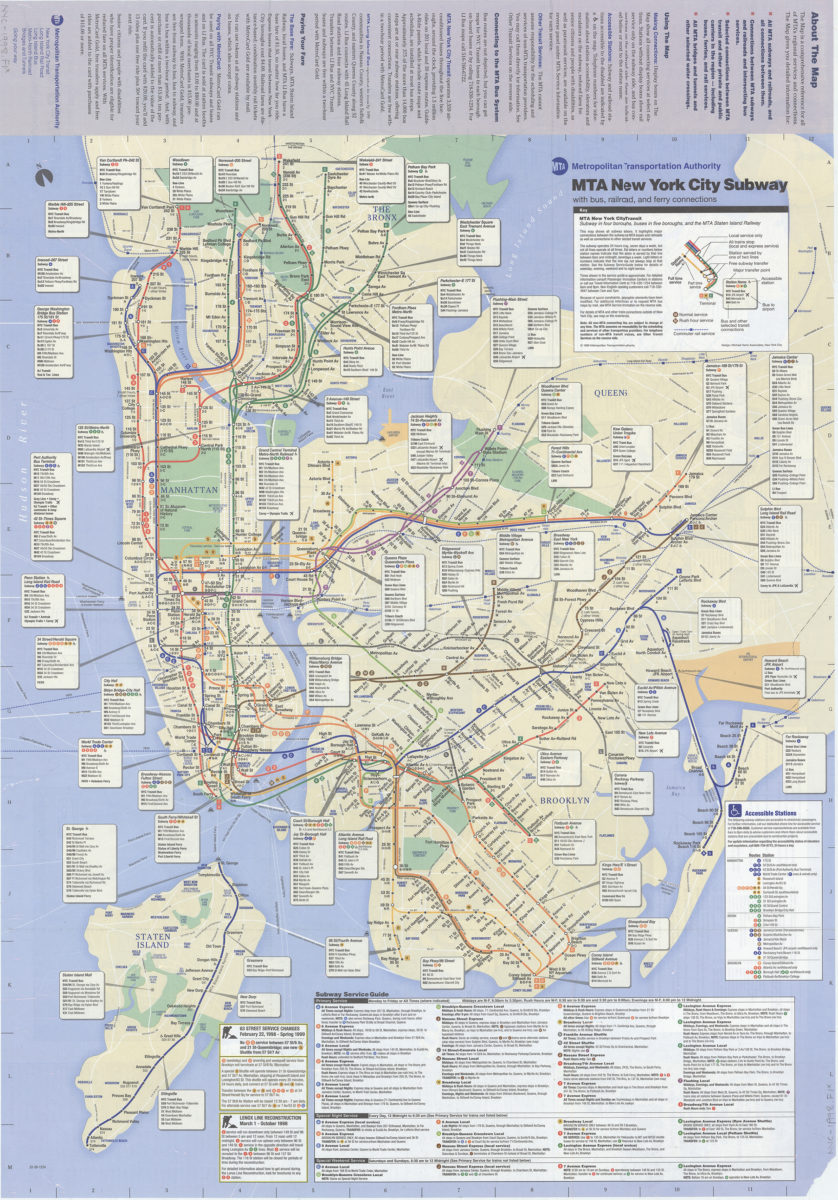
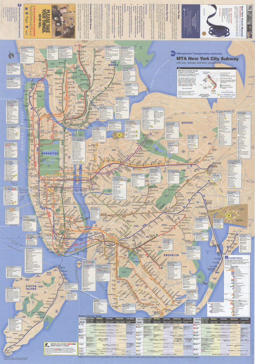
The map: MTA subways and railroads, plus bus connections: MTA Metropolitan Transporation Authority
[ca. 2005]
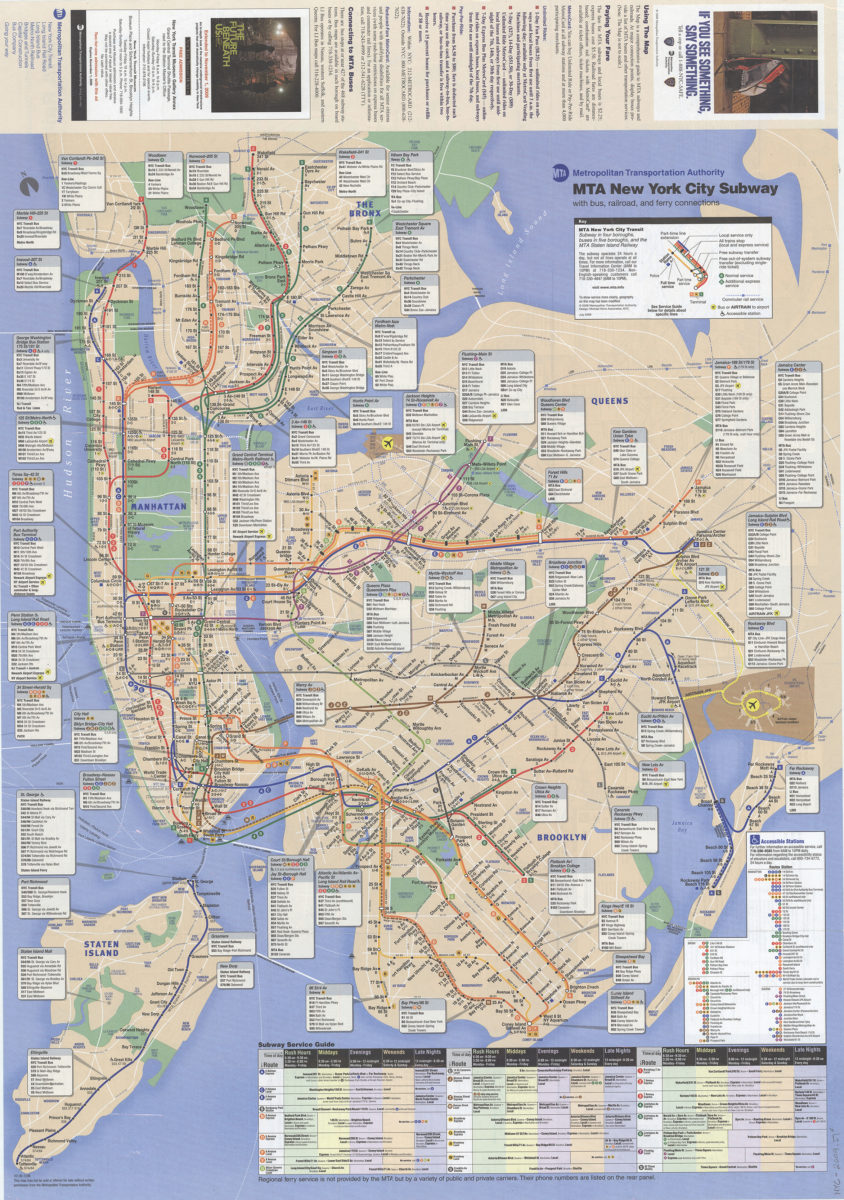
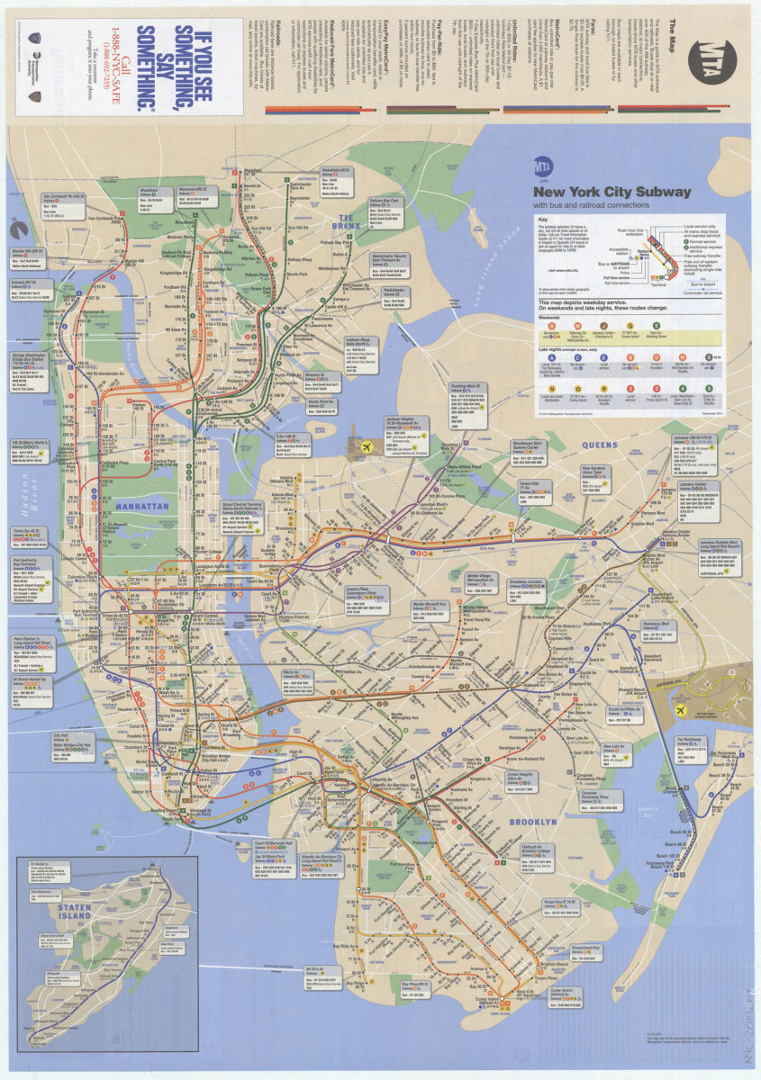
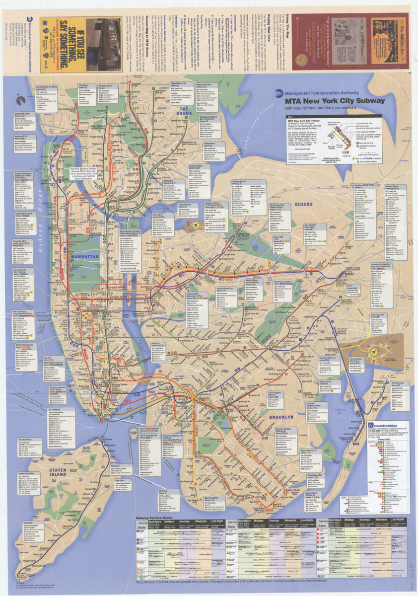
The map: MTA subways and railroads, plus bus connections: MTA Metropolitan Transporation Authority
[ca. 2006]