Center for Brooklyn History
Map Collections
Search
About
Othmer Library & Archives
Submit search query
Refine 3 records
Clear filters
2
Location
Brooklyn (New York, N.Y.)
891
Brooklyn Heights (New York, N.Y.)
76
New York Harbor (N.Y. and N.J.)
16
New York Metropolitan Area
40
Red Hook (New York, N.Y.)
19
Subject
Harbors
11
Marine terminals
2
Piers
25
Railroad terminals
2
Railroads
72
Railroads, Elevated
24
Steamboat lines
4
Street railroads
8
Streets
46
Date
19th Century
945
20th Century
469
or enter range:
from
to
Genres
Tourist maps
55
Transportation maps
120
Sort by:
Date (earliest)
Date (most recent)
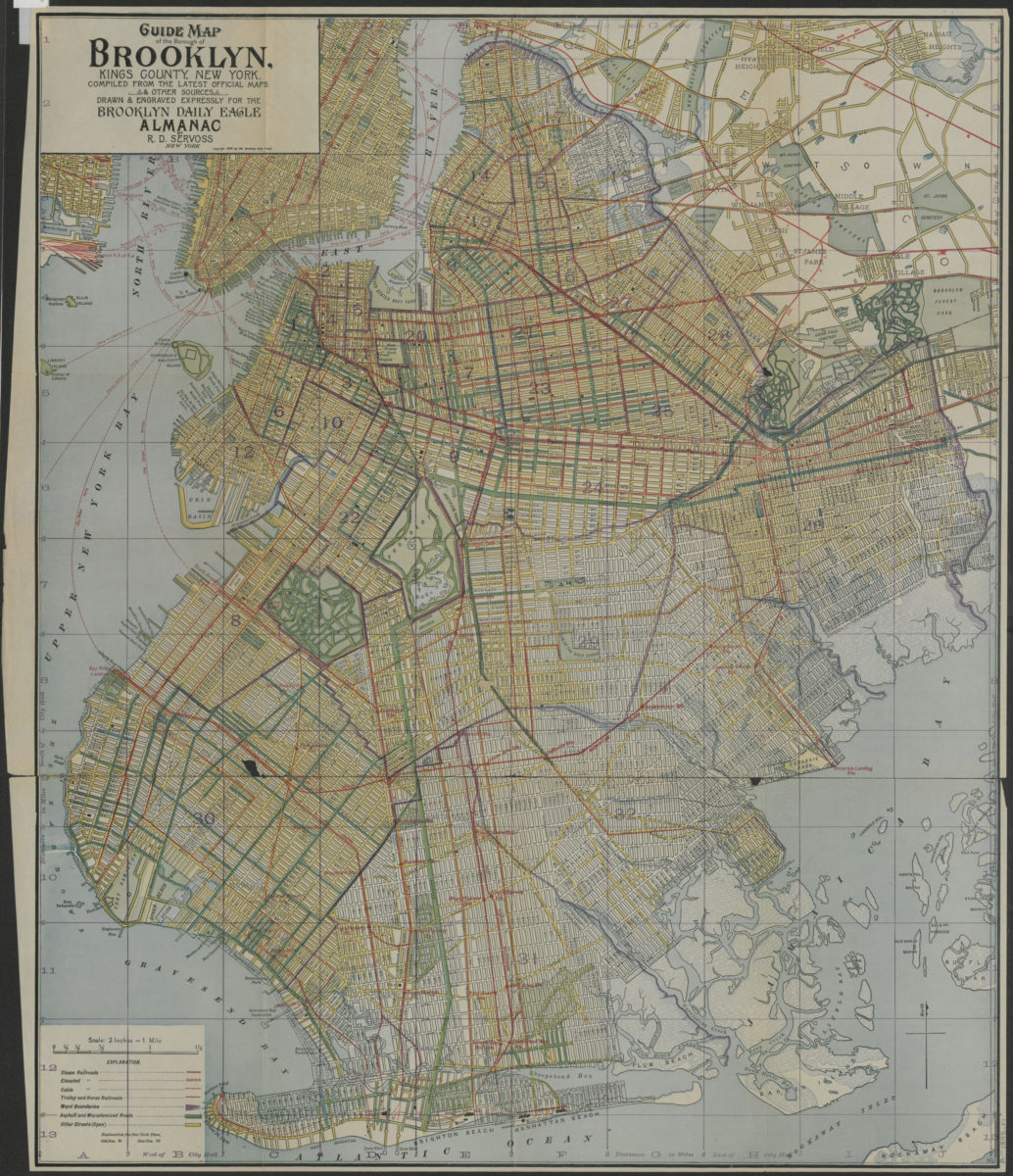
Guide map of the Borough of Brooklyn, Kings County, New York: compiled from the latest official maps & other sources, drawn & engraved expressly for the Brooklyn Daily Eagle Almanac
Guide map of the Borough of Brooklyn, Kings County, New York: compiled from the latest official maps & other sources, drawn & engraved expressly for the Brooklyn Daily Eagle Almanac
[ca. 1898]
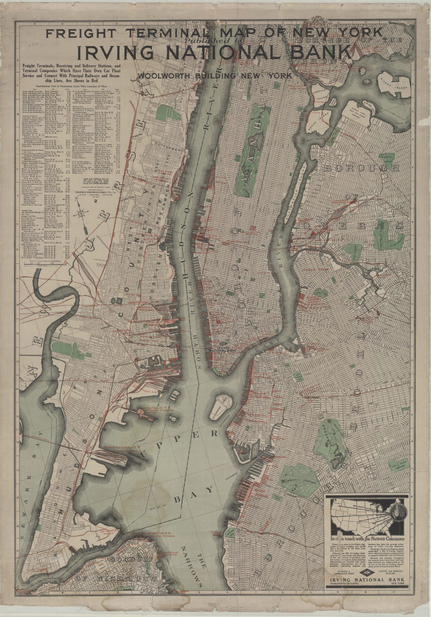
Freight terminal map of New York: published by Irving National Bank
Freight terminal map of New York: published by Irving National Bank
1916
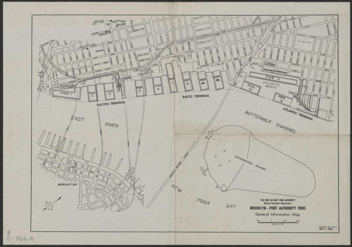
Brooklyn-Port Authority piers: general information map
Brooklyn-Port Authority piers: general information map
1964