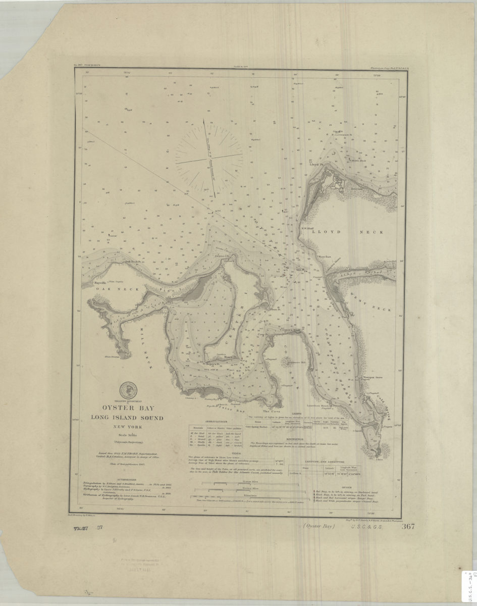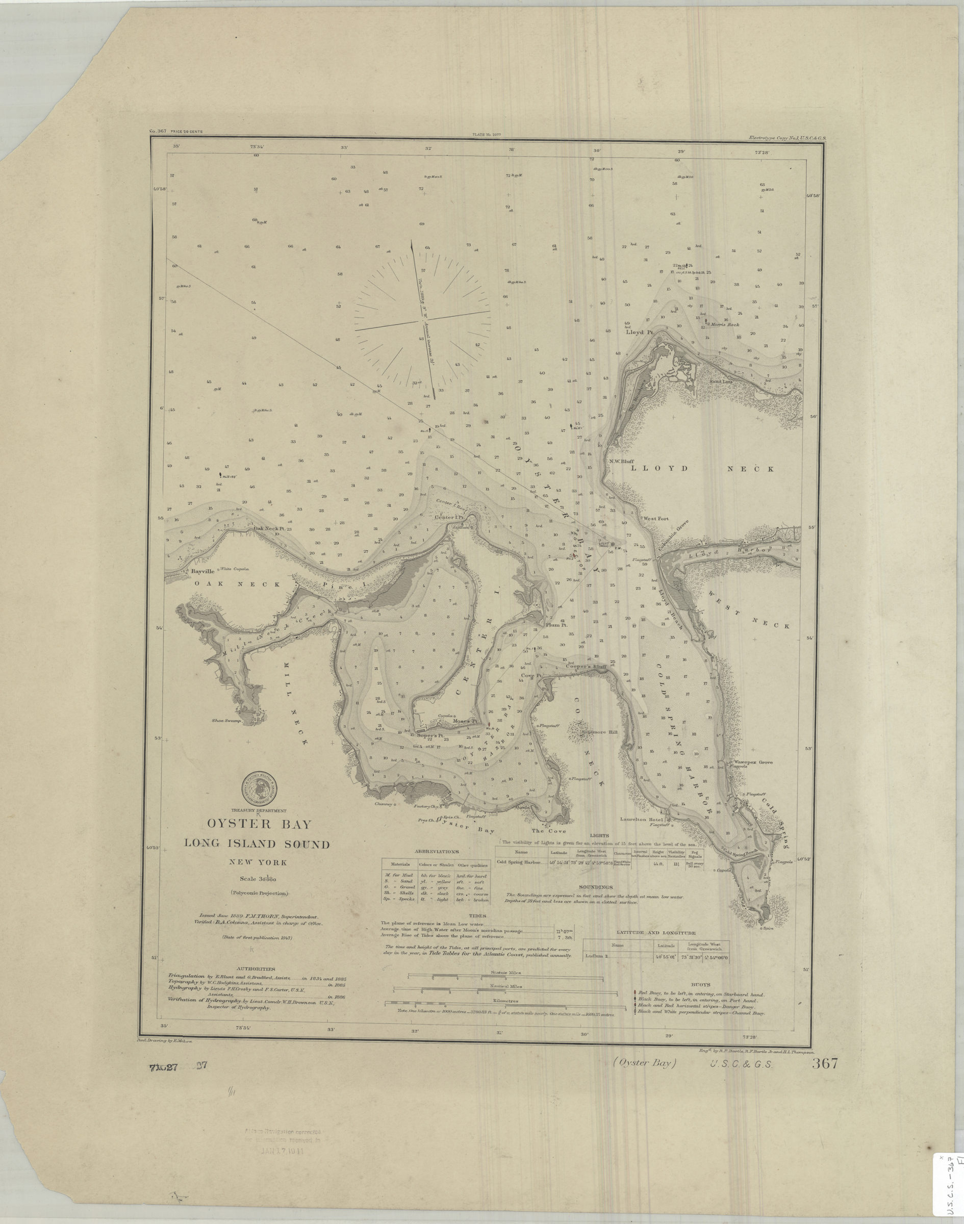
Oyster Bay, Long Island Sound, New York: U.S. Coast and Geodetic Survey ; red. drawing by E. Molkow 1889
Nautical chart also covering Oak Neck, Mill Neck, Cove Neck, West Neck, Lloyd Neck, and Center Island. Shows buoys, some structures, and seafloor terrain. Relief shown by form lines and hachures. Depths shown by shading and soundings in feet. “Verified : B.A. Colonna, Assistant in charge of Office.” “Triangulation by E. Blunt and G. Bradford, Assists.” “Topography by W.C. Hodgkins, Assistant.” “Hydrography by Lieuts F.H. Crosby and F.S. Carter, U.S.N., Assistants.” “Verification of Hydrography by Lieut. Comdr. W.H. Brownson U.S.N., Inspector of Hydrography.” “(Date of first publication 1847)” “Issued June 1889 F.M. Thorn, Superintendent.” Includes seal, keys, lights table, tidal table, and text. “Plate No. 2077”–Upper center margin. “No. 367 price 20 cents.”–Upper left margin. “Electrotype Copy No. 1 U.S.C. & G.S.”–Upper right margin. BHS copy stamped: Aids to Navigation corrected for information received to Jan 17 1911.
Map area shown
Genre
Nautical chartsRelation
Full catalog recordSize
48 × 35 cmDownload
Low Resolution Image
Creator
U.S. Coast and Geodetic Survey,Publisher
Brooklyn Historical SocietyCitation
Oyster Bay, Long Island Sound, New York: U.S. Coast and Geodetic Survey ; red. drawing by E. Molkow; 1889, Map Collection, U.S.C.S.-367.Fl; Brooklyn Historical Society.Scale
Scale 1:30,000