Center for Brooklyn History
Map Collections
Search
About
Othmer Library & Archives
Submit search query
Refine 9 records
Clear filters
3
Location
Bay Ridge (New York, N.Y.)
108
Brooklyn (New York, N.Y.)
891
Coney Island (New York, N.Y.)
22
East Flatbush (New York, N.Y.)
23
Flatbush (New York, N.Y.)
35
Fort Hamilton (New York, N.Y.)
31
Park Slope (New York, N.Y.)
16
Sunset Park (New York, N.Y.)
53
Subject
Landforms
15
Landowners
434
Plank roads
1
Real property
619
Roads
117
Streets
46
Date
19th Century
945
or enter range:
from
to
Genres
Cadastral maps
597
Manuscript maps
365
Sort by:
Date (earliest)
Date (most recent)
Grades on street in Richards tract, Bay Ridge
Grades on street in Richards tract, Bay Ridge
[18??]
[Brooklyn & Coney Island Plank Road surveys]
[Brooklyn & Coney Island Plank Road surveys]
[ca. 1850]
[Maps of land in Fort Hamilton bought and sold by Richard R. Bennet]
[Maps of land in Fort Hamilton bought and sold by Richard R. Bennet]
1853-1854
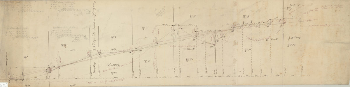
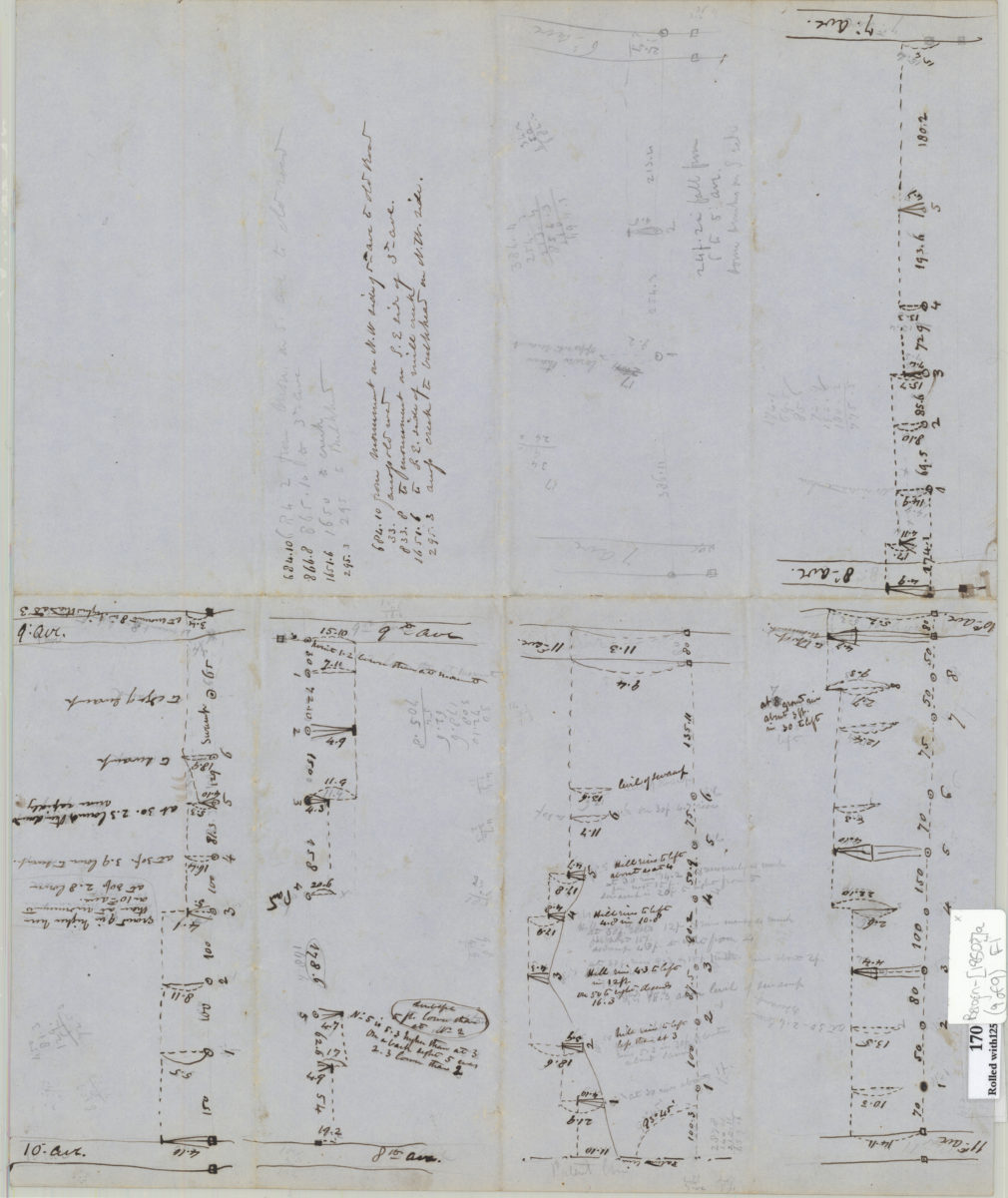
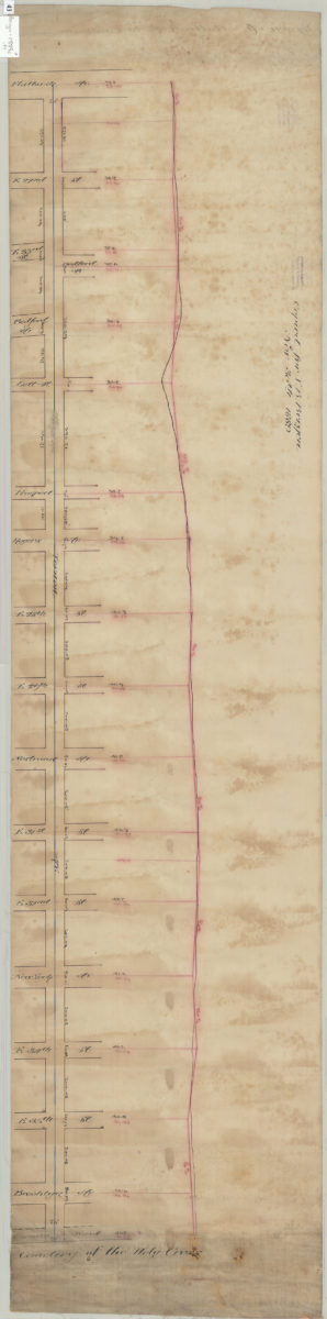
[Profile maps of grade of 3rd Avenue from Brooklyn to Fort Hamilton]
[Profile maps of grade of 3rd Avenue from Brooklyn to Fort Hamilton]
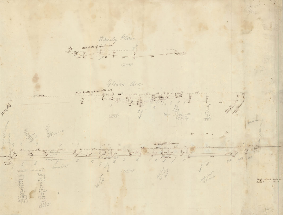
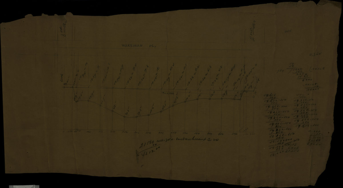
[Profile map of the grade of Wakeman Place between 2nd Avenue and 3rd Avenue]
[Profile map of the grade of Wakeman Place between 2nd Avenue and 3rd Avenue]
[1886]
[Plan and profile of Vernon Avenue from Flatbush Avenue to Canarsie Road]
[Plan and profile of Vernon Avenue from Flatbush Avenue to Canarsie Road]
1889
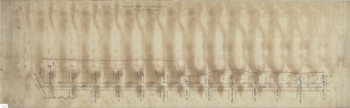
[Plan and profile of Avenue E from Flatbush Avenue to East 37th Street]: Samuel H. McElroy, C.E.
[Plan and profile of Avenue E from Flatbush Avenue to East 37th Street]: Samuel H. McElroy, C.E.
1889
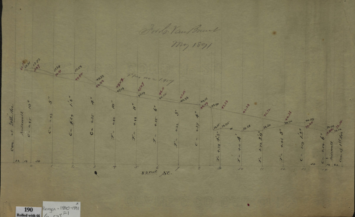
[Profile maps of the grades of 81st Street and 82nd Street between 1st Avenue and 2nd Avenue]
[Profile maps of the grades of 81st Street and 82nd Street between 1st Avenue and 2nd Avenue]
1890-1891
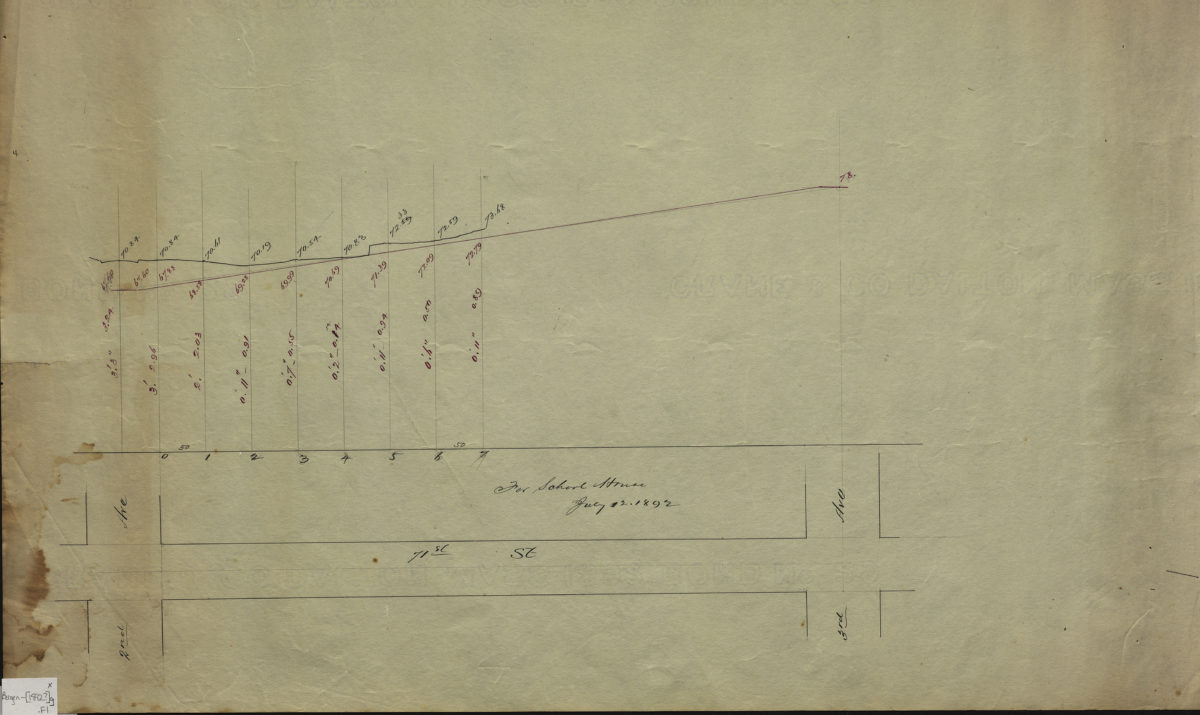
[Profile map of the grade of 71st Street between 2nd Avenue and 3rd Avenue]
[Profile map of the grade of 71st Street between 2nd Avenue and 3rd Avenue]
1892