Center for Brooklyn History
Map Collections
Search
About
Othmer Library & Archives
Submit search query
Refine 5 records
Clear filters
3
Location
Huntington (N.Y.)
7
Long Island (N.Y.)
197
Long Island Sound (N.Y. and Conn.)
12
New York (State)
95
New York Harbor (N.Y. and N.J.)
16
Oyster Bay (N.Y.)
9
Suffolk County (N.Y.)
43
Subject
Lighthouses
1
Nautical charts
14
Date
19th Century
945
or enter range:
from
to
Genres
Bathymetric maps
94
Nautical charts
30
Sort by:
Date (earliest)
Date (most recent)
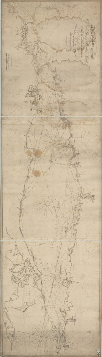
Long Island Sound from New York to Montock [i.e Montauk] Point: surveyed in the years 1828, 29, & 30 by Edmund Blunt ; writing by D.R. Harrison ; plan by W. Hooker
Long Island Sound from New York to Montock [i.e Montauk] Point: surveyed in the years 1828, 29, & 30 by Edmund Blunt ; writing by D.R. Harrison ; plan by W. Hooker
[ca. 1830]
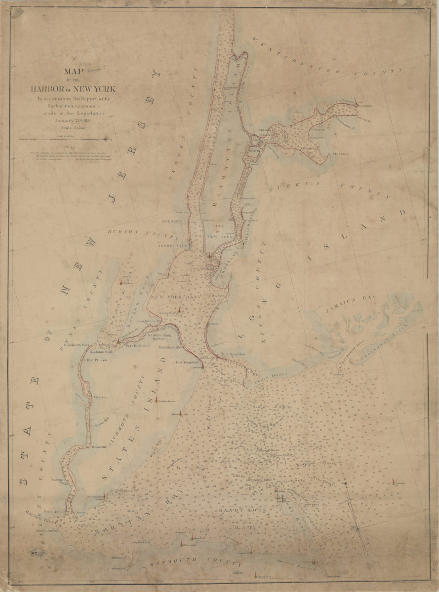
Map of the Harbor of New York: to accompany the report of the Harbor Commissioners made to the Legislature, January 27th, 1857
Map of the Harbor of New York: to accompany the report of the Harbor Commissioners made to the Legislature, January 27th, 1857
[1857]
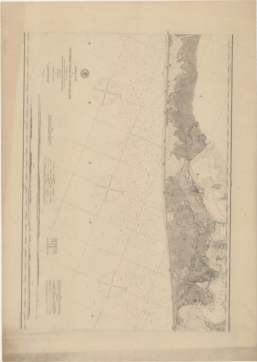
Middle part of the southern coast of Long Island: from a trigonometrical survey: under the direction of F.R. Hassler superintendent of the Survey of the Coast of the United States
Middle part of the southern coast of Long Island: from a trigonometrical survey: under the direction of F.R. Hassler superintendent of the Survey of the Coast of the United States
[1857]
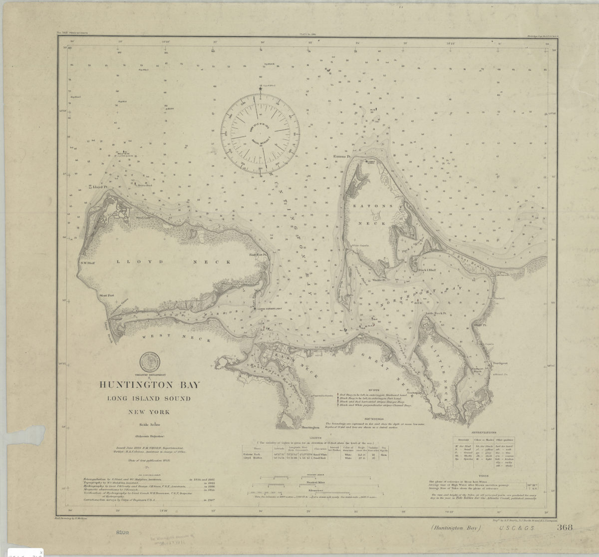
Huntington Bay, Long Island Sound, New York: U.S. Coast and Geodetic Survey ; red. drawing by E. Molkow
Huntington Bay, Long Island Sound, New York: U.S. Coast and Geodetic Survey ; red. drawing by E. Molkow
1889
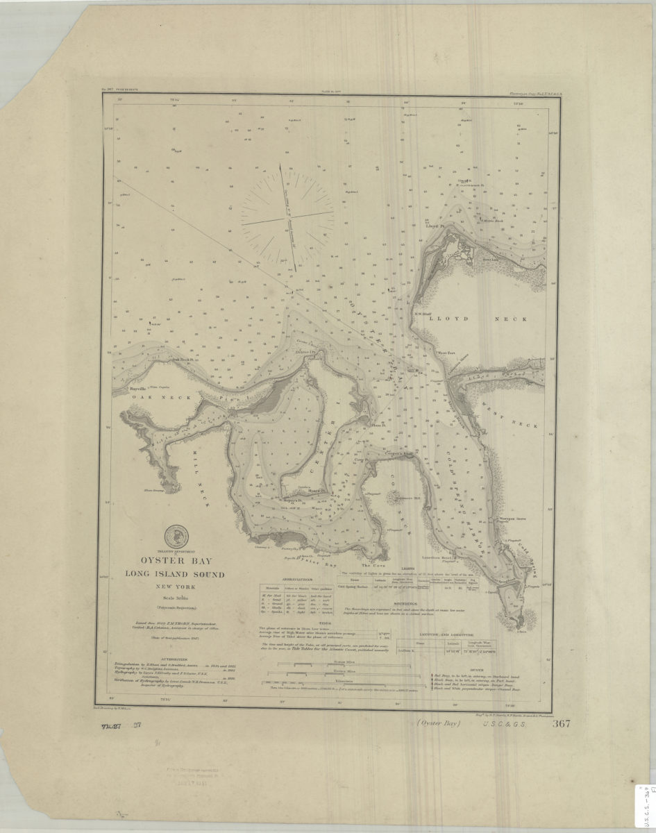
Oyster Bay, Long Island Sound, New York: U.S. Coast and Geodetic Survey ; red. drawing by E. Molkow
Oyster Bay, Long Island Sound, New York: U.S. Coast and Geodetic Survey ; red. drawing by E. Molkow
1889