Center for Brooklyn History
Map Collections
Search
About
Othmer Library & Archives
Submit search query
Refine 4 records
Clear filters
3
Location
Brooklyn (New York, N.Y.)
891
Flatbush (New York, N.Y.)
35
Long Island (N.Y.)
197
New Jersey
27
New York (State)
95
United States
10
Subject
Decedents' estates
1
Fortification
7
Landowners
434
Long Island, Battle of, New York, N.Y. , 1776
7
Real property
619
Date
19th Century
945
or enter range:
from
to
Genres
Cadastral maps
597
Historical maps
53
Manuscript maps
365
Map
191
Military maps
23
Sort by:
Date (earliest)
Date (most recent)
Plan of the Battle of Long Island and of the Brooklyn defences, August 27th, 1776: compiled by Henry P. Johnston ; F. von Egloffstein, del
Plan of the Battle of Long Island and of the Brooklyn defences, August 27th, 1776: compiled by Henry P. Johnston ; F. von Egloffstein, del
[18??]
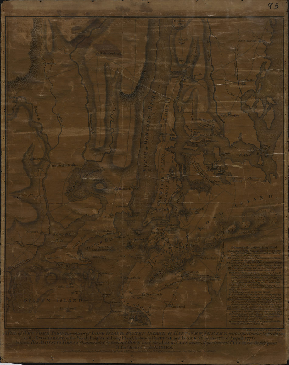
A plan of New York Island, with part of Long Island, Staten Island & East New Jersey: with a particular description of the Engagement on the Woody Heights of Long Island, between Flatbush and Brooklyn, on the 27th of August 1776
A plan of New York Island, with part of Long Island, Staten Island & East New Jersey: with a particular description of the Engagement on the Woody Heights of Long Island, between Flatbush and Brooklyn, on the 27th of August 1776
[1865]
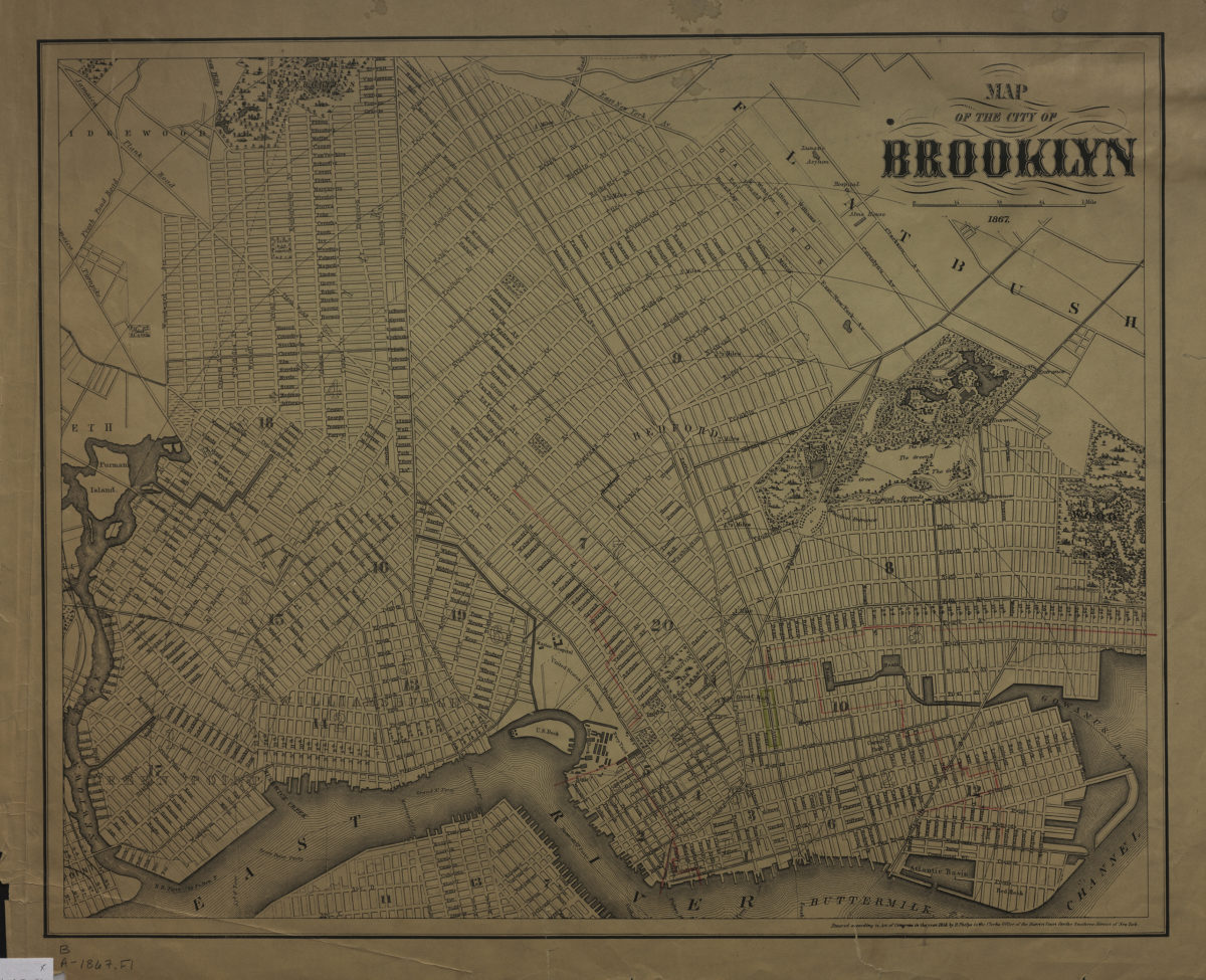
Map of the city of Brooklyn 1867
Map of the city of Brooklyn 1867
1867; [ca. 1858]
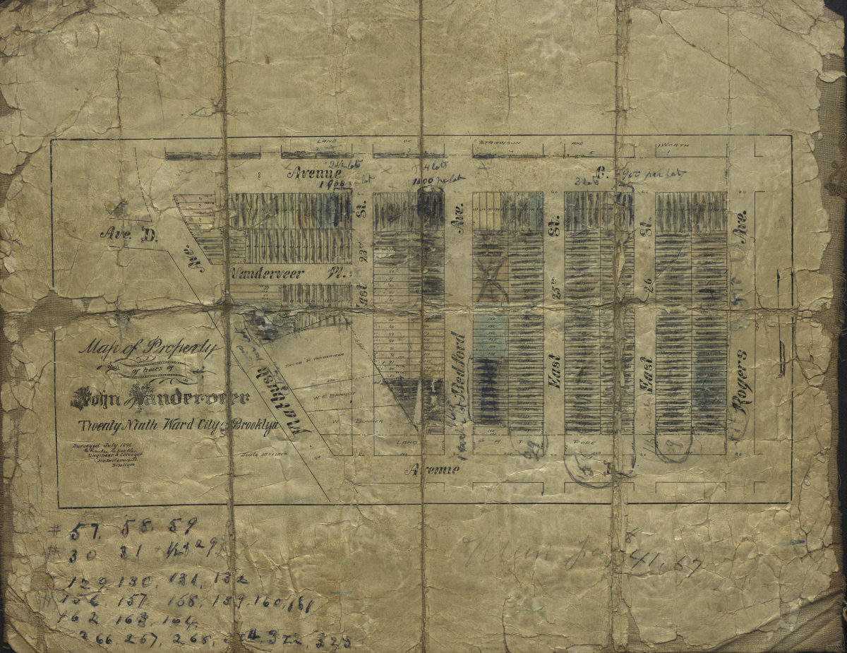
Map of property of heirs of John Vanderveer, Twenty-Ninth Ward, city of Brooklyn: surveyed July 1896 [by] Charles Crooke, city surveyor
Map of property of heirs of John Vanderveer, Twenty-Ninth Ward, city of Brooklyn: surveyed July 1896 [by] Charles Crooke, city surveyor
[1896]