Center for Brooklyn History
Map Collections
Search
About
Othmer Library & Archives
Submit search query
Refine 4 records
Clear filters
2
Location
Brooklyn (New York, N.Y.)
891
Coney Island (New York, N.Y.)
22
New York (N.Y.)
164
Sea Gate (New York, N.Y.)
7
Subject
Parks
35
Planned communities
2
Real property
619
Date
19th Century
945
or enter range:
from
to
Genres
Cadastral maps
597
Manuscript maps
365
Map
191
Topographic maps
70
Sort by:
Date (earliest)
Date (most recent)
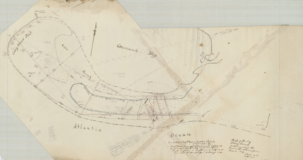
Map of part of Coney Island, as surveyed for the Quarantine Commission
Map of part of Coney Island, as surveyed for the Quarantine Commission
March 1869
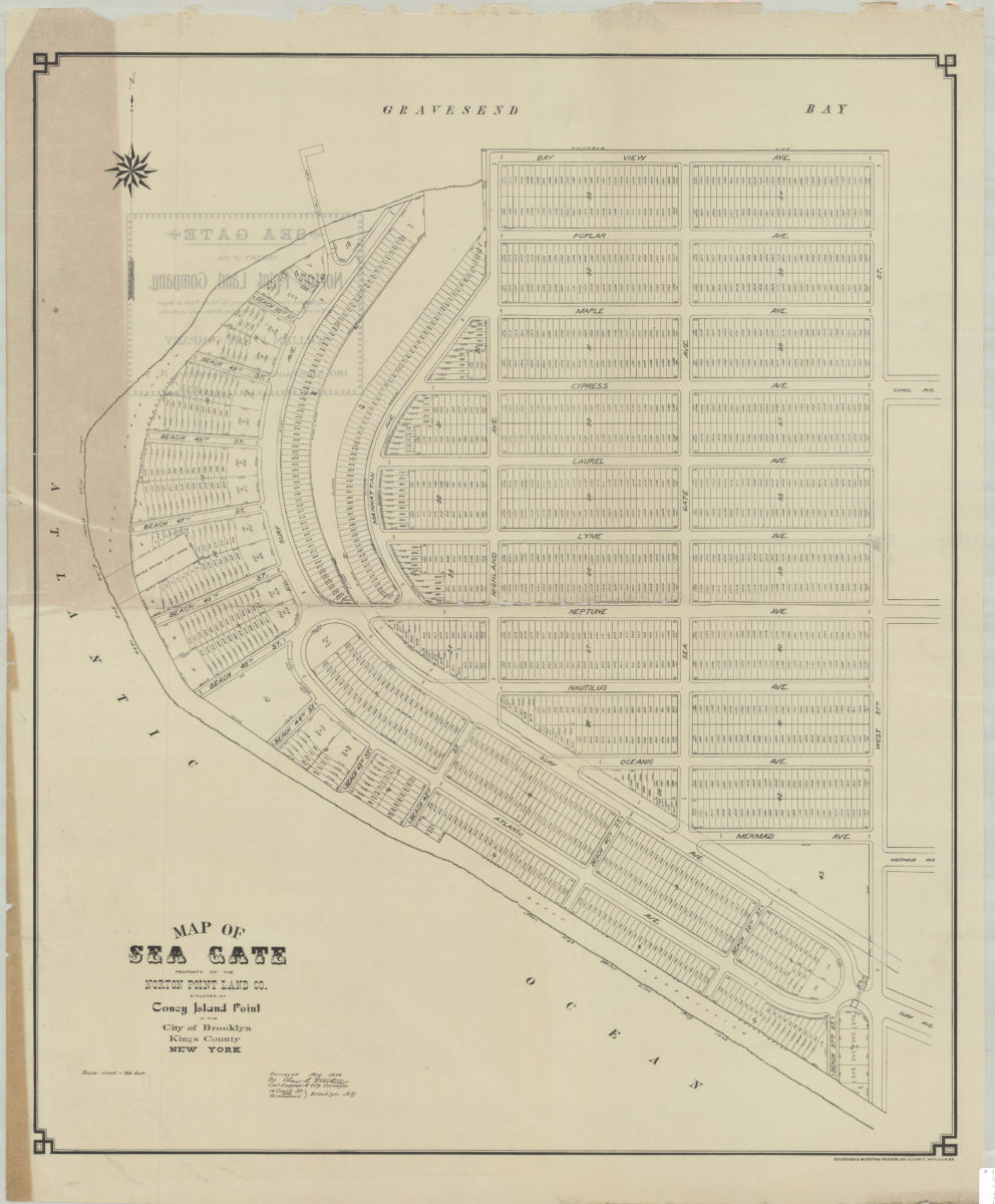
Map of Sea Gate, property of the Norton Point Land Co., situated at Coney Island Point in the city of Brooklyn, Kings County, New York: surveyed … by Chas. S. Voorhies, civil engineer & city surveyor
Map of Sea Gate, property of the Norton Point Land Co., situated at Coney Island Point in the city of Brooklyn, Kings County, New York: surveyed … by Chas. S. Voorhies, civil engineer & city surveyor
[1896]
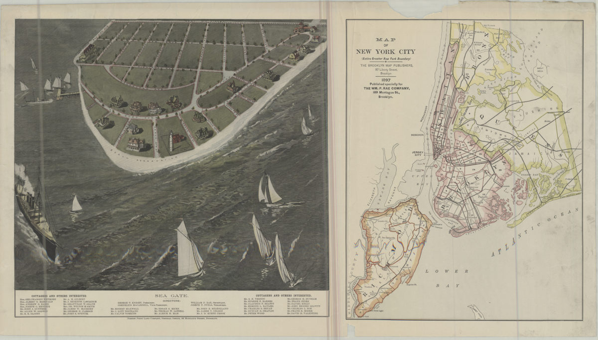
Map of New York City (entire greater New York boundary) ; Sea Gate
Map of New York City (entire greater New York boundary) ; Sea Gate
1897
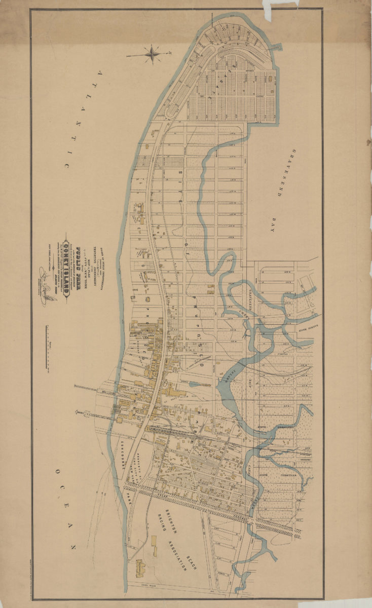
Tentative amendment to the Map or plan of the city of New York, showing a public park in that part of the borough of Brooklyn formerly known as the town of Gravesend and designated Coney Island, from W. 37th St. (Seagate)
Tentative amendment to the Map or plan of the city of New York, showing a public park in that part of the borough of Brooklyn formerly known as the town of Gravesend and designated Coney Island, from W. 37th St. (Seagate)
[1899]