Center for Brooklyn History
Map Collections
Search
About
Othmer Library & Archives
Submit search query
Refine 5 records
Clear filters
3
Location
Astoria (New York, N.Y.)
4
Brooklyn (New York, N.Y.)
891
Hunters Point (New York, N.Y.)
2
Jersey City (N.J.)
4
Long Island City (New York, N.Y.)
8
Manhattan (New York, N.Y.)
120
New York (N.Y.)
164
Queens (New York, N.Y.)
83
Ravenswood (New York, N.Y.)
4
Sunnyside (New York, N.Y.)
1
Subject
Buildings
12
Canals
15
Church property
1
Fills (Earthwork)
4
Landforms
15
Landowners
434
Piers
25
Ponds
6
Railroads
72
Real property
619
Rivers
16
Schools
1
Streets
46
Wetlands
6
Date
19th Century
945
or enter range:
from
to
Genres
Bathymetric maps
94
Cadastral maps
597
Early maps
35
Historical maps
53
Map
191
Sort by:
Date (earliest)
Date (most recent)
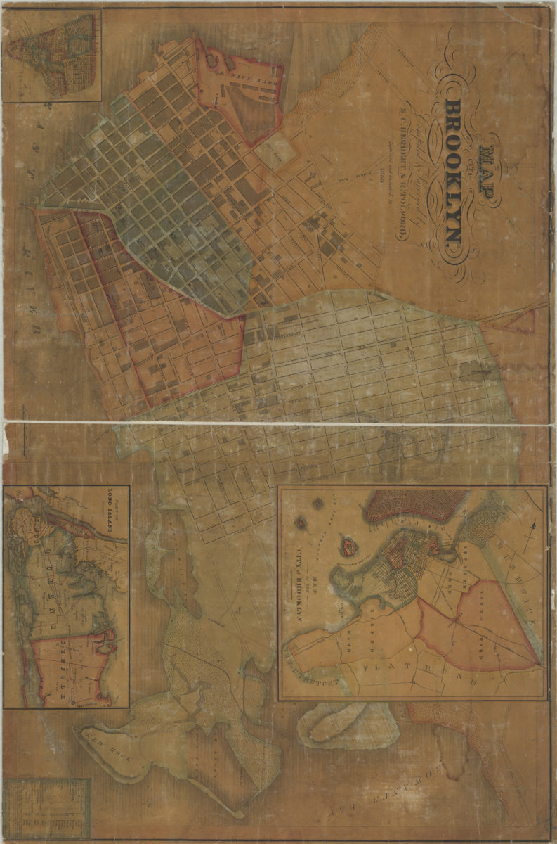
Map of the City of Brooklyn: compiled & surveyed by S.C. Herbert & R. Tolford
Map of the City of Brooklyn: compiled & surveyed by S.C. Herbert & R. Tolford
1835
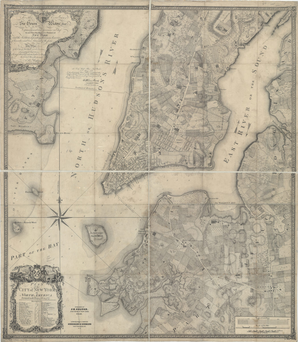
City & County map of New-York, Brooklyn, Williamsburgh, Jersey City and the adjacent waters: by J.H. Colton
City & County map of New-York, Brooklyn, Williamsburgh, Jersey City and the adjacent waters: by J.H. Colton
1852; [ca. 1845]
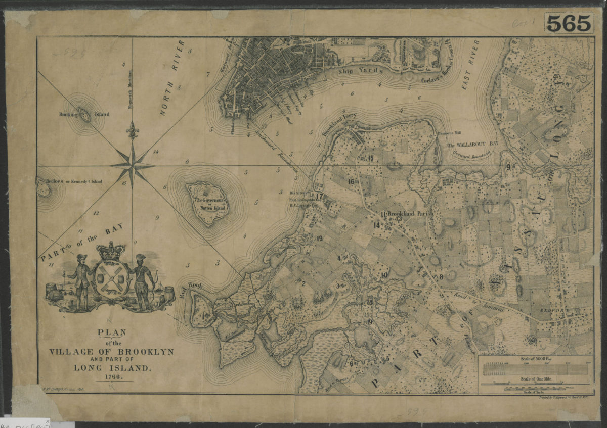
Plan of the city of New York in North America: surveyed in the years 1766 & 1767: B. Ratzer ; Thos. Kitchin sculpt
Plan of the city of New York in North America: surveyed in the years 1766 & 1767: B. Ratzer ; Thos. Kitchin sculpt
1853
Plan of the village of Brooklyn and part of Long Island 1766
Plan of the village of Brooklyn and part of Long Island 1766
[1864]
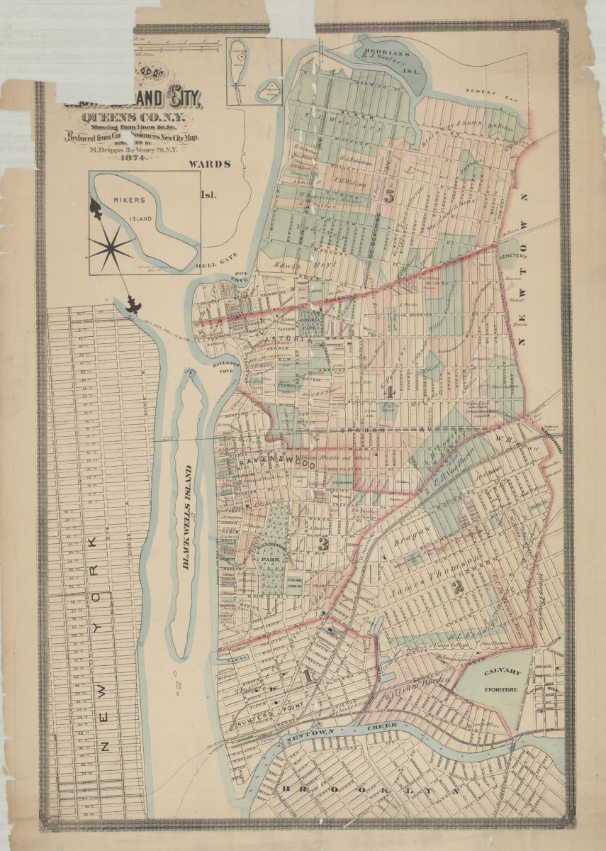
Map of Long Island City, Queens Co. N.Y.: showing farm lines &c. &c.: reduced from Commissioners new city map
Map of Long Island City, Queens Co. N.Y.: showing farm lines &c. &c.: reduced from Commissioners new city map
1874