Center for Brooklyn History
Map Collections
Search
About
Othmer Library & Archives
Submit search query
Refine 5 records
Clear filters
3
Location
Bergen Beach (New York, N.Y.)
3
Brooklyn (New York, N.Y.)
891
Canarsie (New York, N.Y.)
18
East Flatbush (New York, N.Y.)
23
Flatlands (New York, N.Y.)
19
Manhattan (New York, N.Y.)
120
Marine Park (New York, N.Y.)
5
Mill Basin (New York, N.Y.)
3
New York (N.Y.)
164
Wallabout Bay (New York, N.Y.)
6
Subject
Indian trails
1
Indians of North America
6
Neighborhoods
3
Date
20th Century
469
or enter range:
from
to
Genres
Historical maps
53
Military maps
23
Statistical maps
8
Sort by:
Date (earliest)
Date (most recent)
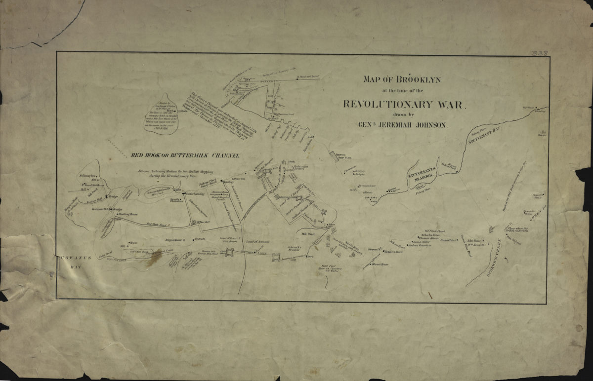
Map of Brooklyn at the time of the Revolutionary War: drawn by Genl. Jeremiah Johnson
Map of Brooklyn at the time of the Revolutionary War: drawn by Genl. Jeremiah Johnson
[19??]
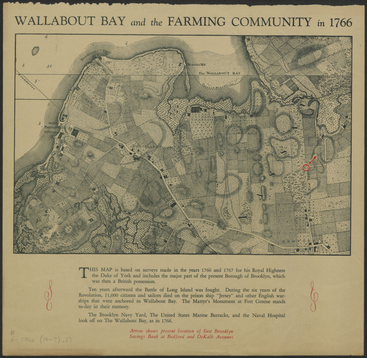
Wallabout Bay and the farming community in 1766
Wallabout Bay and the farming community in 1766
[19??]
A conjectural plan of the three flats called by the Indians Keskateuw and by the Dutch Amersfort or the Village of Amersfort: made solely to elucidate the text-matter of this book and not purporting to determine what any of the flats comprised
A conjectural plan of the three flats called by the Indians Keskateuw and by the Dutch Amersfort or the Village of Amersfort: made solely to elucidate the text-matter of this book and not purporting to determine what any of the flats comprised
[1924; 1924]
Indian villages, paths, ponds and places in Kings County
[1946; 1946]
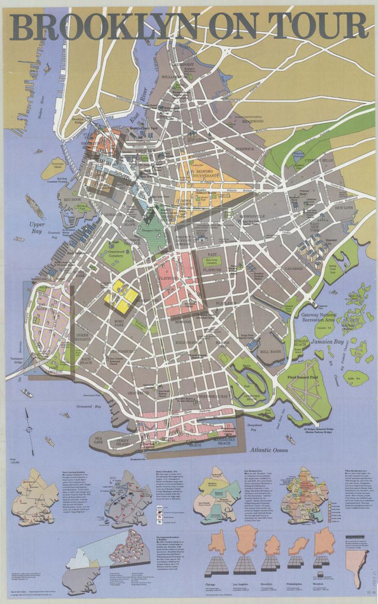
Brooklyn on tour: maps by Cadre Graphics ; graphic design by Keith Godard of Works
Brooklyn on tour: maps by Cadre Graphics ; graphic design by Keith Godard of Works
[ca. 1984]