Center for Brooklyn History
Map Collections
Search
About
Othmer Library & Archives
Submit search query
Refine 7 records
Clear filters
3
Location
Cold Spring Harbor (N.Y.)
1
ferries
1
Greenwich Village (New York, N.Y.)
1
Long Island (N.Y.)
197
Manhattan (New York, N.Y.)
120
New York (N.Y.)
164
New York (State)
95
New York Metropolitan Area
40
Subject
Camp sites, facilities, etc
1
Exhibitions
5
Local transit
63
Parks
35
Railroads
72
Recreation
5
Roads
117
Subways
55
Date
20th Century
469
or enter range:
from
to
Genres
Pictorial maps
38
Road maps
83
Tourist maps
55
Transportation maps
120
Sort by:
Date (earliest)
Date (most recent)
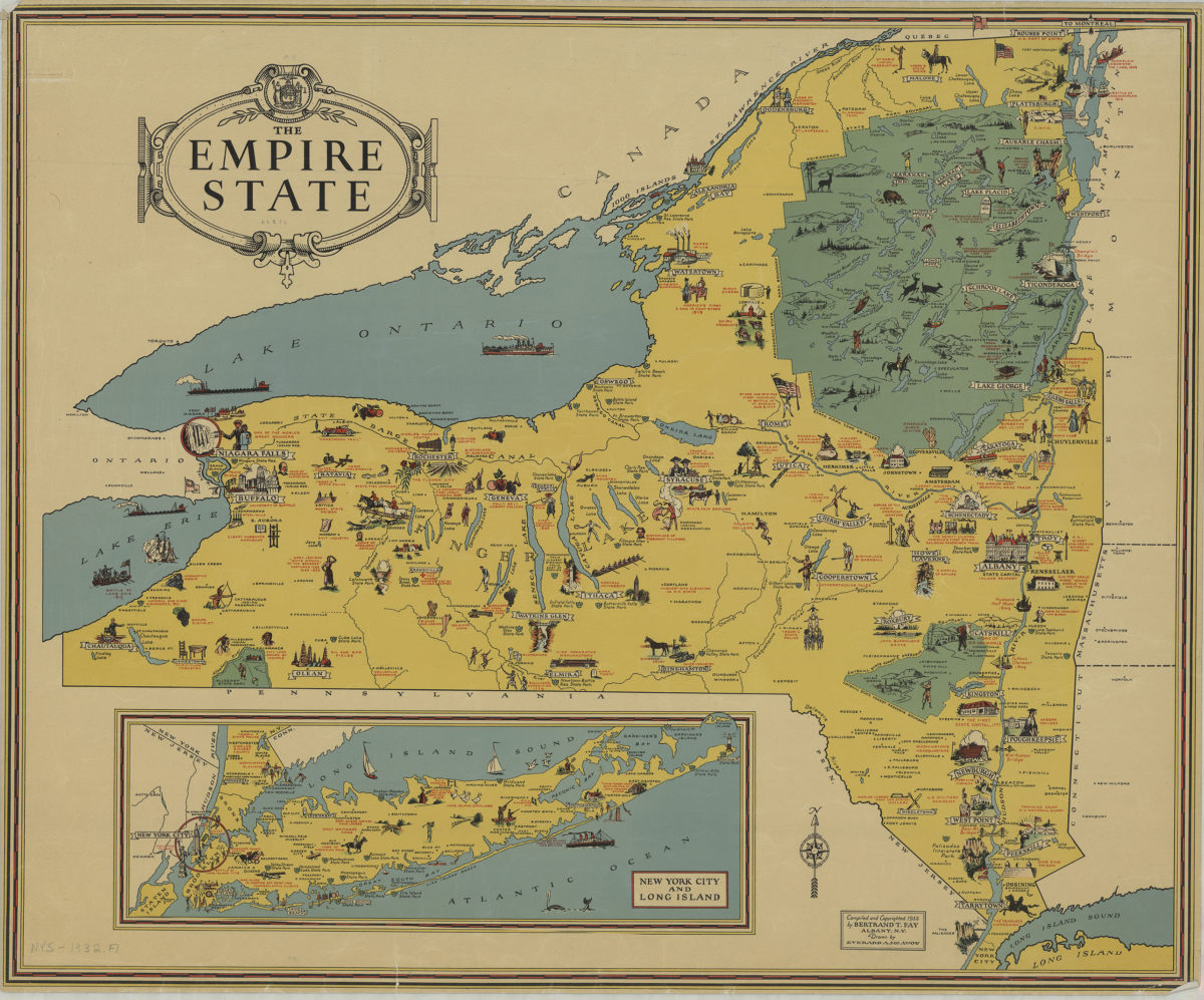
The Empire State: compiled and copyrighted 1932 by Bertrand T. Fay ; drawn by Everard A. McAvoy
The Empire State: compiled and copyrighted 1932 by Bertrand T. Fay ; drawn by Everard A. McAvoy
[1932;1932]
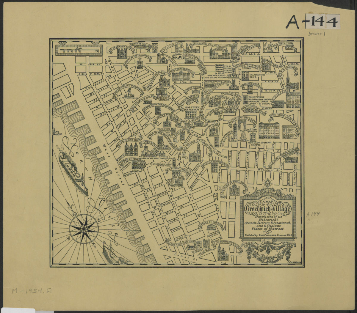
A map of Greenwich Village showing some of its historical, artistic, literary, educational, and religious places of interest
A map of Greenwich Village showing some of its historical, artistic, literary, educational, and religious places of interest
[1938; 1984]
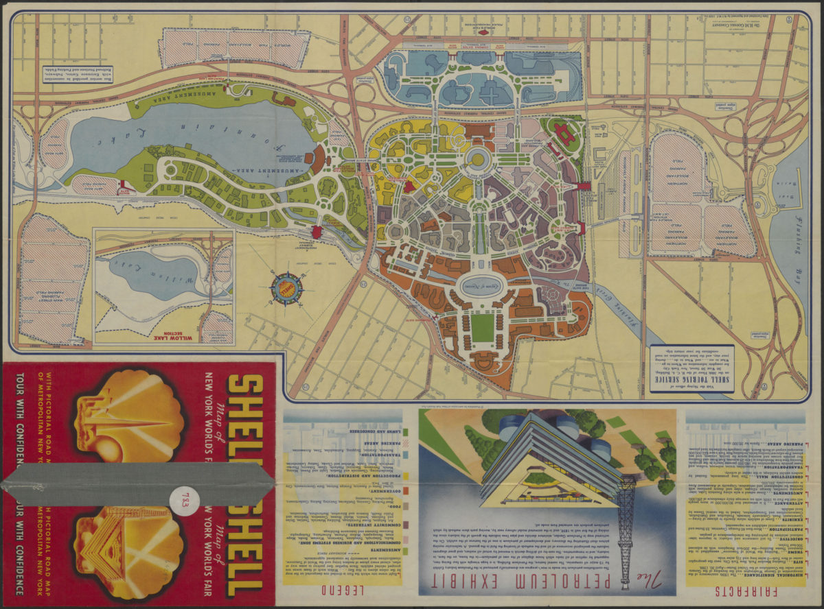
The locale of the New York World’s Fair: H.M. Gousha Company
The locale of the New York World’s Fair: H.M. Gousha Company
1939
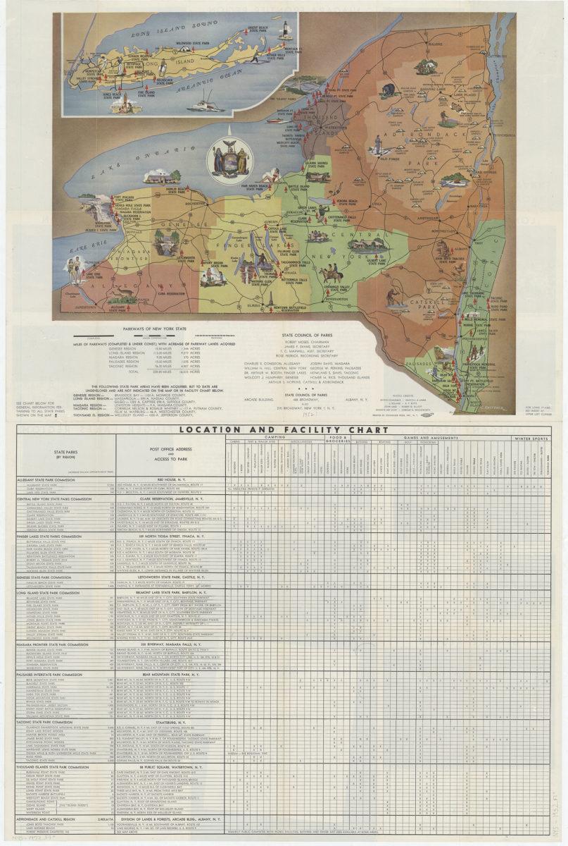
New York state parks: C. Koetzner
New York state parks: C. Koetzner
[195?]
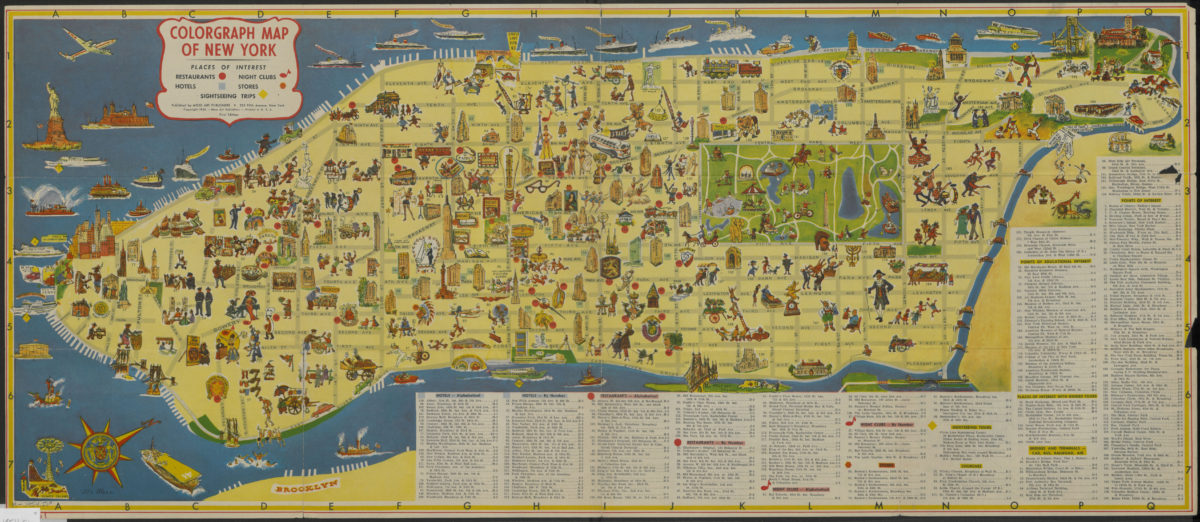
Colorgraph map of New York
Colorgraph map of New York
[ca. 1954]
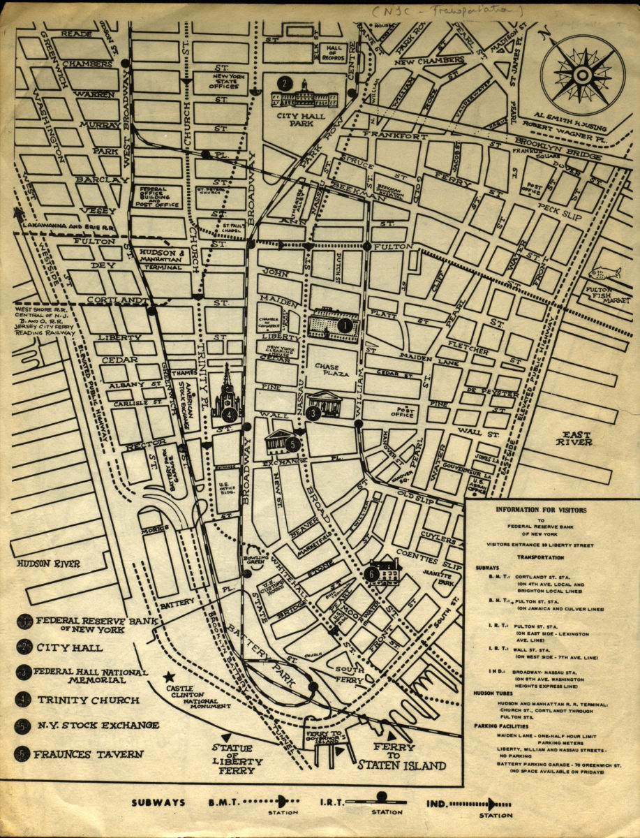
Information for visitors to Federal Reserve Bank of New York
Information for visitors to Federal Reserve Bank of New York
[1956-1966]
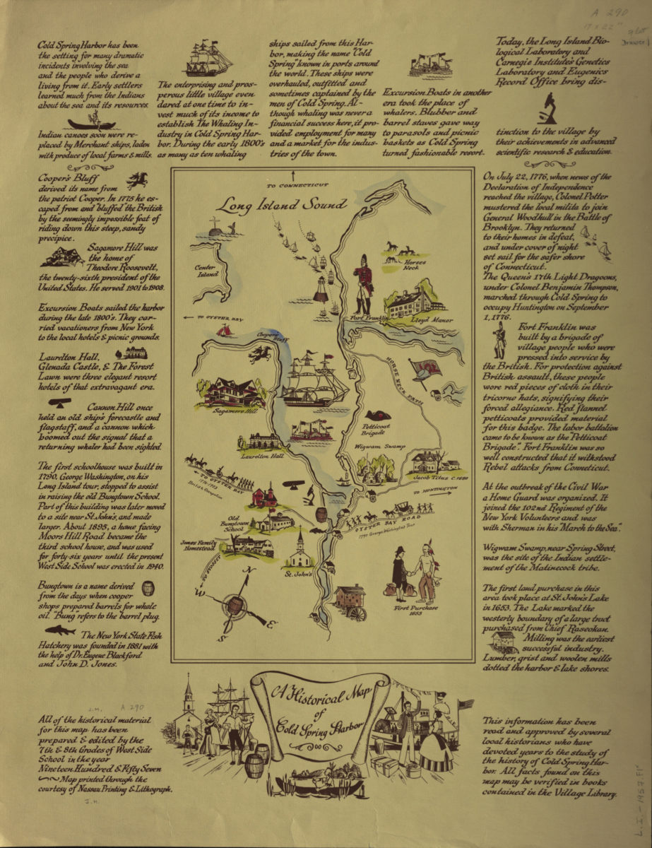
A historical map of Cold Spring Harbor
A historical map of Cold Spring Harbor
1957