Center for Brooklyn History
Map Collections
Search
About
Othmer Library & Archives
Submit search query
Refine 8 records
Clear filters
2
Location
Cold Spring Harbor (N.Y.)
1
ferries
1
Greenwich Village (New York, N.Y.)
1
Long Island (N.Y.)
197
Manhattan (New York, N.Y.)
120
New York (N.Y.)
164
New York (State)
95
New York Metropolitan Area
40
Subject
Camp sites, facilities, etc
1
Exhibitions
5
Local transit
63
Parks
35
Railroads
72
Recreation
5
Roads
117
Subways
55
Date
19th Century
945
20th Century
469
or enter range:
from
to
Genres
Pictorial maps
38
Road maps
83
Tourist maps
55
Transportation maps
120
Sort by:
Date (earliest)
Date (most recent)
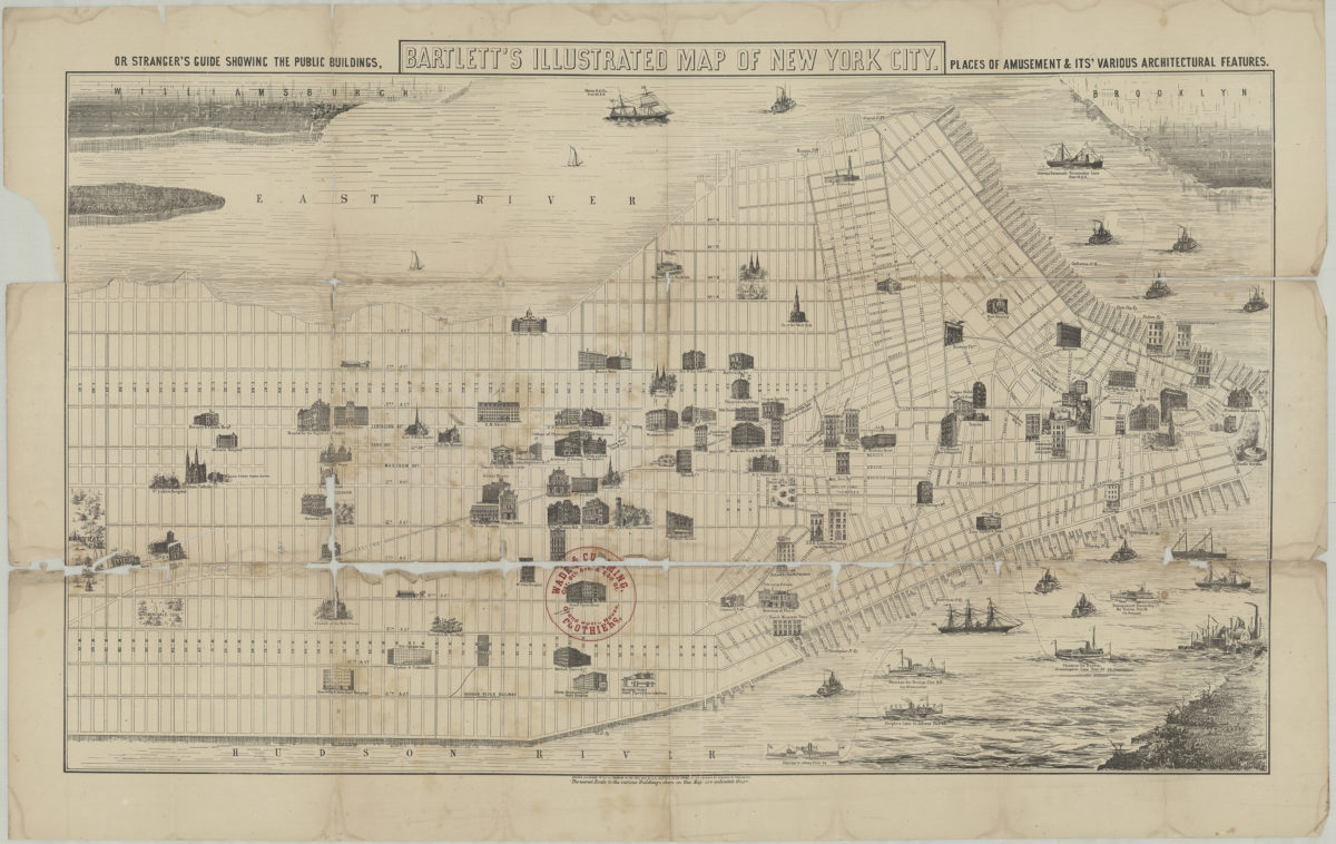
Bartlett’s illustrated map of New York City, or stranger’s guide showing the public buildings, places of amusement and its various architectural features
Bartlett’s illustrated map of New York City, or stranger’s guide showing the public buildings, places of amusement and its various architectural features
[1870]
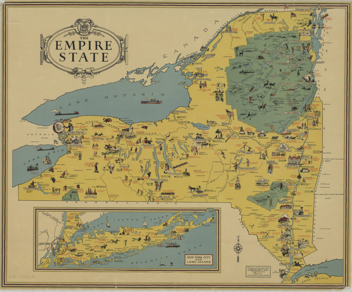
The Empire State: compiled and copyrighted 1932 by Bertrand T. Fay ; drawn by Everard A. McAvoy
The Empire State: compiled and copyrighted 1932 by Bertrand T. Fay ; drawn by Everard A. McAvoy
[1932;1932]
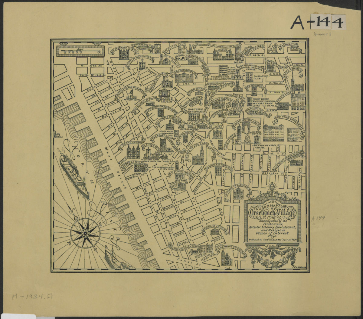
A map of Greenwich Village showing some of its historical, artistic, literary, educational, and religious places of interest
A map of Greenwich Village showing some of its historical, artistic, literary, educational, and religious places of interest
[1938; 1984]
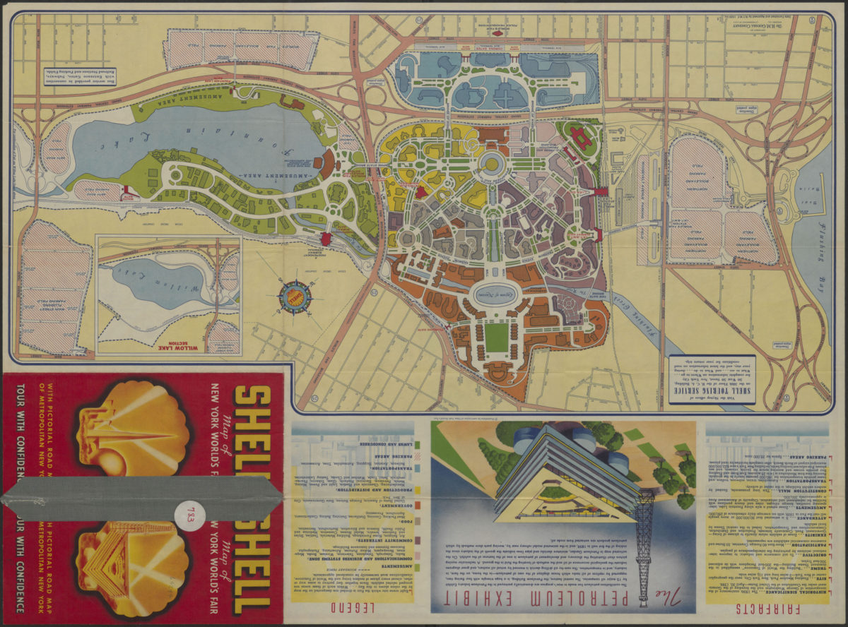
The locale of the New York World’s Fair: H.M. Gousha Company
The locale of the New York World’s Fair: H.M. Gousha Company
1939
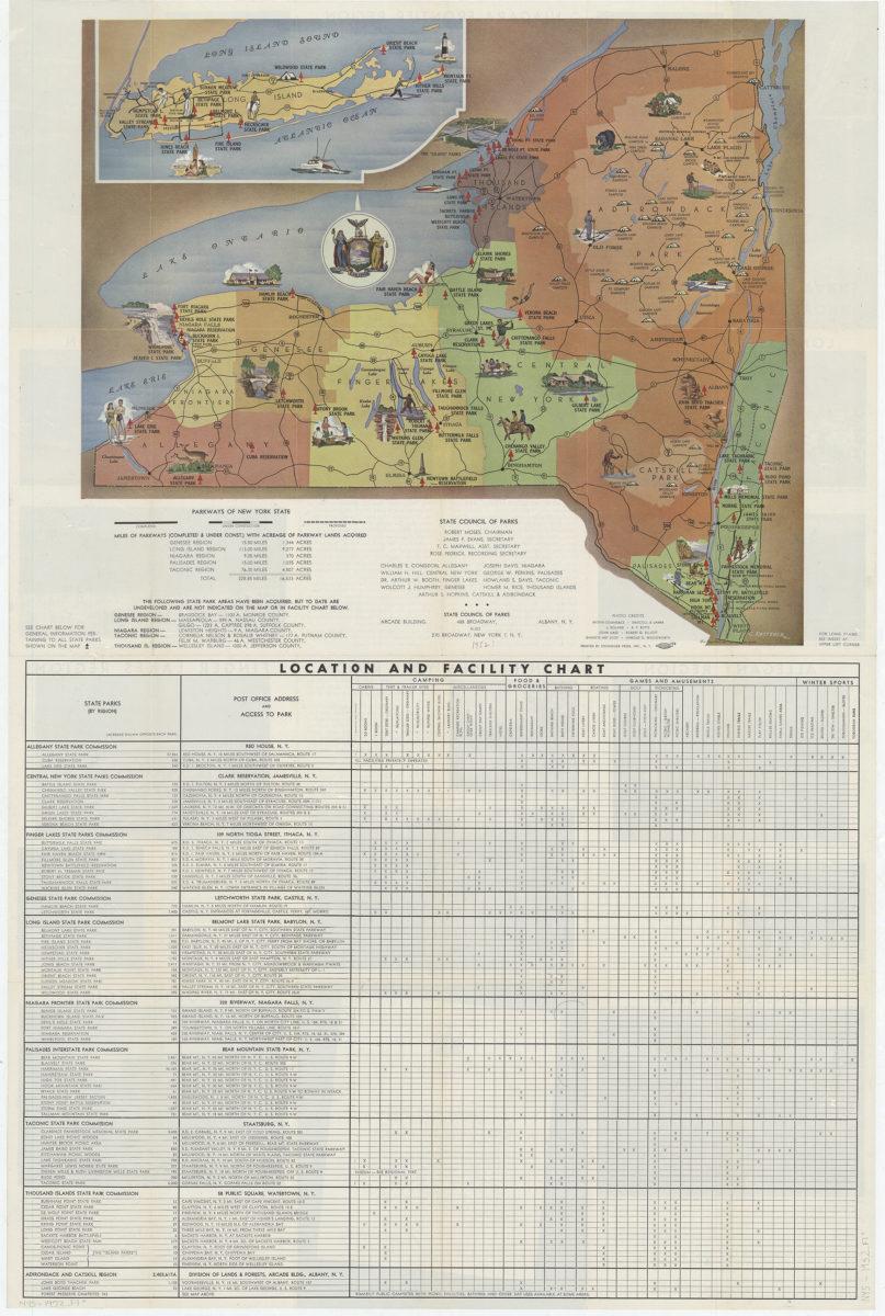
New York state parks: C. Koetzner
New York state parks: C. Koetzner
[195?]
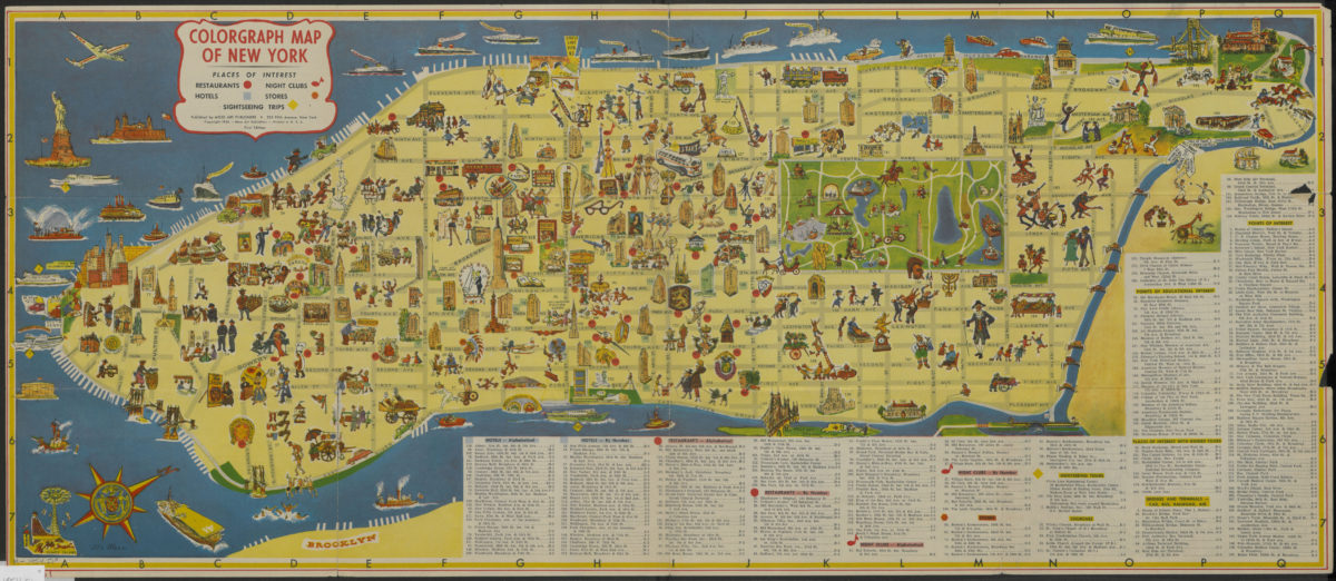
Colorgraph map of New York
Colorgraph map of New York
[ca. 1954]
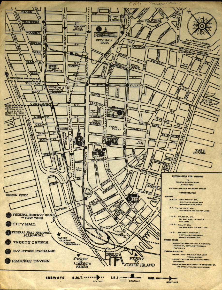
Information for visitors to Federal Reserve Bank of New York
Information for visitors to Federal Reserve Bank of New York
[1956-1966]
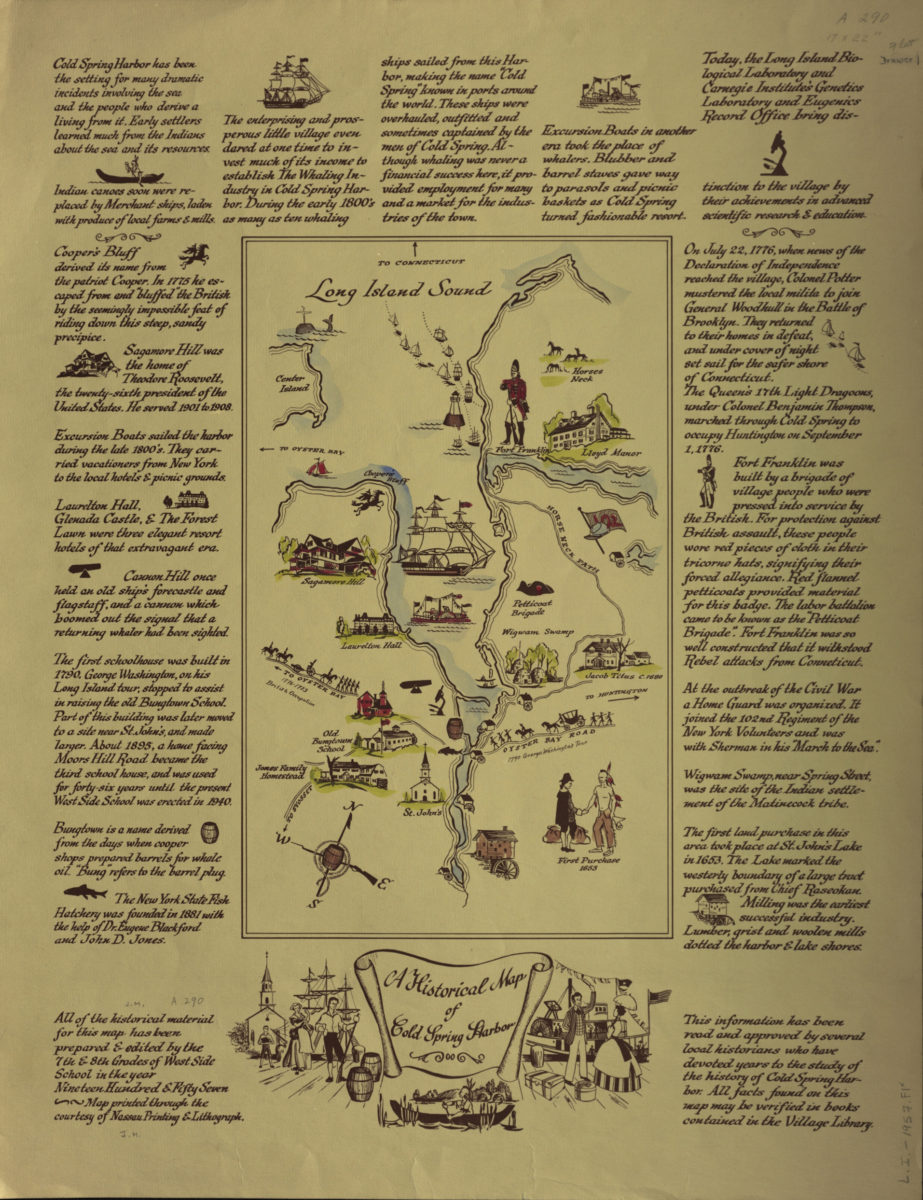
A historical map of Cold Spring Harbor
A historical map of Cold Spring Harbor
1957