Center for Brooklyn History
Map Collections
Search
About
Othmer Library & Archives
Submit search query
Refine 7 records
Clear filters
3
Location
Long Island (N.Y.)
197
Manhattan (New York, N.Y.)
120
New Jersey
27
New York (N.Y.)
164
New York (State)
95
New York Metropolitan Area
40
Subject
Canals
15
Railroads
72
Road maps
2
Roads
117
Date
20th Century
469
21th Century
66
or enter range:
from
to
Genres
Map
191
Road maps
83
Tourist maps
55
Transportation maps
120
Sort by:
Date (earliest)
Date (most recent)
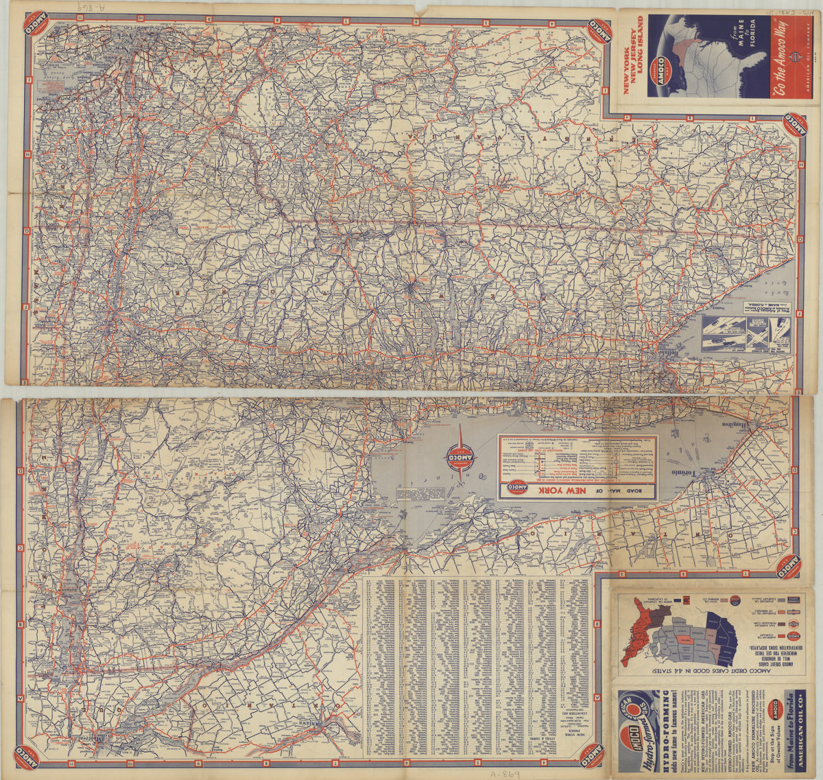
New York, New Jersey, Long Island: [compliments of] Amoco
New York, New Jersey, Long Island: [compliments of] Amoco
[1936]
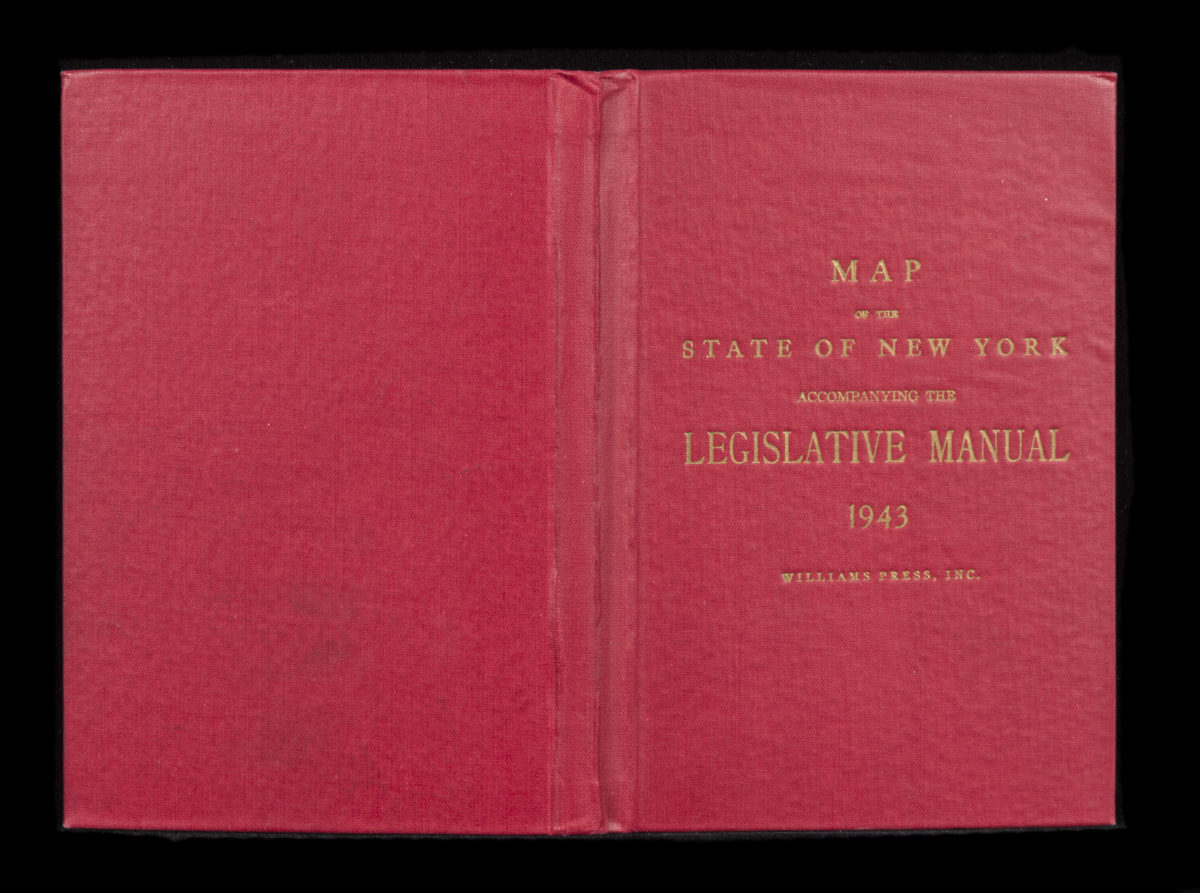
Canal and railroad map of the State of New York: to accompany the Legislative Manual
Canal and railroad map of the State of New York: to accompany the Legislative Manual
1943
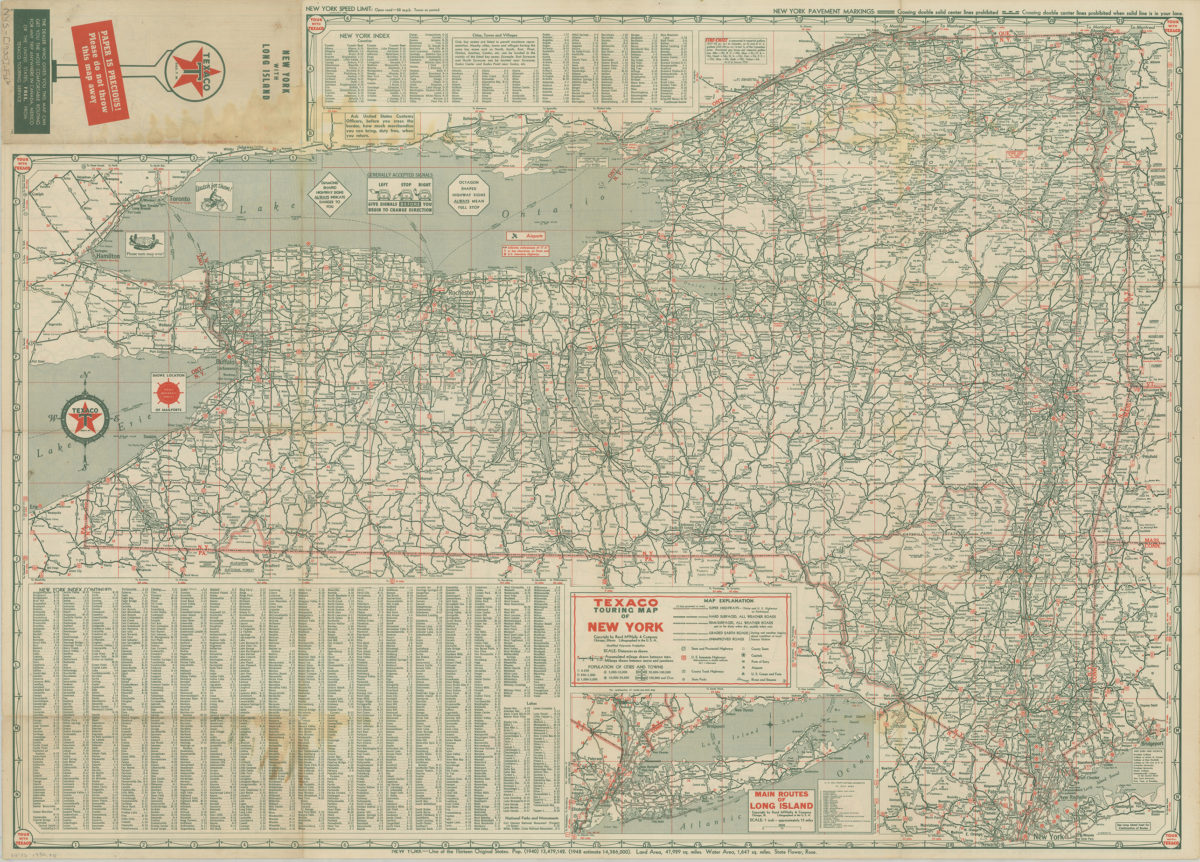
Texaco touring map of Long Island and Metropolitan New York
Texaco touring map of Long Island and Metropolitan New York
[1950]
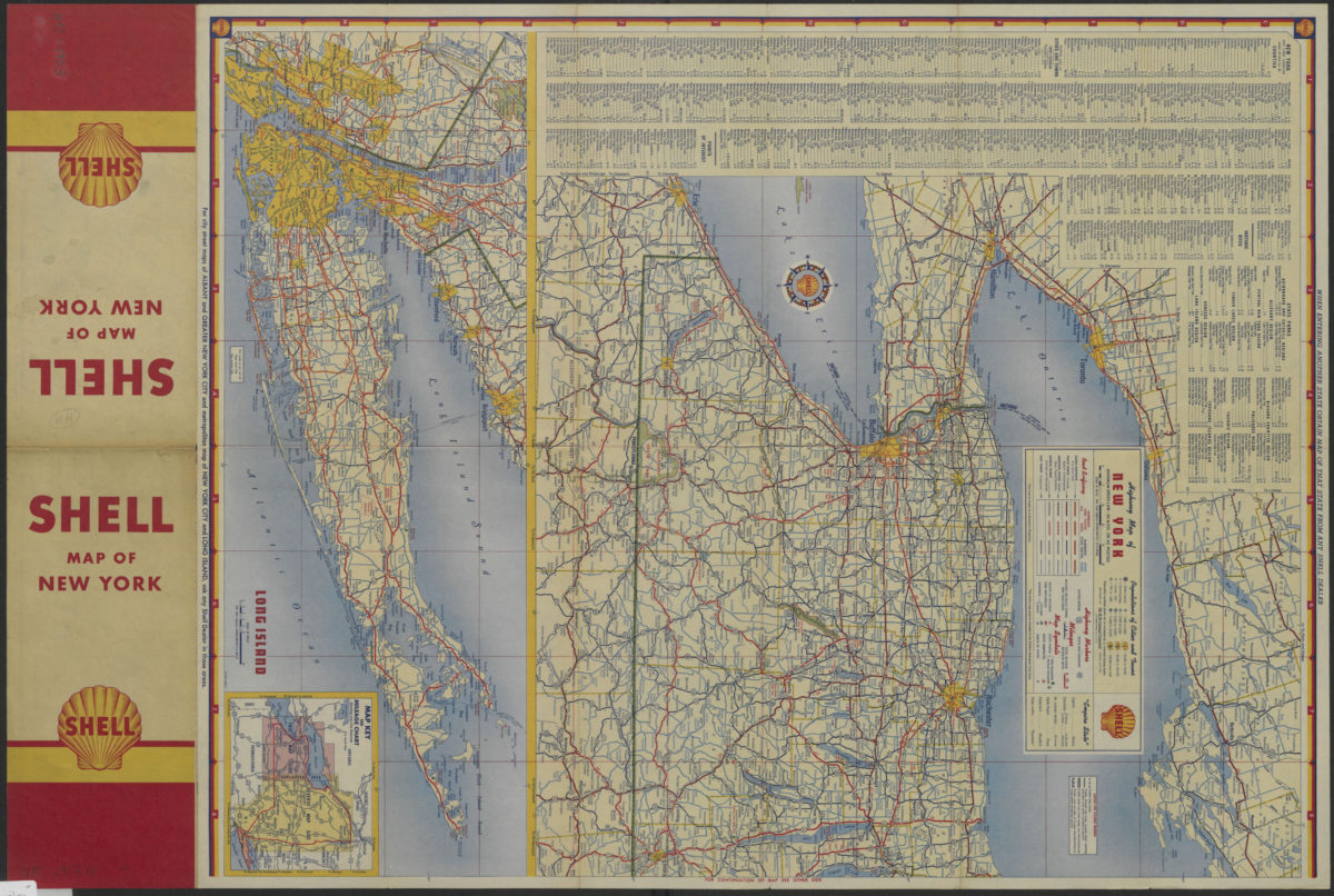
Highway map of New York
Highway map of New York
[1953]
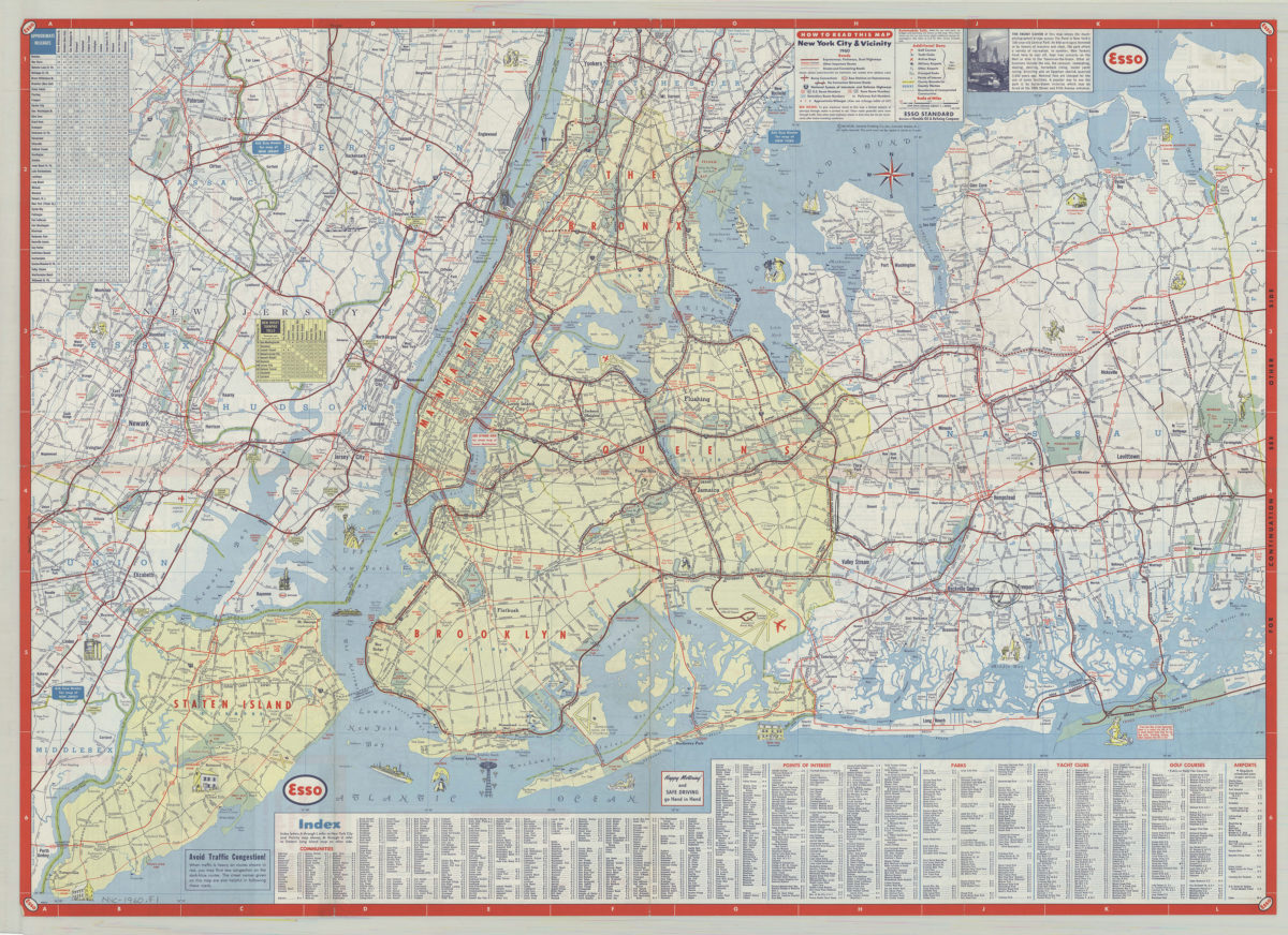
New York City & vicinity,1960: General Drafting Company ; [prepared for] Esso Standard
New York City & vicinity,1960: General Drafting Company ; [prepared for] Esso Standard
1960
Long Island, New York City & metro area counties: [prepared for] Texaco
Long Island, New York City & metro area counties: [prepared for] Texaco
1975
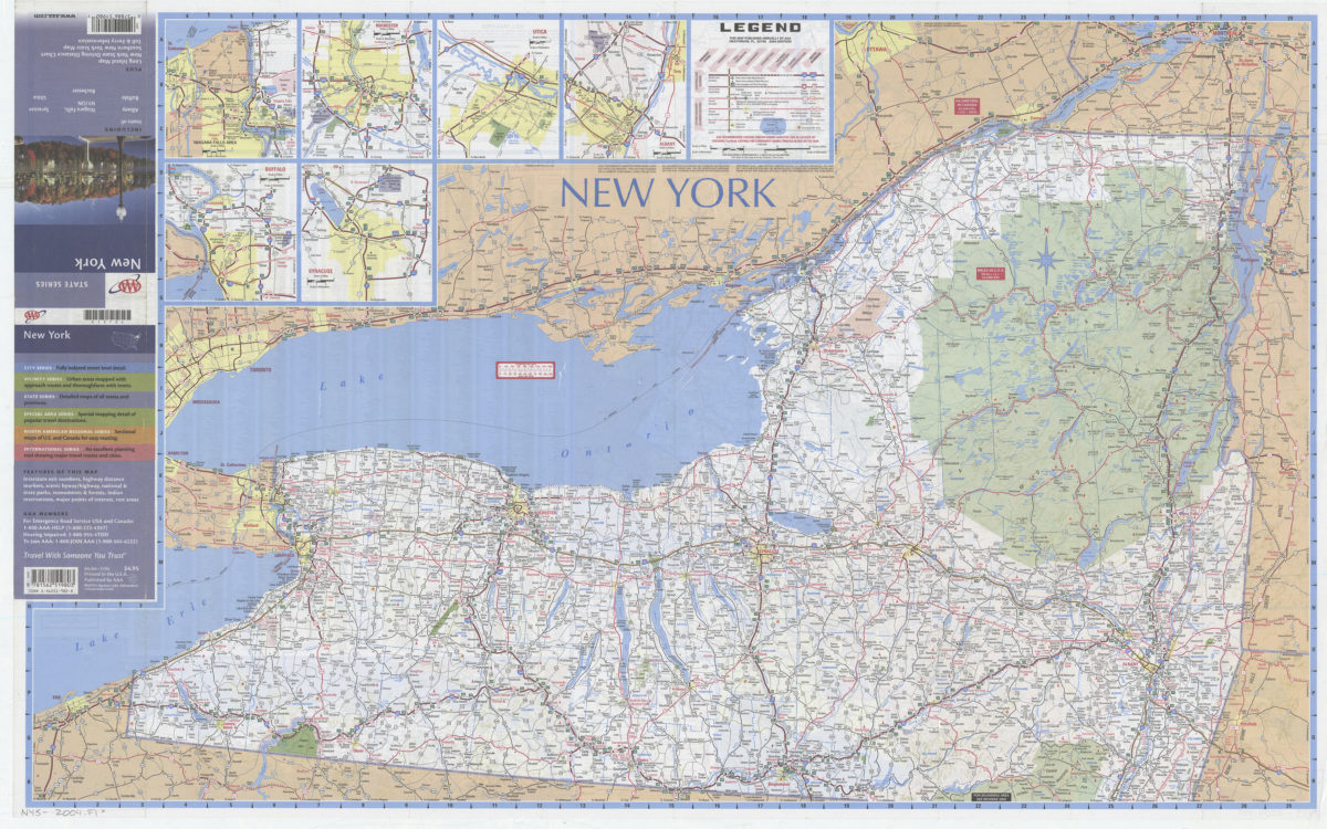
New York: including insets of Albany, Buffalo, Niagara Falls NY-ON, Rochester, Syracuse, Utica, plus Long Island map … toll & ferry information: AAA
New York: including insets of Albany, Buffalo, Niagara Falls NY-ON, Rochester, Syracuse, Utica, plus Long Island map … toll & ferry information: AAA
[2004]