Center for Brooklyn History
Map Collections
Search
About
Othmer Library & Archives
Submit search query
Refine 11 records
Clear filters
2
Location
Brooklyn (New York, N.Y.)
891
Long Island (N.Y.)
197
Manhattan (New York, N.Y.)
120
New York (N.Y.)
164
New York (State)
95
New York Metropolitan Area
40
Suffolk County (N.Y.)
43
Subject
Canals
15
Railroads
72
Roads
117
Date
19th Century
945
20th Century
469
or enter range:
from
to
Genres
Historical maps
53
Manuscript maps
365
Road maps
83
Topographic maps
70
Transportation maps
120
Sort by:
Date (earliest)
Date (most recent)
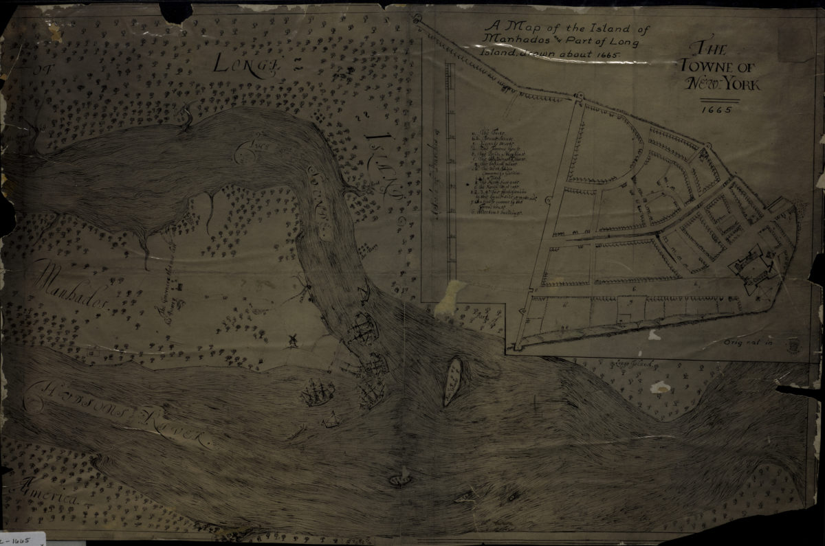
A map of the island of Manhados and part of Long Island, drawn about 1665
A map of the island of Manhados and part of Long Island, drawn about 1665
[18??]
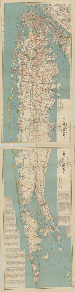
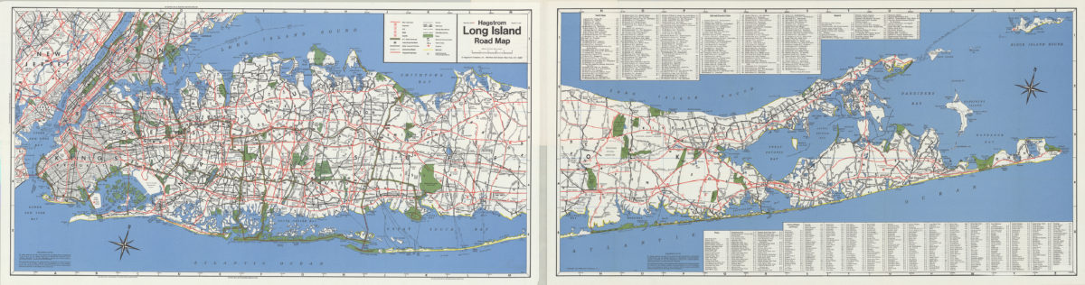
Hagstrom’s map of Long Island, New York
Hagstrom’s map of Long Island, New York
1932
Canal and railroad map of the State of New York: to accompany the Legislative Manual
Canal and railroad map of the State of New York: to accompany the Legislative Manual
1943
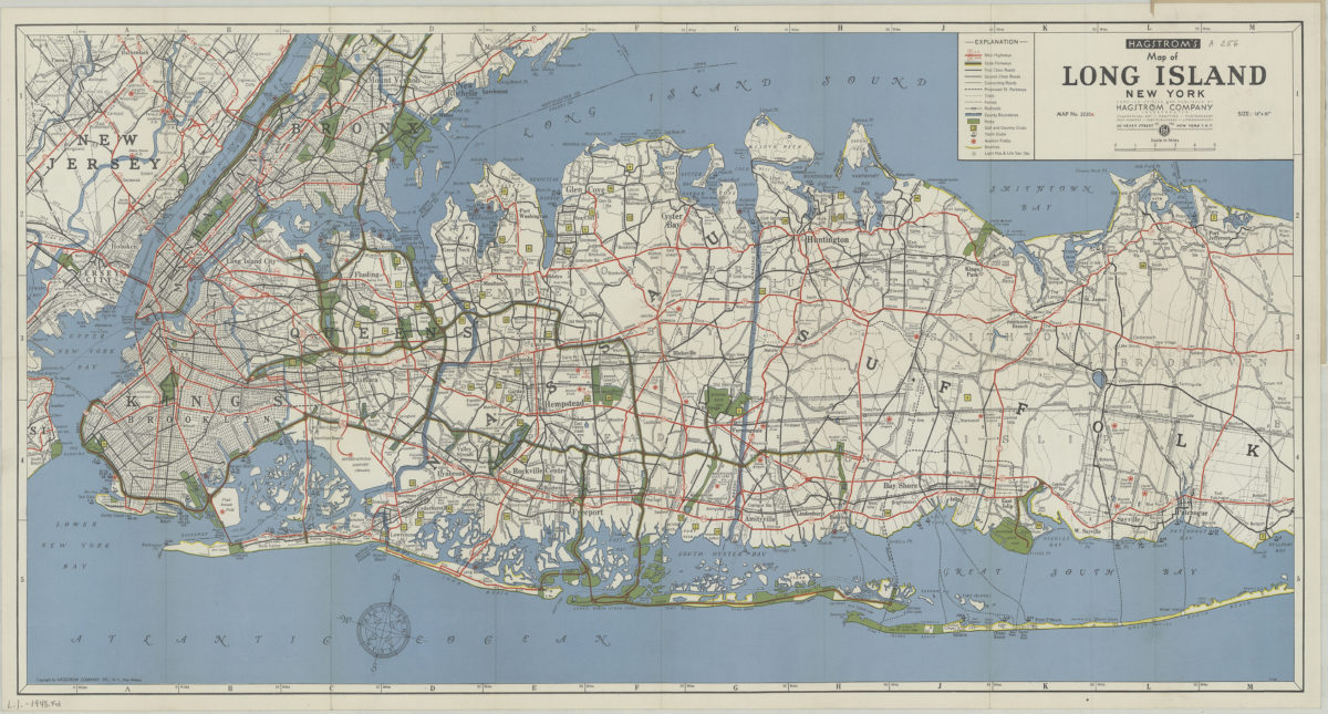
Hagstrom’s map of Long Island, New York
Hagstrom’s map of Long Island, New York
[1948]
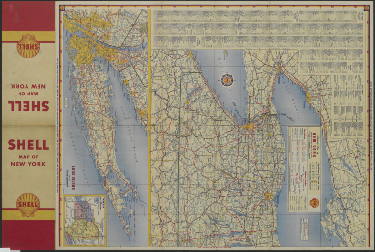
Highway map of New York
Highway map of New York
[1953]
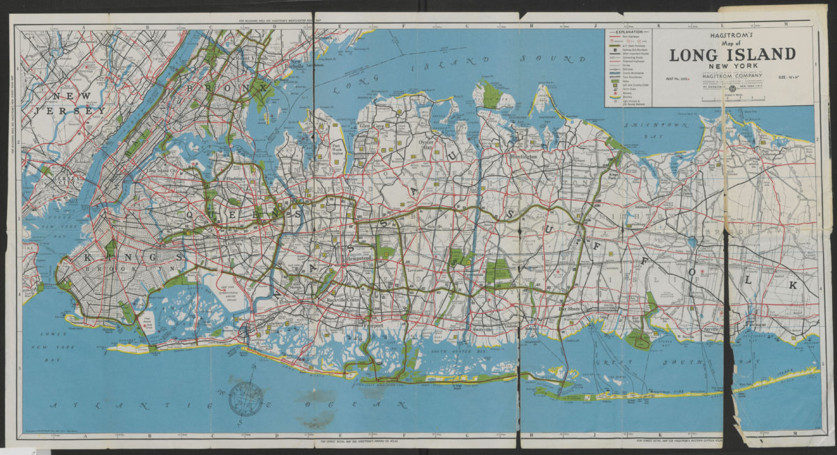
Hagstrom’s map of Long Island, New York
Hagstrom’s map of Long Island, New York
[1962]
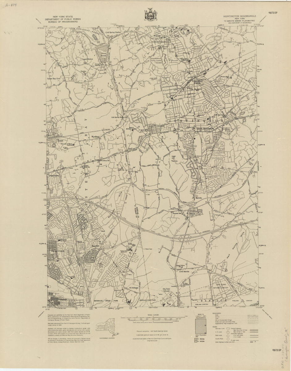
Huntington quadrangle, New York
Huntington quadrangle, New York
[1966]
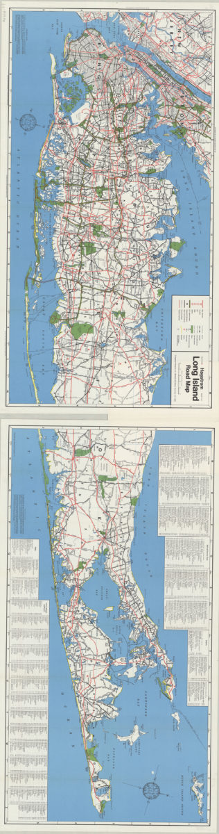
Hagstrom Long Island road map
Hagstrom Long Island road map
[1971]
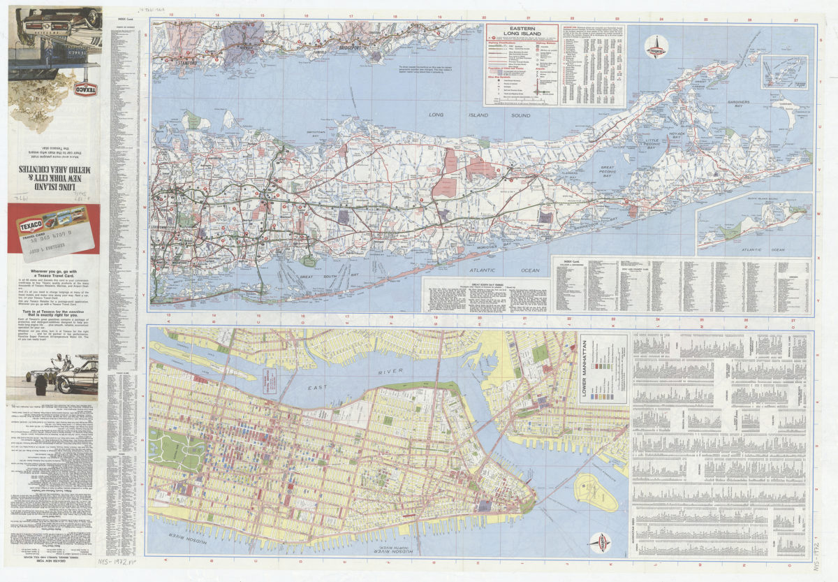
Long Island, New York City & metro area counties
Long Island, New York City & metro area counties
[1972]
Hagstrom Long Island road map
Hagstrom Long Island road map
[1974]
Long Island, New York City & metro area counties: [prepared for] Texaco
Long Island, New York City & metro area counties: [prepared for] Texaco
1975