Center for Brooklyn History
Map Collections
Search
About
Othmer Library & Archives
Submit search query
Refine 11 records
Clear filters
2
Location
Bedford-Stuyvesant (New York, N.Y.)
67
Boerum Hill (New York, N.Y.)
6
Brooklyn (New York, N.Y.)
891
Brooklyn Heights (New York, N.Y.)
76
Bushwick (New York, N.Y.)
20
Clinton Hill (New York, N.Y.)
10
Cobble Hill (New York, N.Y.)
7
Downtown Brooklyn (New York, N.Y.)
29
Fort Greene (New York, N.Y.)
22
Gowanus (New York, N.Y.)
12
Greenpoint (New York, N.Y.)
38
Red Hook (New York, N.Y.)
19
Sunset Park (New York, N.Y.)
53
Williamsburg (New York, N.Y.)
36
Subject
Election districts
36
Landowners
434
Real property
619
Roads
117
Date
18th Century
12
19th Century
945
20th Century
469
or enter range:
from
to
Genres
Cadastral maps
597
Early maps
35
Manuscript maps
365
Map
191
Zoning maps
55
Sort by:
Date (earliest)
Date (most recent)
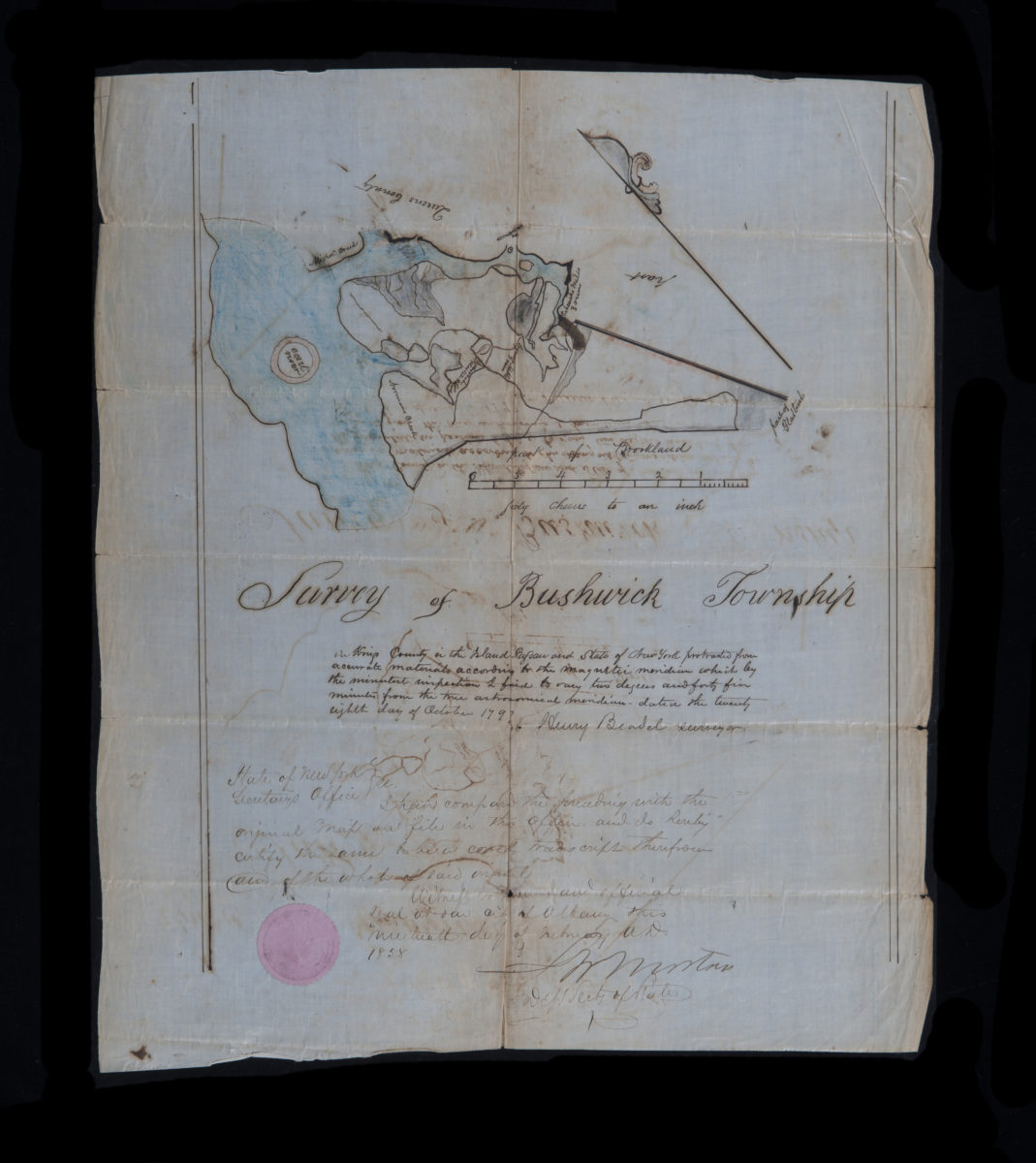
Survey of Bushwick Township in Kings County …: Henry Beadel
Survey of Bushwick Township in Kings County …: Henry Beadel
October 28, 1797
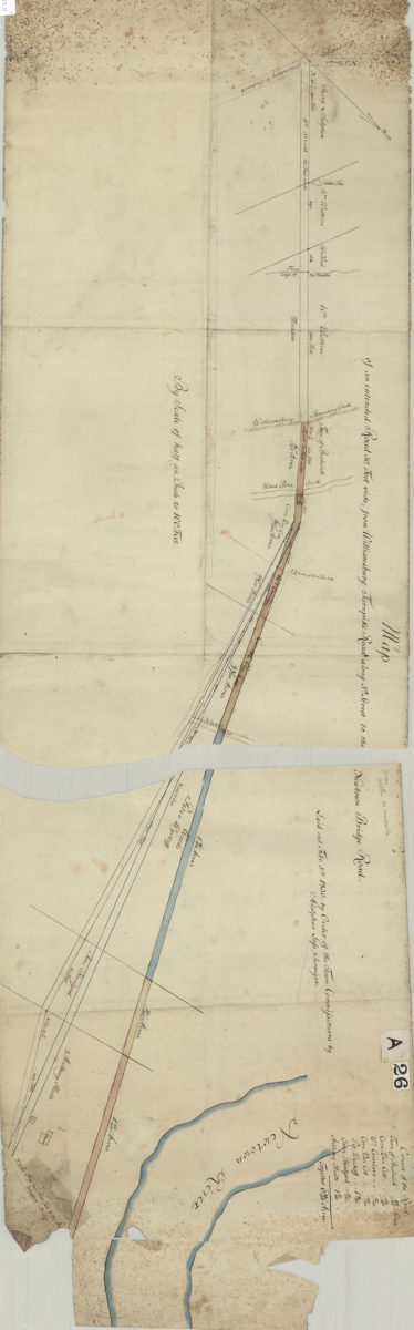
Map of an intended road 50 feet wide, from Williamsburg Turnpike Road along 5th Street to the Newtown Bridge Road: laid out … by order of the Town Commissioners: by Adolphus Lofs, surveyor
Map of an intended road 50 feet wide, from Williamsburg Turnpike Road along 5th Street to the Newtown Bridge Road: laid out … by order of the Town Commissioners: by Adolphus Lofs, surveyor
February 5, 1830
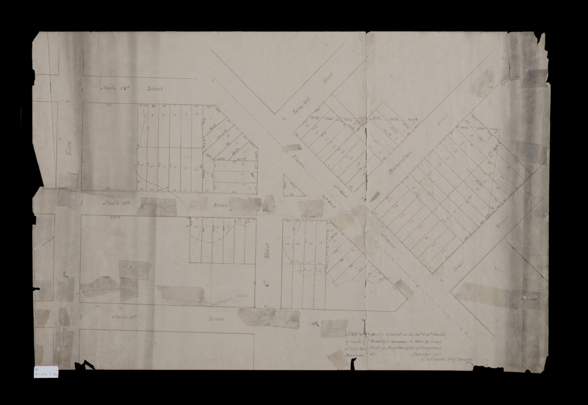
Map of property situated in the 14th & 15th Wards of the city of Brooklyn, belonging to Peter B. Amory: J.V. Meserole, city surveyor
Map of property situated in the 14th & 15th Wards of the city of Brooklyn, belonging to Peter B. Amory: J.V. Meserole, city surveyor
November 1871
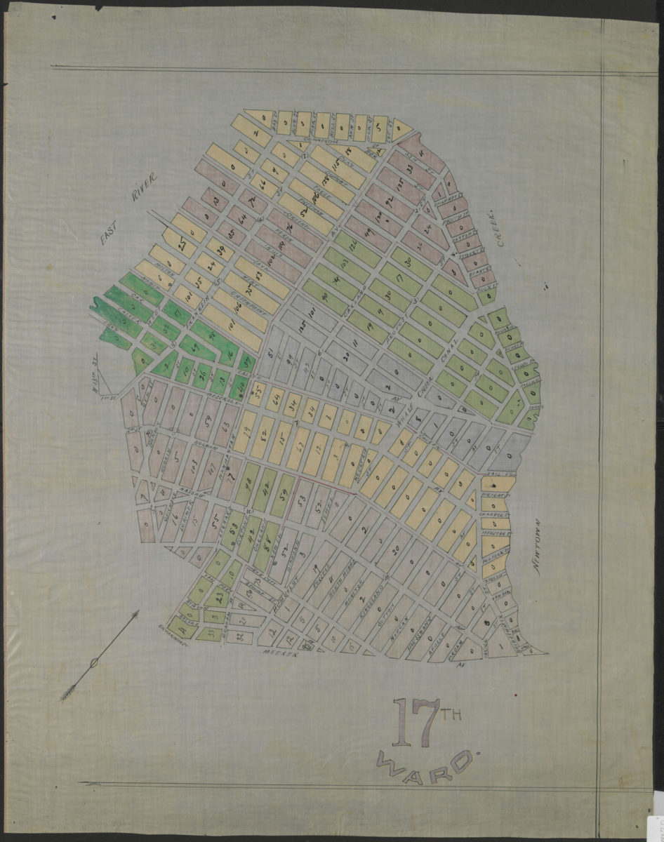
17th Ward
17th Ward
[1883]
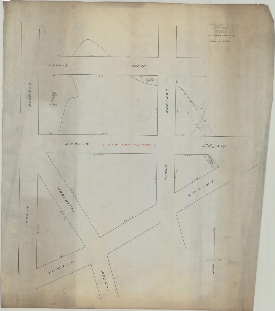
[Map of area bounded by Lorimer St., Jane St., Leonard St., and Driggs Ave.]: B.R. Meserole
[Map of area bounded by Lorimer St., Jane St., Leonard St., and Driggs Ave.]: B.R. Meserole
July 17, 1897
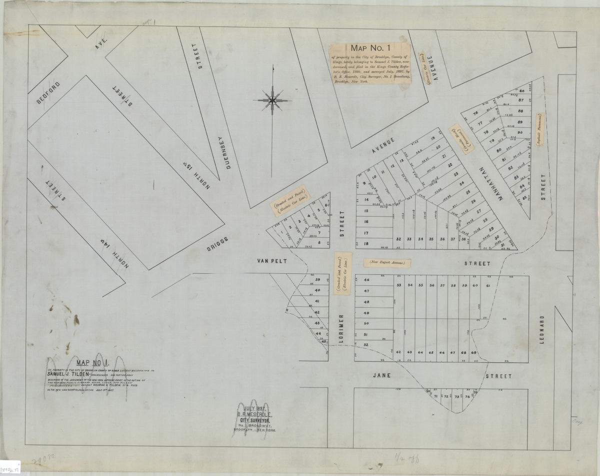
Map no. 1 of property in the city of Brooklyn, county of Kings, lately belonging to Samuel J. Tilden, now deceased, and filed in the Kings County Register’s Office, 1899, and surveyed July 1897: by B.R. Meserole, city surveyor
Map no. 1 of property in the city of Brooklyn, county of Kings, lately belonging to Samuel J. Tilden, now deceased, and filed in the Kings County Register’s Office, 1899, and surveyed July 1897: by B.R. Meserole, city surveyor
[1897]
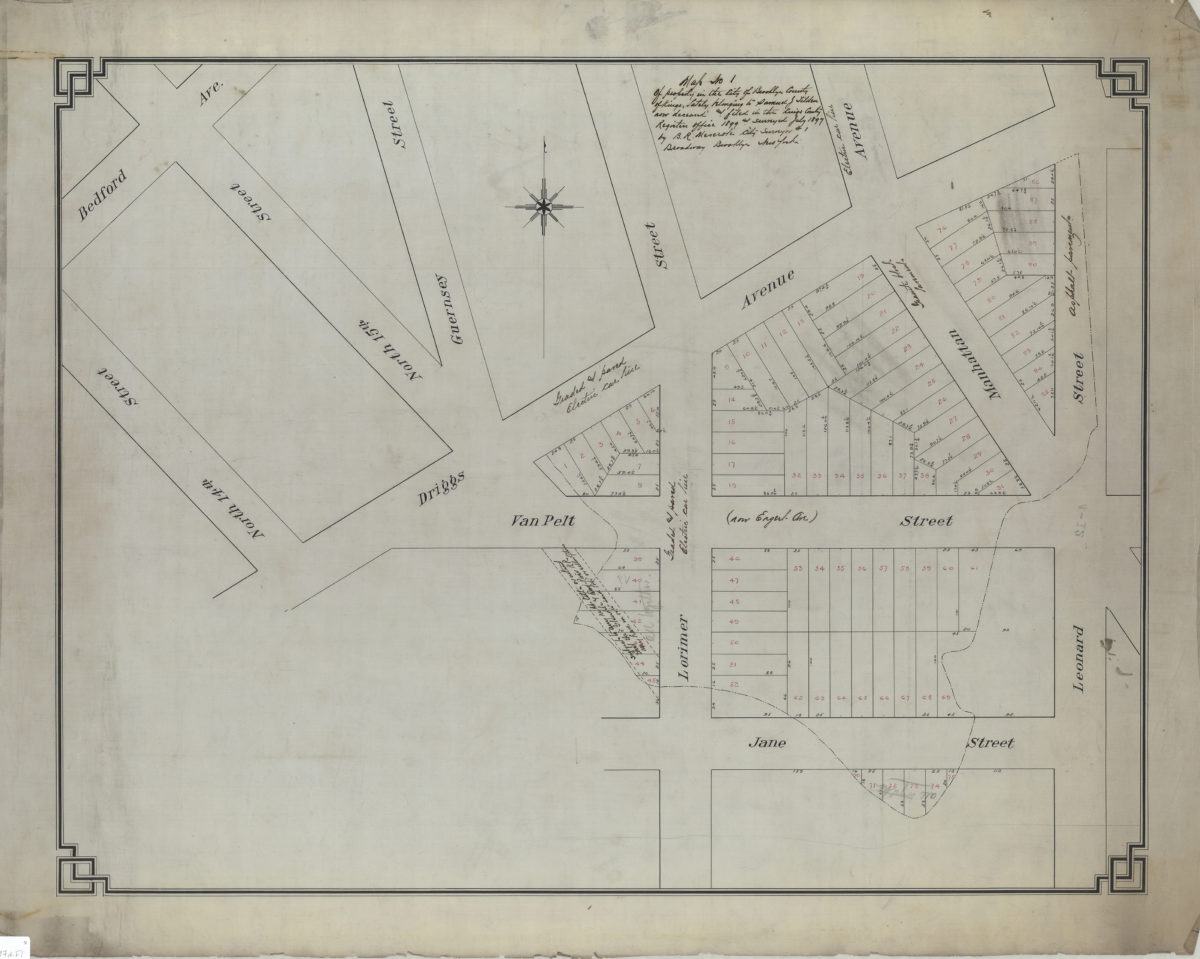
Map no. 1 of property in the city of Brooklyn, county of Kings, lately belonging to Samuel J. Tilden, now deceased, and filed in the Kings County Register’s Office, 1899, and surveyed July 1897: by B.R. Meserole, city surveyor
Map no. 1 of property in the city of Brooklyn, county of Kings, lately belonging to Samuel J. Tilden, now deceased, and filed in the Kings County Register’s Office, 1899, and surveyed July 1897: by B.R. Meserole, city surveyor
July 1897
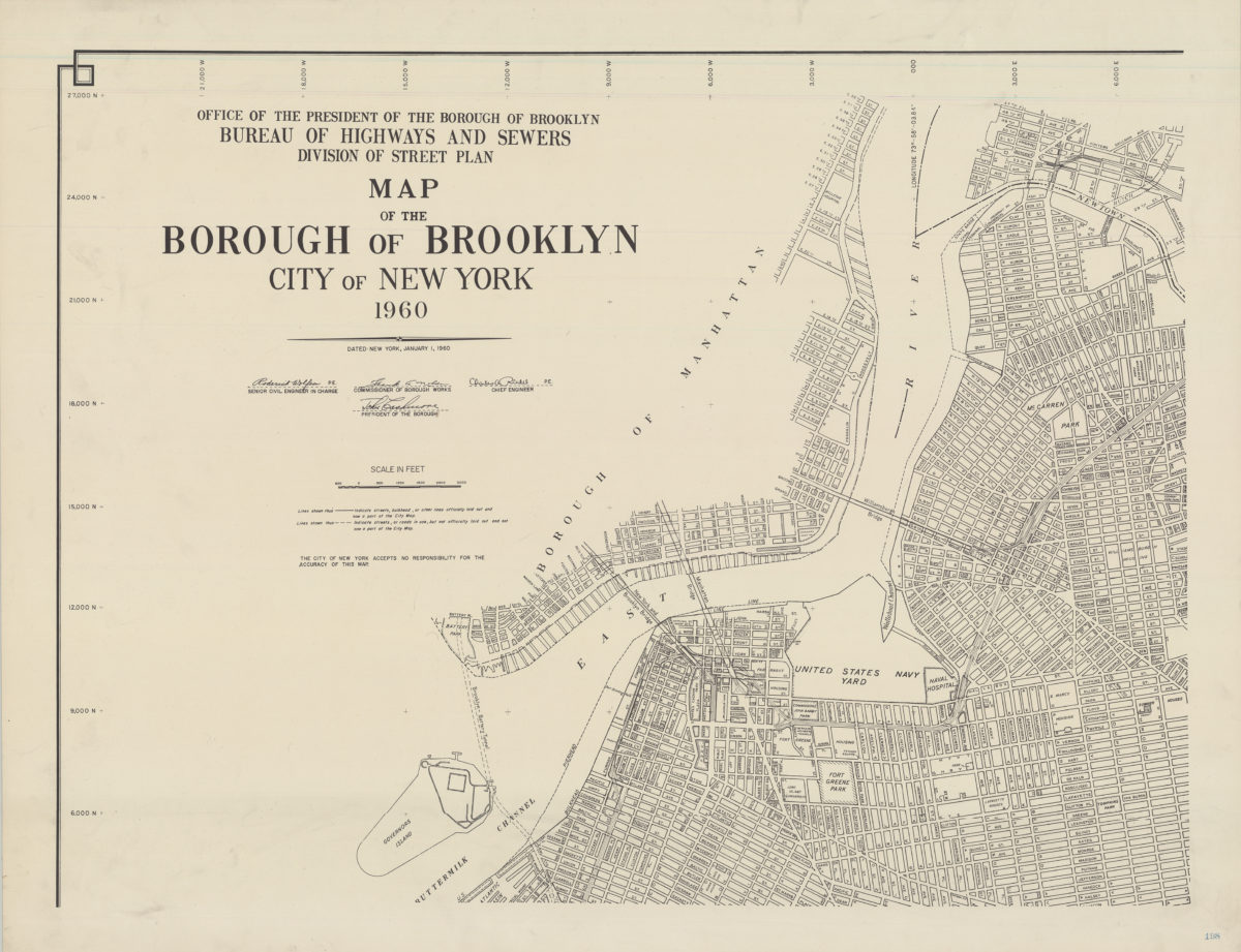
Map of the Borough of Brooklyn, City of New York, 1960
Map of the Borough of Brooklyn, City of New York, 1960
1960
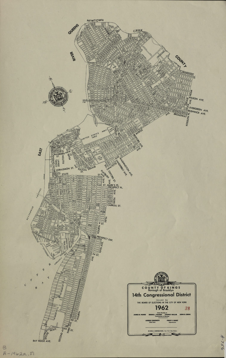
County of Kings, Borough of Brooklyn, 14th Congressional District: issued by the Board of Elections in the City of New York
County of Kings, Borough of Brooklyn, 14th Congressional District: issued by the Board of Elections in the City of New York
1962
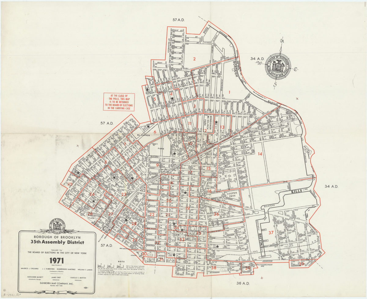
Borough of Brooklyn 35th Assembly District, 1971: issued by the Board of Elections in the City of New York
Borough of Brooklyn 35th Assembly District, 1971: issued by the Board of Elections in the City of New York
1971
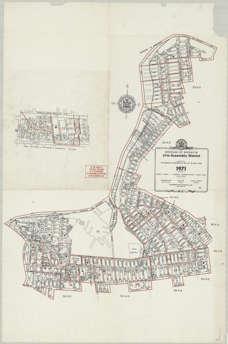
Borough of Brooklyn 57th Assembly District, 1971: issued by the Board of Elections in the City of New York
Borough of Brooklyn 57th Assembly District, 1971: issued by the Board of Elections in the City of New York
1971