Center for Brooklyn History
Map Collections
Search
About
Othmer Library & Archives
Submit search query
Refine 4 records
Clear filters
2
Location
Brooklyn (New York, N.Y.)
891
Brooklyn Heights (New York, N.Y.)
76
Subject
ferries
32
Landowners
434
Piers
25
Real property
619
Waterfronts
5
Date
19th Century
945
20th Century
469
or enter range:
from
to
Genres
Cadastral maps
597
Manuscript maps
365
Sort by:
Date (earliest)
Date (most recent)
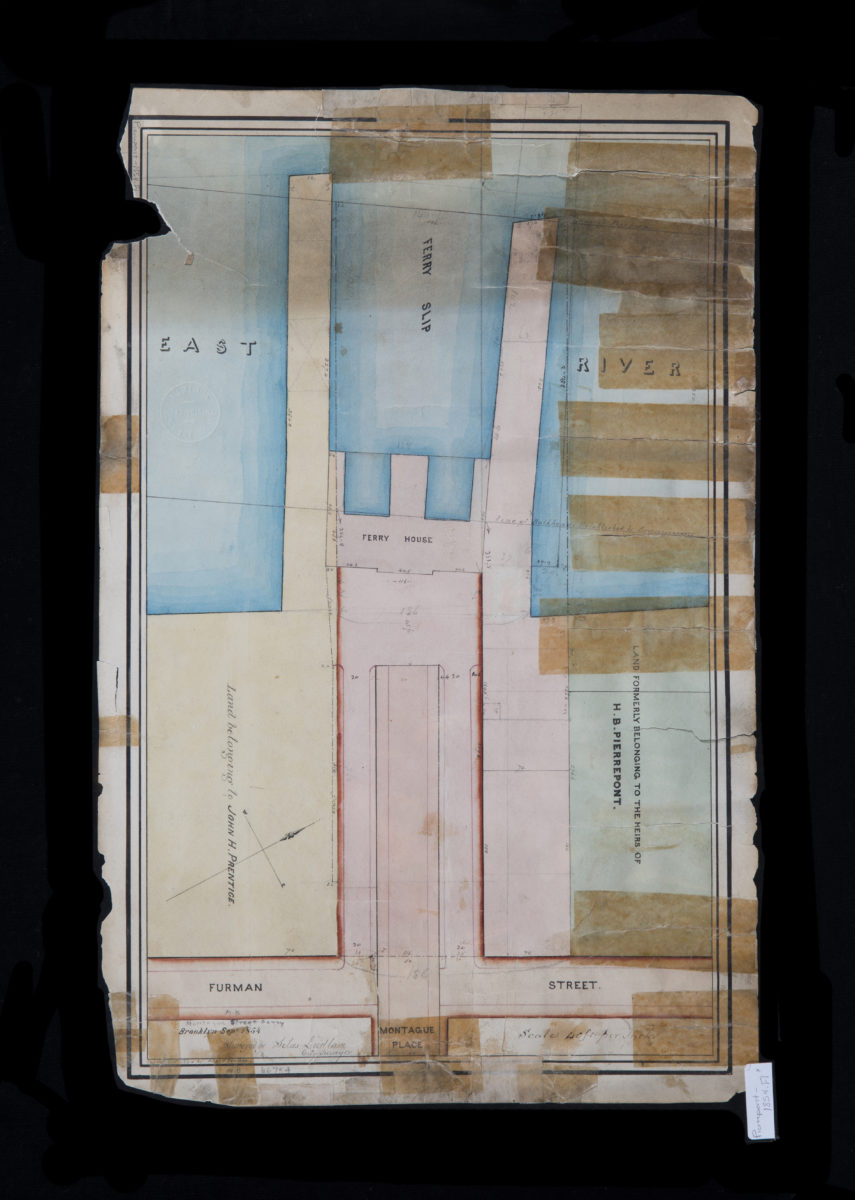
Montague Street Ferry: surveyed by Silas Ludlam ; copied … by Richd. F. Tooms
Montague Street Ferry: surveyed by Silas Ludlam ; copied … by Richd. F. Tooms
September 1854
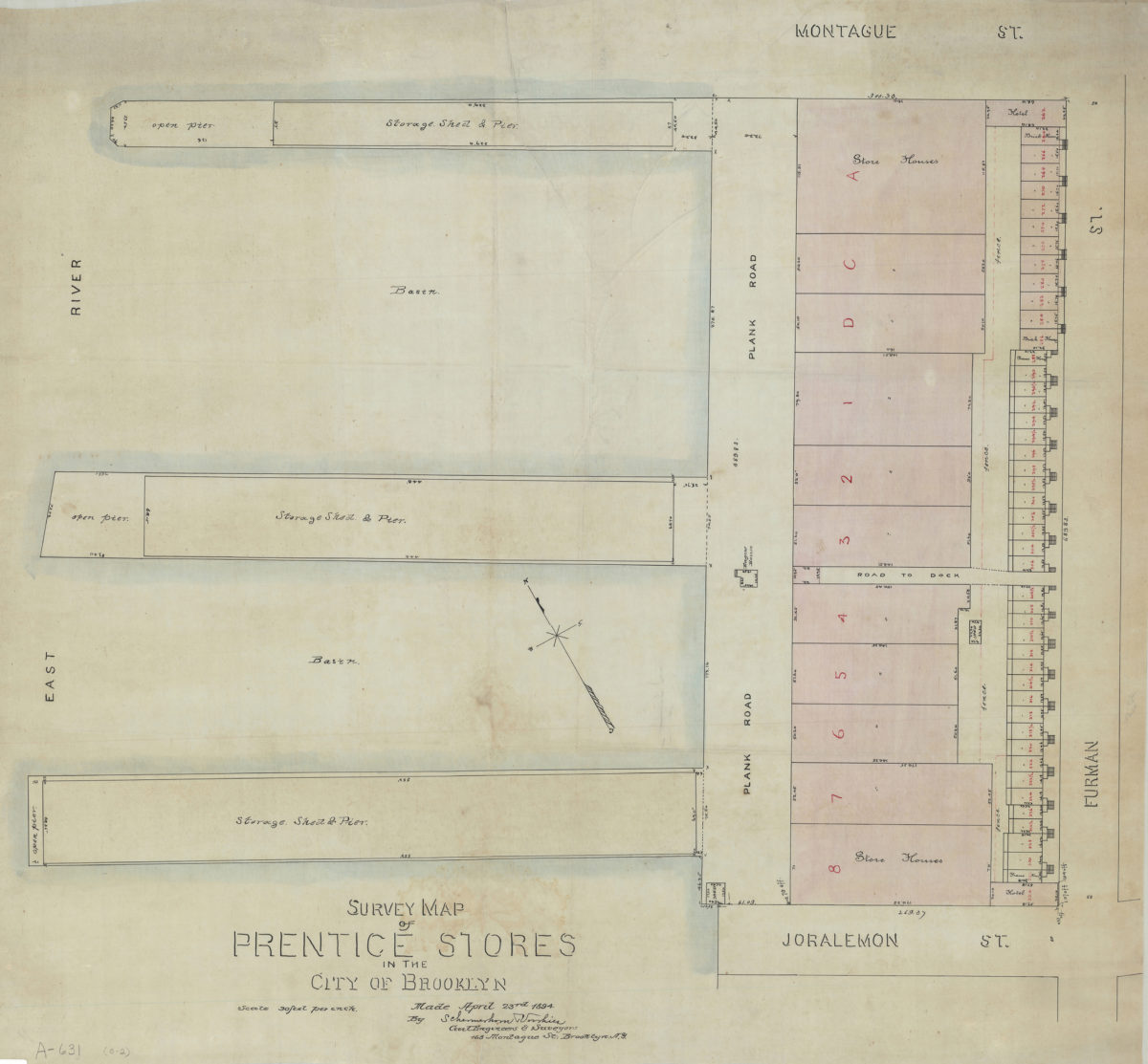
Survey map of Prentice Stores in the city of Brooklyn: by Schermerhorn [and] Voorhies, civil engineers & surveyors
Survey map of Prentice Stores in the city of Brooklyn: by Schermerhorn [and] Voorhies, civil engineers & surveyors
April 23, 1894
[Map of properties at Montague Pl. and Furman St.]: surveyed by Ludlam & Stuchfield, city surveyors
[Map of properties at Montague Pl. and Furman St.]: surveyed by Ludlam & Stuchfield, city surveyors
December 4, 1894
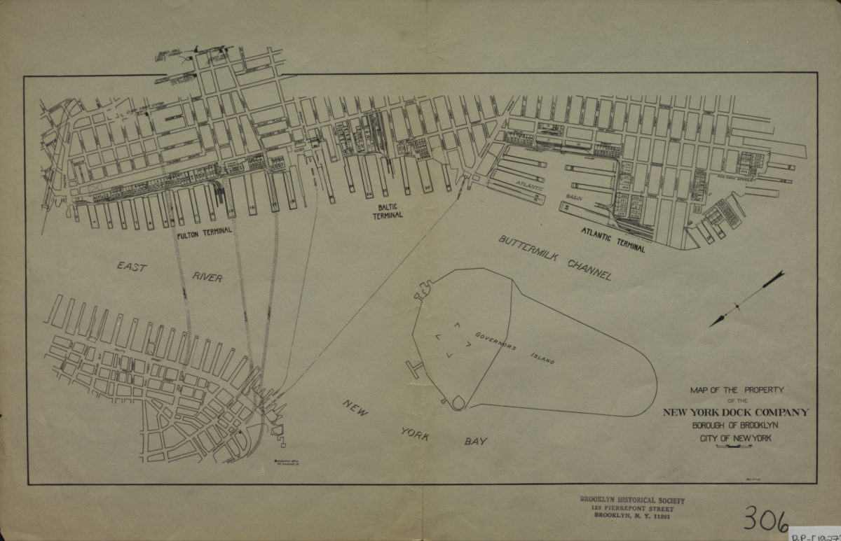
Map of the property of the New York Dock Company, Borough of Brooklyn, City of New York
Map of the property of the New York Dock Company, Borough of Brooklyn, City of New York
[1927]