Center for Brooklyn History
Map Collections
Search
About
Othmer Library & Archives
Submit search query
Refine 53 records
Clear filter
1
Location
Amagansett (N.Y.)
1
Atlantic States
2
Bergen Beach (New York, N.Y.)
3
Brooklyn (New York, N.Y.)
891
Brooklyn Heights (New York, N.Y.)
76
Canarsie (New York, N.Y.)
18
Central Park (New York, N.Y.)
3
Clermont (N.Y. : Town)
1
DUMBO Historic District (New York, N.Y.)
7
East Flatbush (New York, N.Y.)
23
Flatlands (New York, N.Y.)
19
Fulton Ferry Historic District (New York, N.Y.)
5
Germantown (N.Y. : Town)
1
Great Neck (N.Y.)
3
Harlem (New York, N.Y.)
1
Hoboken (N.J.)
1
Hudson River (N.Y. and N.J.)
7
Inwood (New York, N.Y.)
1
Jersey City (N.J.)
4
Lawrence (Mercer County, N.J. : Township)
1
Livingston (N.Y. : Town)
1
Long Island (N.Y.)
197
Long Island, Battle of, New York, N.Y., 1776
4
Maidenhead (N.J.)
1
Manhattan (New York, N.Y.)
120
Marine Park (New York, N.Y.)
5
Mill Basin (New York, N.Y.)
3
Mohawk River Valley (N.Y.)
3
New England
8
New Jersey
27
New Netherland
2
New York (N.Y.)
164
New York (State)
95
New York Metropolitan Area
40
New York Region
5
Oyster Bay (N.Y.)
9
United States
10
Upper East Side (New York, N.Y.)
1
Upper West Side (New York, N.Y.)
2
Vermont
1
Wallabout Bay (New York, N.Y.)
6
Washington Heights (New York, N.Y.)
2
Western Hemisphere
1
Show 23 more
Subject
Bays
5
Buildings
12
Fills (Earthwork)
4
Fires
1
Fortification
7
Harlem Heights, Battle of, N.Y.
1
Indian land transfers
1
Indian trails
1
Indians of North America
6
Land titles
1
Landforms
15
Landowners
434
Long Island, Battle of, New York, N.Y. , 1776
7
Names, Personal
1
Neighborhoods
3
Parks
35
Piers
25
Ponds
6
Real property
619
Rivers
16
Roads
117
Swamps
2
Wetlands
6
Show 3 more
Date
19th Century
945
20th Century
469
or enter range:
from
to
Genres
Bathymetric maps
94
Cadastral maps
597
Early maps
35
Historical maps
53
Manuscript maps
365
Military maps
23
Physical maps
4
Pictorial maps
38
Statistical maps
8
Thematic maps
60
Topographic maps
70
Sort by:
Date (earliest)
Date (most recent)
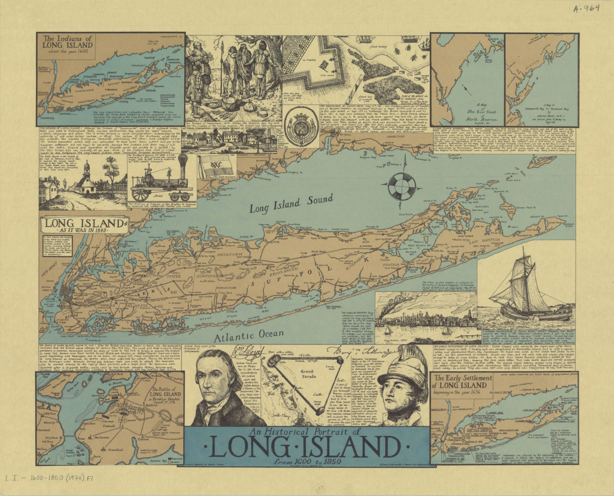
An historical portrait of Long Island from 1600 to 1850: drawn & engraved by Ronald Toelke
An historical portrait of Long Island from 1600 to 1850: drawn & engraved by Ronald Toelke
[ca. 1974]
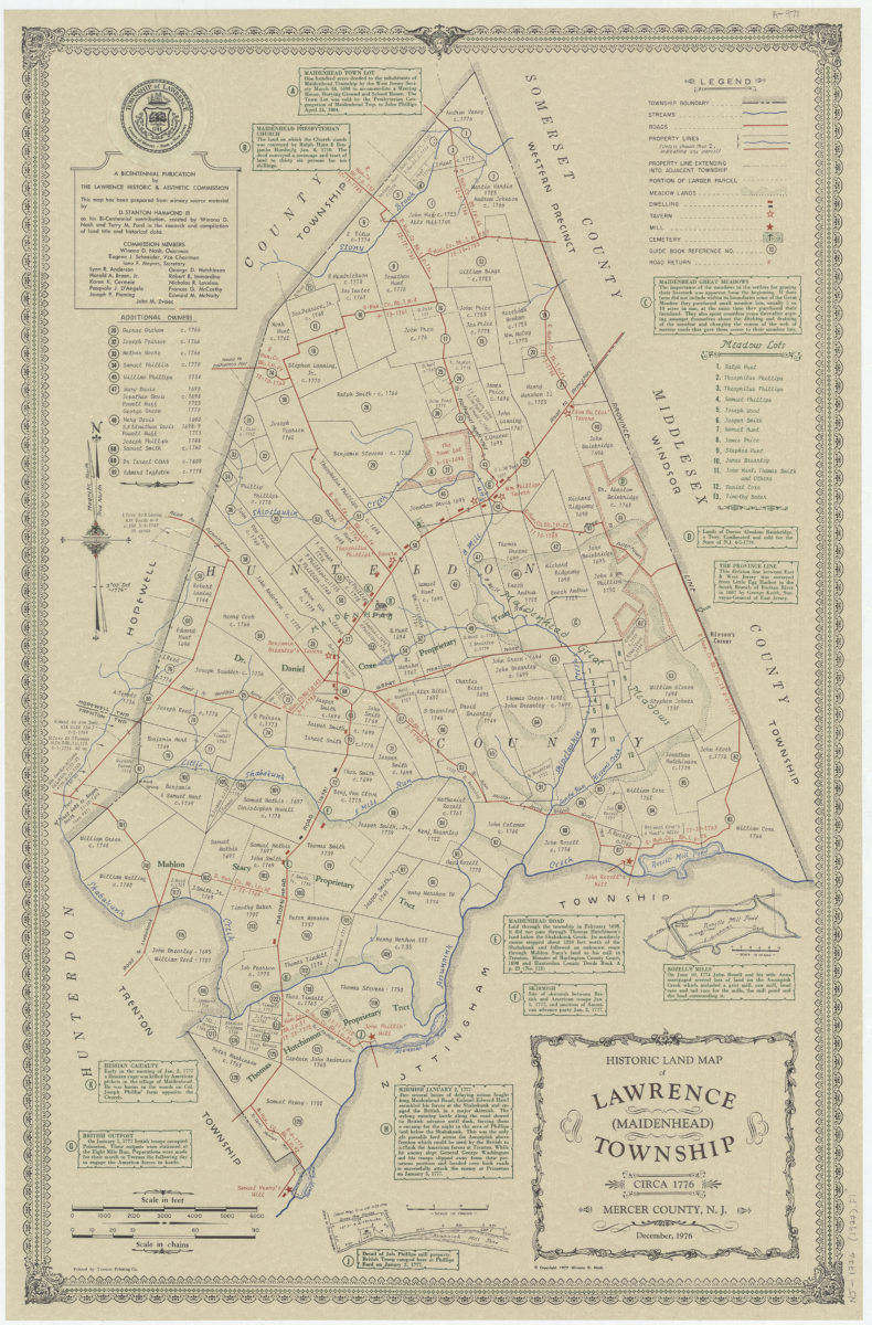
Historic land map of Lawrence (Maidenhead) Township, circa 1776, Mercer County, N.J.: December 1976: this map has been prepared from primary source material by D. Stanton Hammond, III as his Bi-centennial contribution
Historic land map of Lawrence (Maidenhead) Township, circa 1776, Mercer County, N.J.: December 1976: this map has been prepared from primary source material by D. Stanton Hammond, III as his Bi-centennial contribution
[ca. 1977]
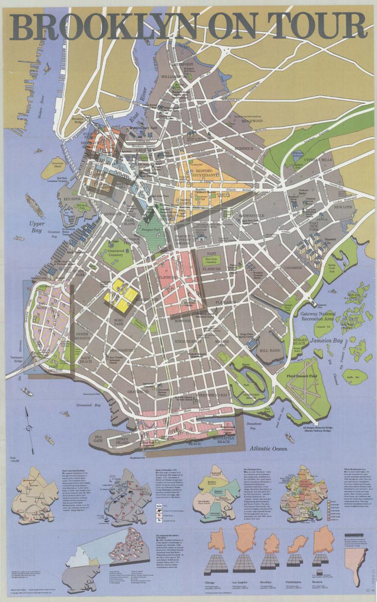
Brooklyn on tour: maps by Cadre Graphics ; graphic design by Keith Godard of Works
Brooklyn on tour: maps by Cadre Graphics ; graphic design by Keith Godard of Works
[ca. 1984]
Previous
1
2