Center for Brooklyn History
Map Collections
Search
About
Othmer Library & Archives
Submit search query
Refine 54 records
Clear filters
2
Location
Bedford-Stuyvesant (New York, N.Y.)
67
Boerum Hill (New York, N.Y.)
6
Brooklyn (New York, N.Y.)
891
Brooklyn Heights (New York, N.Y.)
76
Carroll Gardens (New York, N.Y.)
21
Clinton Hill (New York, N.Y.)
10
Cobble Hill (New York, N.Y.)
7
Crown Heights (New York, N.Y.)
25
Downtown Brooklyn (New York, N.Y.)
29
DUMBO Historic District (New York, N.Y.)
7
Fort Brooklyn (New York, N.Y.)
1
Fort Greene (New York, N.Y.)
22
Gowanus (New York, N.Y.)
12
Manhattan (New York, N.Y.)
120
New York (N.Y.)
164
Park Slope (New York, N.Y.)
16
Pierrepont Homestead (New York, N.Y.)
6
Prospect Heights (New York, N.Y.)
16
Red Hook (New York, N.Y.)
19
Williamsburg (New York, N.Y.)
36
Subject
Apartment houses
1
Auctions
32
Farms
2
ferries
32
Fortification
7
Gardens
1
Land grants
12
Landowners
434
Piers
25
Real property
619
Riparian rights
13
Roads
117
Streets
46
Submerged lands
17
Tenement houses
1
Date
19th Century
945
or enter range:
from
to
Genres
Advertisements
30
Broadsides
33
Cadastral maps
597
Historical maps
53
Manuscript maps
365
Map
191
Military maps
23
Sort by:
Date (earliest)
Date (most recent)
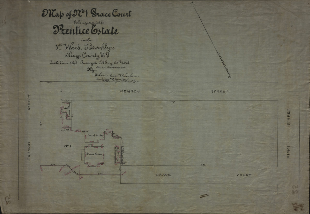
Map of No. 1 Grace Court belonging to the Prentice Estate, in the 1st Ward, Brooklyn, Kings County, NY: by Schermerhorn [and] Voorhies, civil engrs. & surveyor[s]
Map of No. 1 Grace Court belonging to the Prentice Estate, in the 1st Ward, Brooklyn, Kings County, NY: by Schermerhorn [and] Voorhies, civil engrs. & surveyor[s]
May 28, 1894
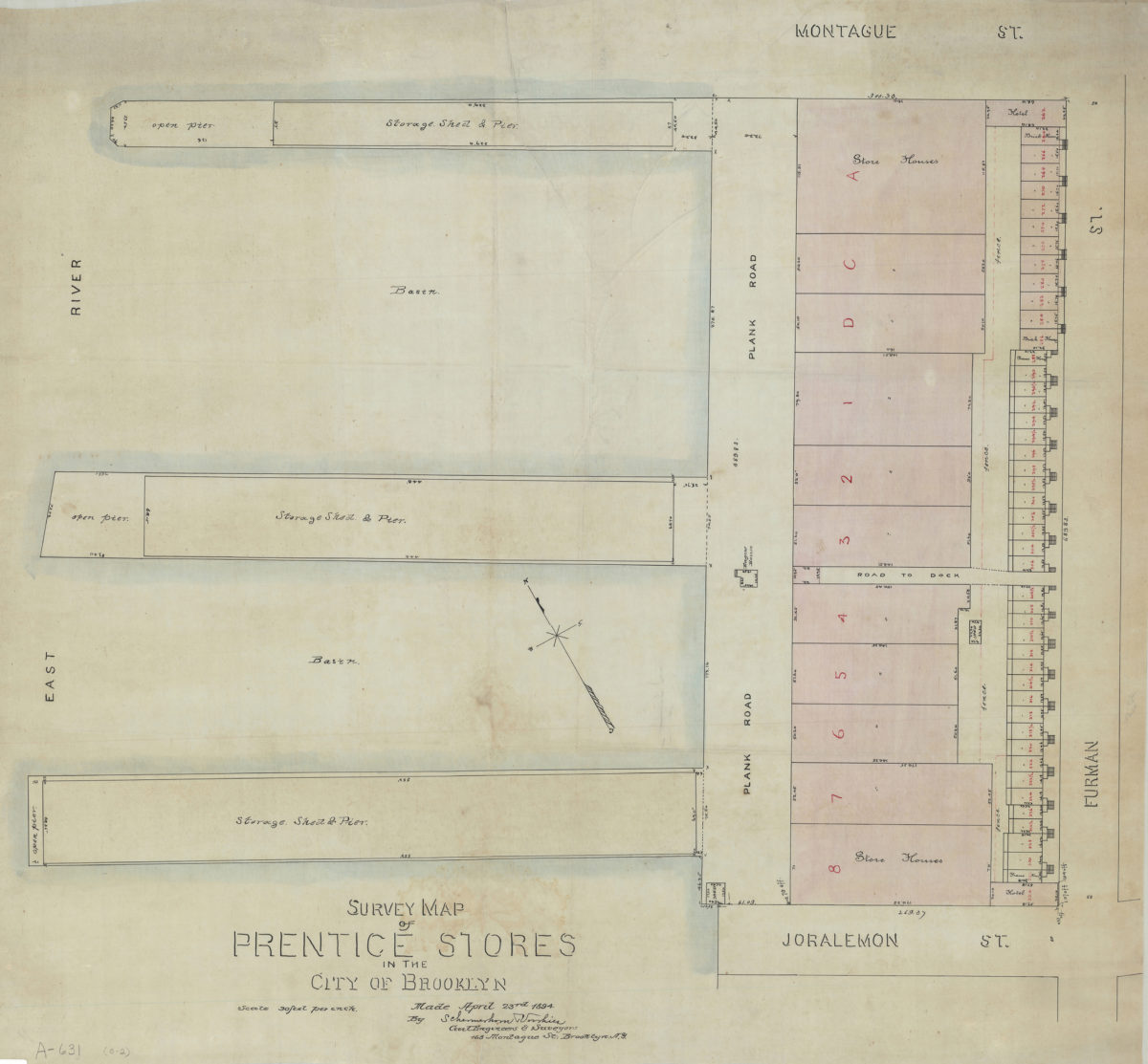
Survey map of Prentice Stores in the city of Brooklyn: by Schermerhorn [and] Voorhies, civil engineers & surveyors
Survey map of Prentice Stores in the city of Brooklyn: by Schermerhorn [and] Voorhies, civil engineers & surveyors
April 23, 1894
[Map of properties at Montague Pl. and Furman St.]: surveyed by Ludlam & Stuchfield, city surveyors
[Map of properties at Montague Pl. and Furman St.]: surveyed by Ludlam & Stuchfield, city surveyors
December 4, 1894
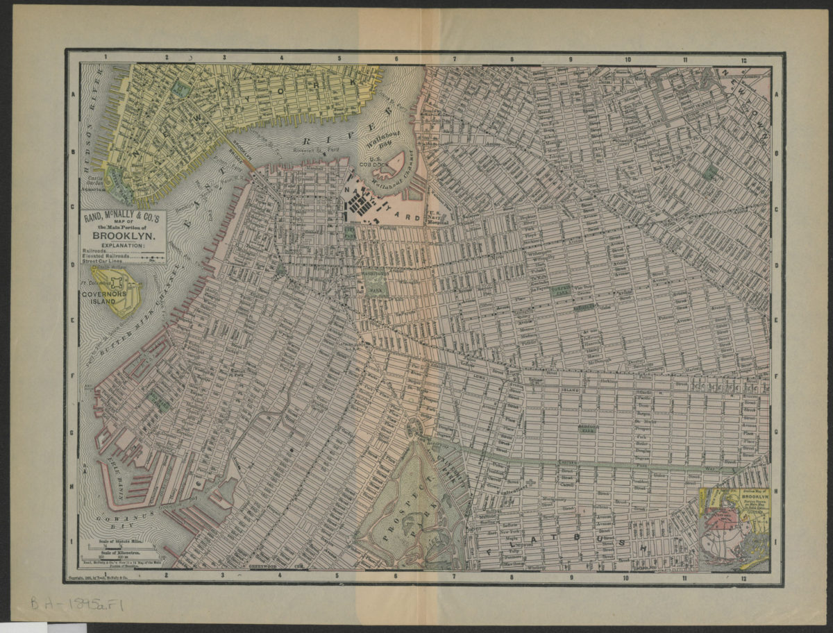
Rand, McNally & Co.’s map of the main portion of Brooklyn
Rand, McNally & Co.’s map of the main portion of Brooklyn
[1895; 1895]
Previous
1
2