Center for Brooklyn History
Map Collections
Search
About
Othmer Library & Archives
Submit search query
Refine 5 records
Clear filters
2
Location
Brooklyn (New York, N.Y.)
891
Canarsie (New York, N.Y.)
18
Cypress Hills (New York, N.Y.)
8
East New York (New York, N.Y.)
16
Subject
Auctions
32
Farms
2
Landowners
434
Real property
619
Streets
46
Date
19th Century
945
or enter range:
from
to
Genres
Advertisements
30
Broadsides
33
Cadastral maps
597
Manuscript maps
365
Sort by:
Date (earliest)
Date (most recent)
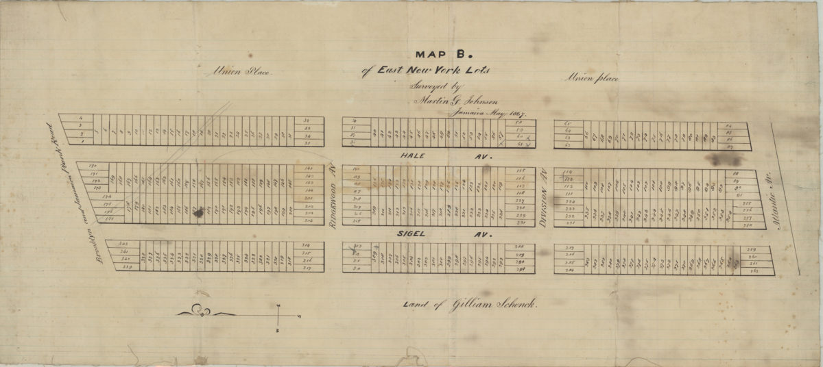
Map B of East New York lots: surveyed by Martin G. Johnson, Jamaica
Map B of East New York lots: surveyed by Martin G. Johnson, Jamaica
May 1867
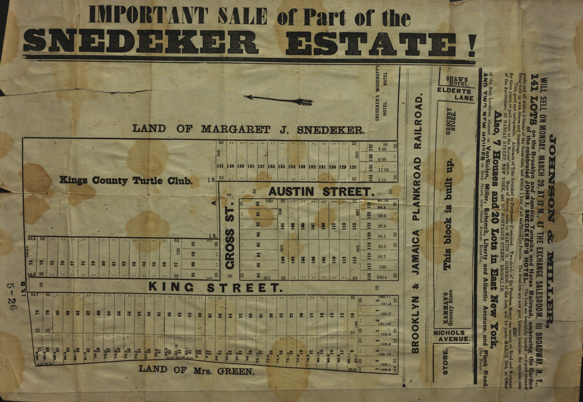
Important sale of part of the Snedeker Estate
Important sale of part of the Snedeker Estate
[187?]
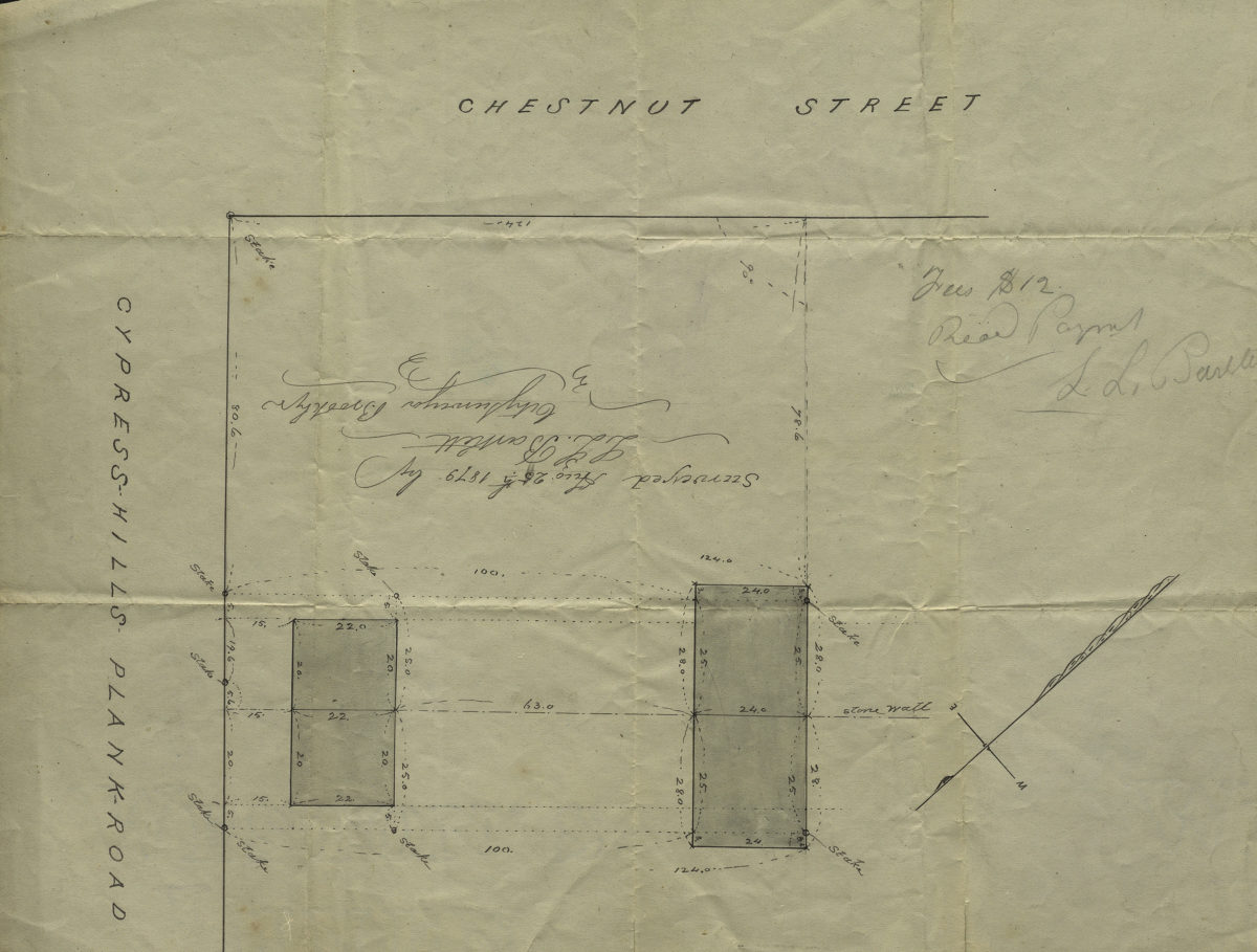
[Map of Chestnut St. and Cypress Hills Plank Road]: surveyed by L.L. Bartlett, city surveyor
[Map of Chestnut St. and Cypress Hills Plank Road]: surveyed by L.L. Bartlett, city surveyor
August 25, 1879
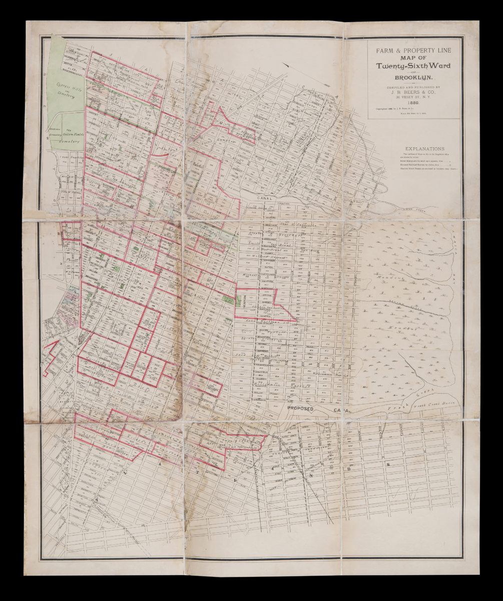
Farm & property line map of Twenty-sixth Ward of Brooklyn: compiled and published by J.H. Beers & Co
Farm & property line map of Twenty-sixth Ward of Brooklyn: compiled and published by J.H. Beers & Co
1889
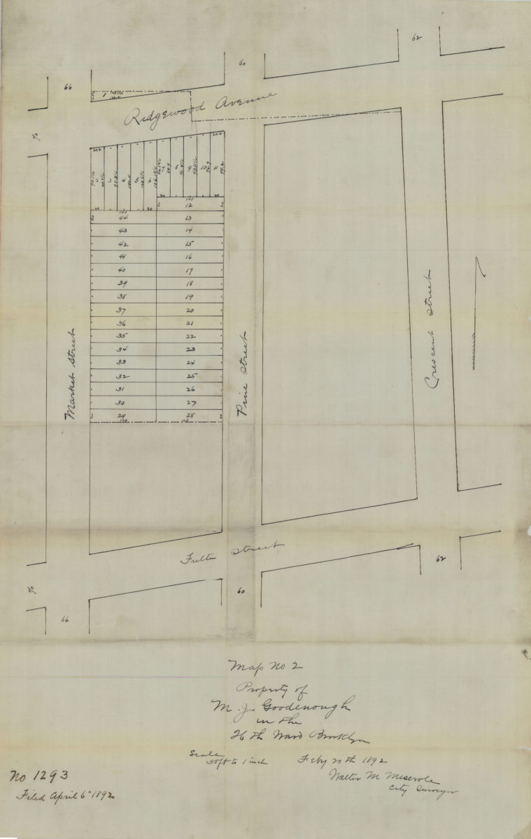
Map no. 2: property of M. J. Goodenough in the 26th Ward, Brooklyn, Feb[ruar]y 20th, 1892: Walter M. Meserole, city surveyor
Map no. 2: property of M. J. Goodenough in the 26th Ward, Brooklyn, Feb[ruar]y 20th, 1892: Walter M. Meserole, city surveyor
1892