Center for Brooklyn History
Map Collections
Search
About
Othmer Library & Archives
Submit search query
Refine 4 records
Clear filters
2
Location
Brooklyn (New York, N.Y.)
891
New York (N.Y.)
164
Wallabout Bay (New York, N.Y.)
6
Subject
Bays
5
Landowners
434
Real property
619
Date
19th Century
945
or enter range:
from
to
Genres
Bathymetric maps
94
Cadastral maps
597
Historical maps
53
Manuscript maps
365
Pictorial maps
38
Sort by:
Date (earliest)
Date (most recent)
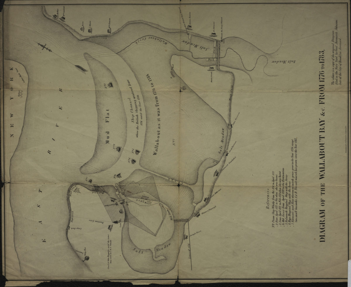
Diagram of the Wallabout Bay &c. from 1776 to 1783
Diagram of the Wallabout Bay &c. from 1776 to 1783
[18??]
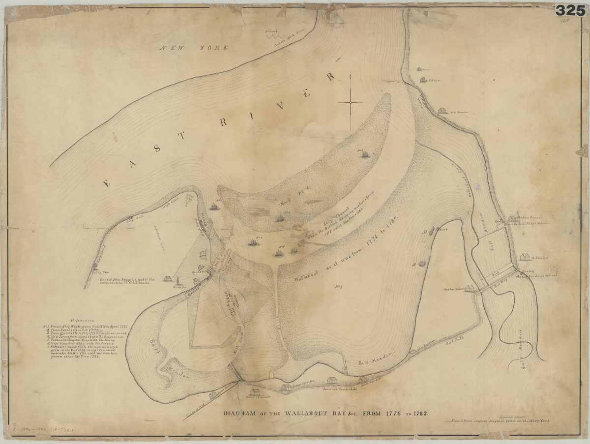
Diagram of the Wallabout Bay &c. from 1776 to 1783
Diagram of the Wallabout Bay &c. from 1776 to 1783
[18??]
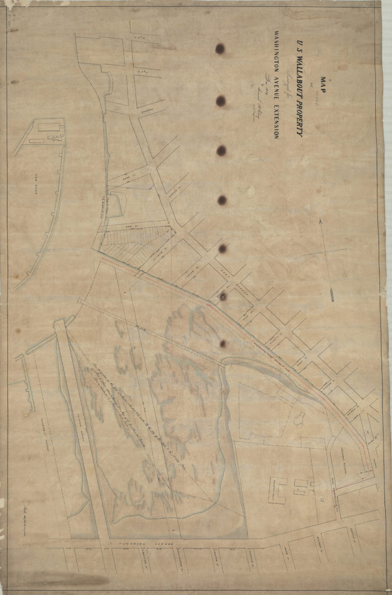
Map of U.S. Wallabout property: surveyed for Washington Avenue extension, Dec. 1859: by Samuel McElroy, civil engineer
Map of U.S. Wallabout property: surveyed for Washington Avenue extension, Dec. 1859: by Samuel McElroy, civil engineer
December 1859
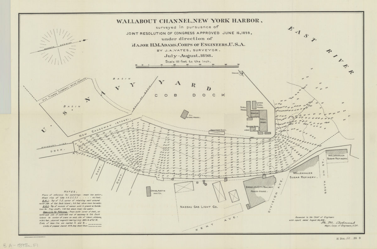
Wallabout Channel, New York Harbor, surveyed in pursuance of joint resolution of Congress approved June 16, 1898: under direction of Major H. M. Adams, Corps of Engineers, U.S.A. by J. A. Yates, surveyor
Wallabout Channel, New York Harbor, surveyed in pursuance of joint resolution of Congress approved June 16, 1898: under direction of Major H. M. Adams, Corps of Engineers, U.S.A. by J. A. Yates, surveyor
1898