Center for Brooklyn History
Map Collections
Search
About
Othmer Library & Archives
Submit search query
Refine 8 records
Clear filters
2
Location
Brooklyn (New York, N.Y.)
891
Hudson County (N.J.)
3
Jersey City (N.J.)
4
Manhattan (New York, N.Y.)
120
New Jersey
27
New York (N.Y.)
164
Queens (New York, N.Y.)
83
Stapleton (New York, N.Y.)
1
Staten Island (N.Y.)
10
U.S.
1
Subject
Bus lines
20
Bus travel
22
ferries
32
Local transit
63
Names, Geographical
1
Postal codes
4
Railroads
72
Roads
117
Street addresses
11
Streets
46
Topographic maps
1
Date
20th Century
469
or enter range:
from
to
Genres
Bathymetric maps
94
Map
191
Road maps
83
Topographic maps
70
Transportation maps
120
Sort by:
Date (earliest)
Date (most recent)
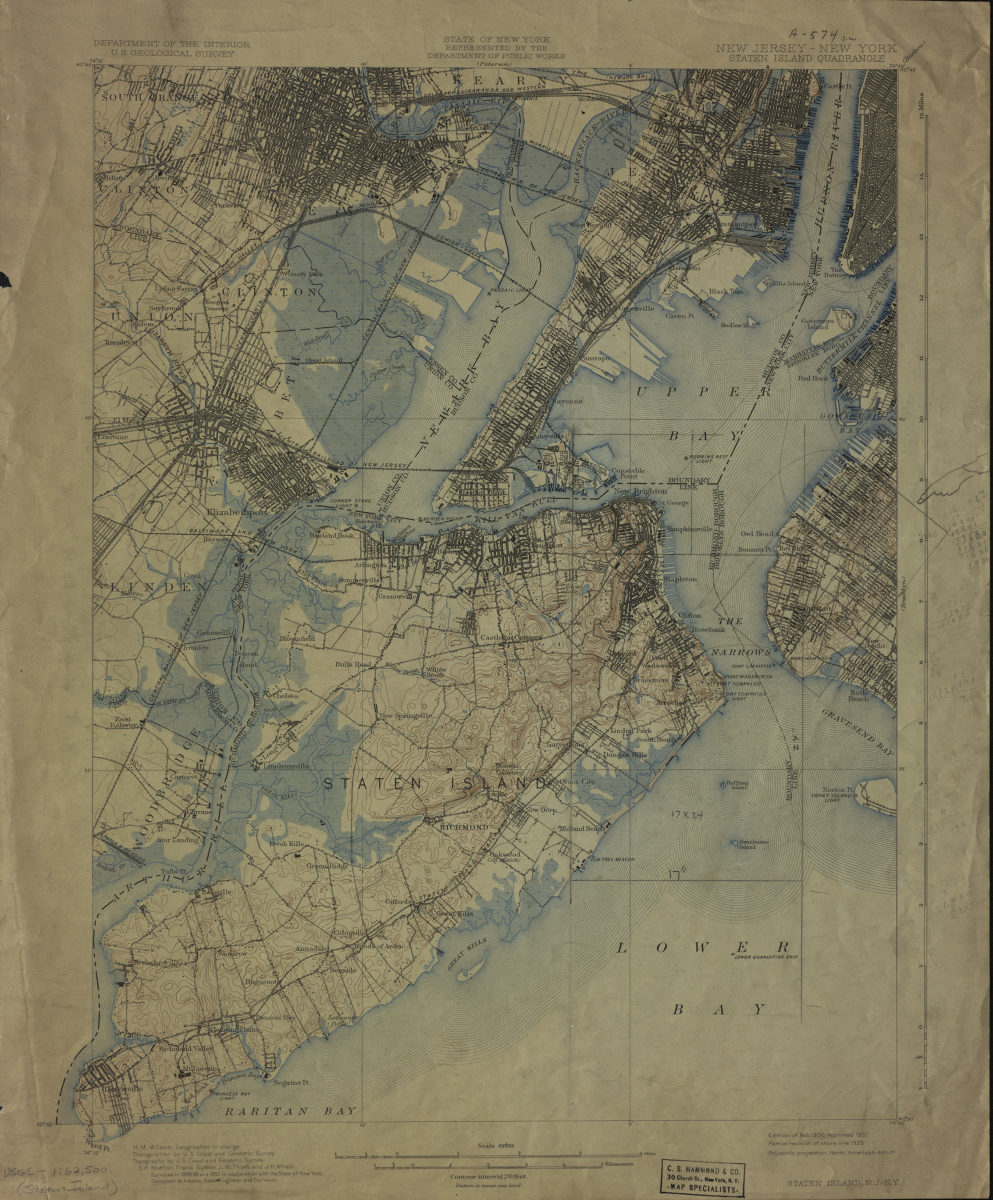
New Jersey- New York: Staten Island Quadrangle
New Jersey- New York: Staten Island Quadrangle
1900
[Map of Mahattan south of Central Park, eastern edge of Brooklyn, southwest edge of New Jersey, and the nothwest edge of Staten Island]
[Map of Mahattan south of Central Park, eastern edge of Brooklyn, southwest edge of New Jersey, and the nothwest edge of Staten Island]
[19??]
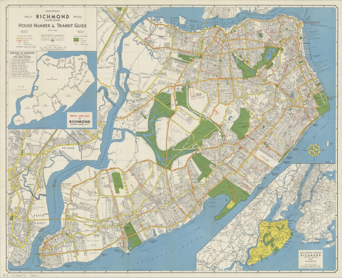
Hagstrom’s map of Richmond (Staten Island), N. Y. City: house number & transit guide: compiled, printed, and published by Hagstrom Company
Hagstrom’s map of Richmond (Staten Island), N. Y. City: house number & transit guide: compiled, printed, and published by Hagstrom Company
[1963]
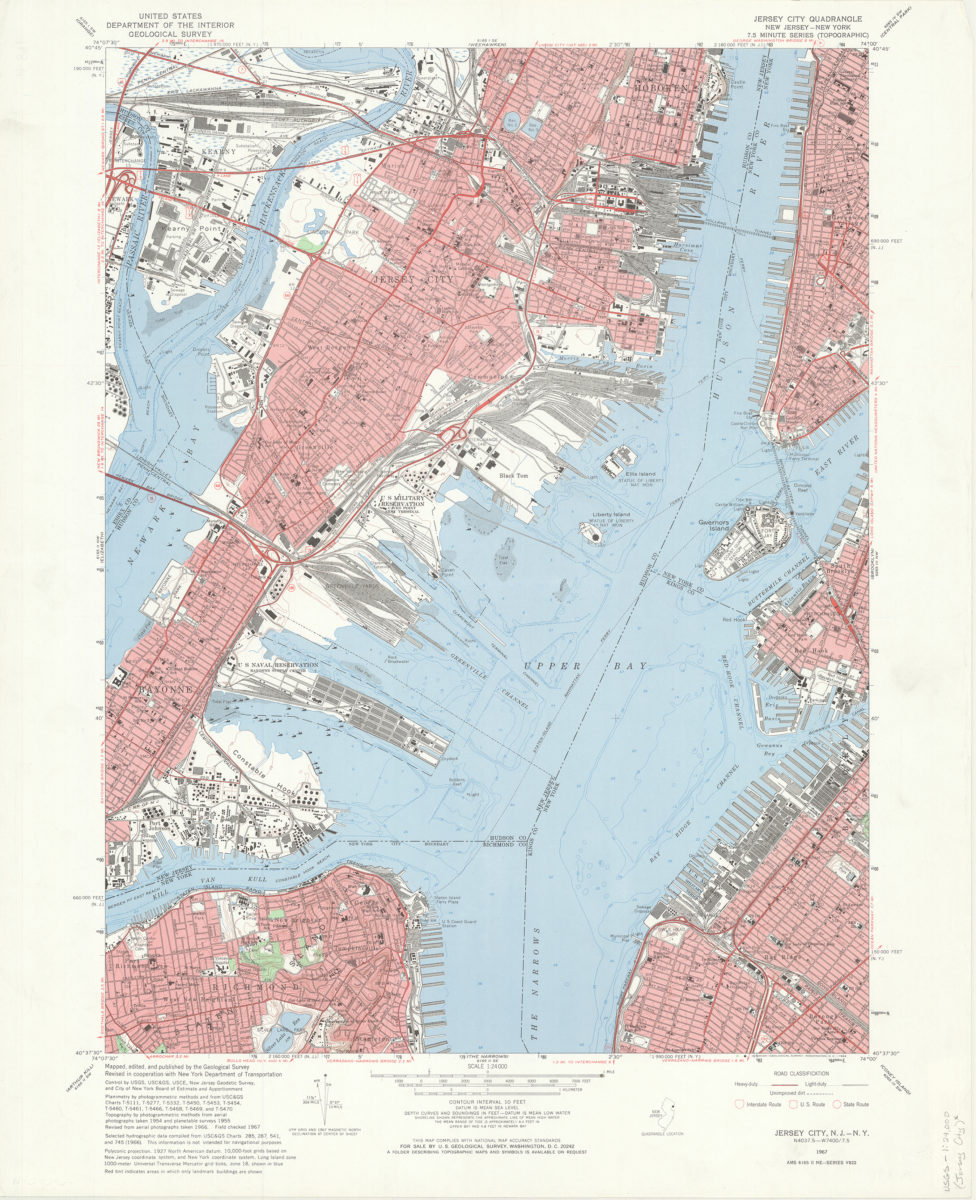
Jersey City quadrangle, New Jersey – New York: mapped, edited, and published by the Geological Survey ; revised in cooperation with New York Dept. of Transportation
Jersey City quadrangle, New Jersey – New York: mapped, edited, and published by the Geological Survey ; revised in cooperation with New York Dept. of Transportation
1967
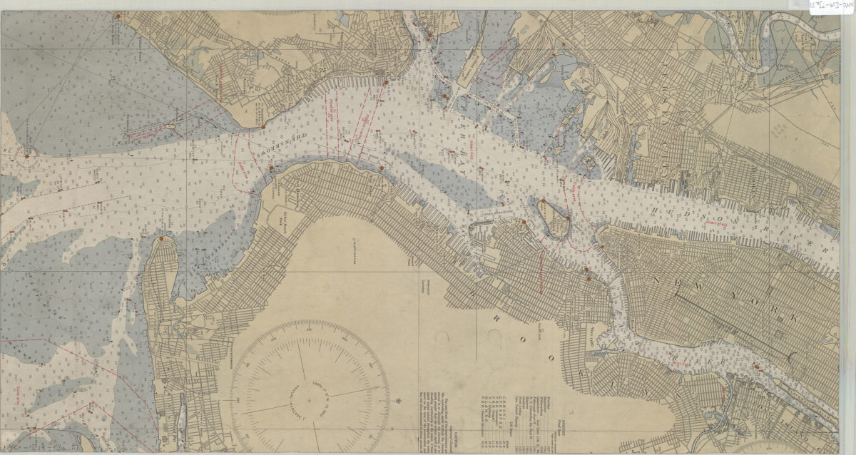
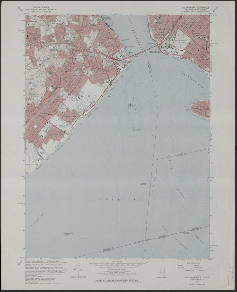
The Narrows quadrangle, New York–New Jersey: 7.5 minute series (topographic): mapped, edited, and published by the Geological Survey ; revised in cooperation with New York Department of Transportation
The Narrows quadrangle, New York–New Jersey: 7.5 minute series (topographic): mapped, edited, and published by the Geological Survey ; revised in cooperation with New York Department of Transportation
1968
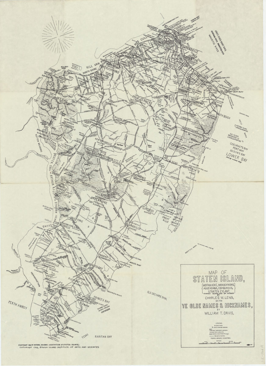
Map of Staten Island: Motanucke, Monocknong, Aquehonga, Eghquaous, Staaten Eylant, Cherry Island, Isle of Mines: by Charles W. Leng ; with ye olde names & nicknames by William T. Davis
Map of Staten Island: Motanucke, Monocknong, Aquehonga, Eghquaous, Staaten Eylant, Cherry Island, Isle of Mines: by Charles W. Leng ; with ye olde names & nicknames by William T. Davis
[ca. 1968]
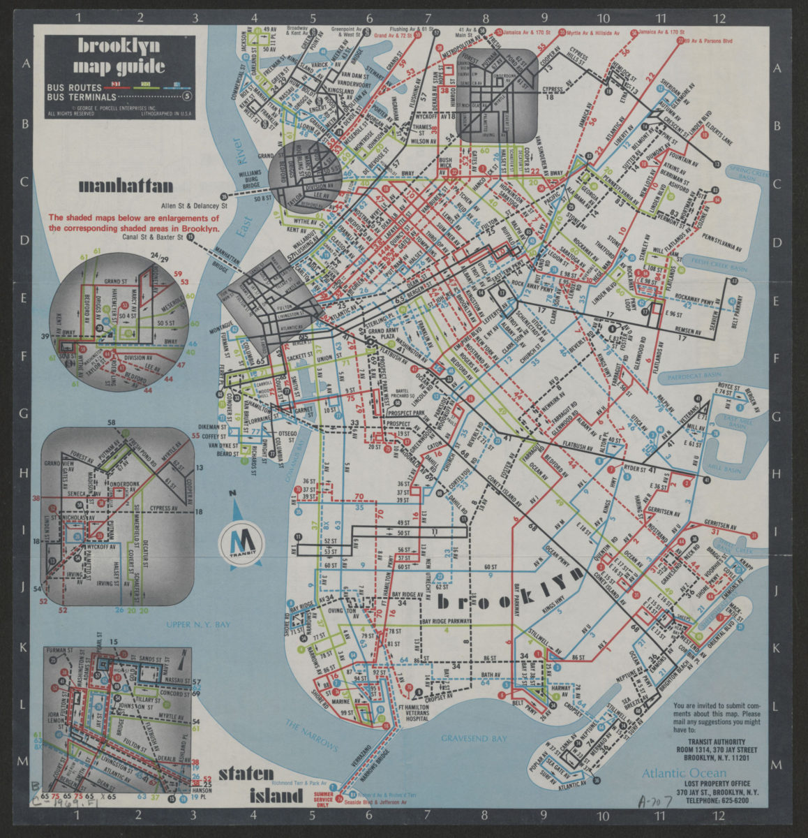
Brooklyn Staten Island bus map: M Transit
Brooklyn Staten Island bus map: M Transit
[ca. 1969]
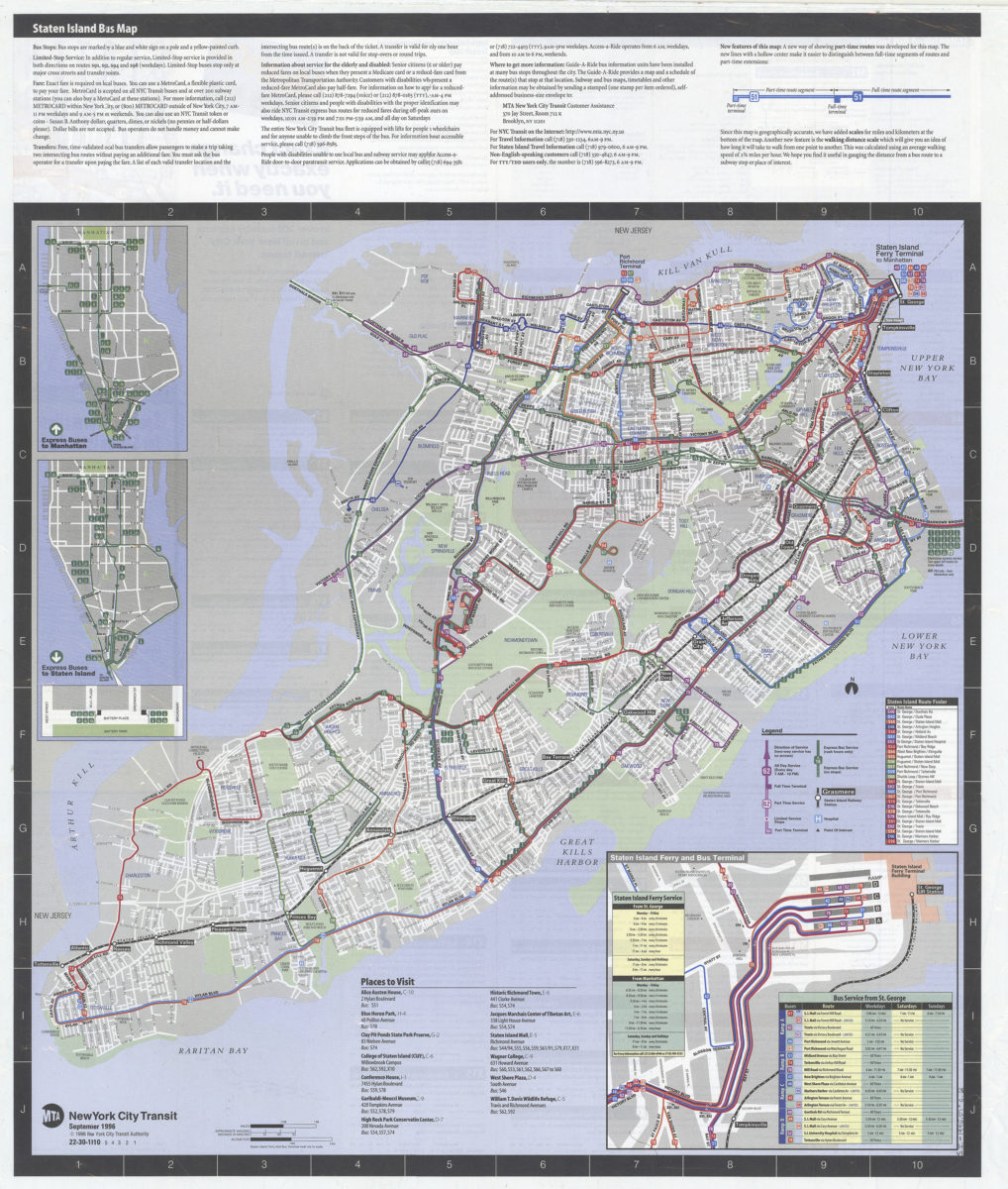
Staten Island bus map: MTA, New York City Transit
Staten Island bus map: MTA, New York City Transit
[ca. 1996]