Center for Brooklyn History
Map Collections
Search
About
Othmer Library & Archives
Submit search query
Refine 8 records
Clear filters
3
Location
Brooklyn (New York, N.Y.)
891
Canarsie (New York, N.Y.)
18
Cypress Hills (New York, N.Y.)
8
East New York (New York, N.Y.)
16
Flatlands (New York, N.Y.)
19
Fort Hamilton (New York, N.Y.)
31
Gravesend (New York, N.Y.)
25
New Lots (New York, N.Y.)
1
New Utrecht (New York, N.Y.)
9
Subject
Aqueducts
3
Farms
2
Landowners
434
Real property
619
Date
19th Century
945
20th Century
469
or enter range:
from
to
Genres
Cadastral maps
597
Manuscript maps
365
Sort by:
Date (earliest)
Date (most recent)
[Map of East New York Ave.].
[Map of East New York Ave.].
[18??]
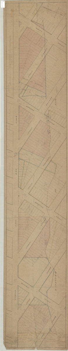
Rough sketch of route of acqueduct [sic] from Baisley’s Mill to … [text illegible] Mill at railroad, East New York
Rough sketch of route of acqueduct [sic] from Baisley’s Mill to … [text illegible] Mill at railroad, East New York
[185?]
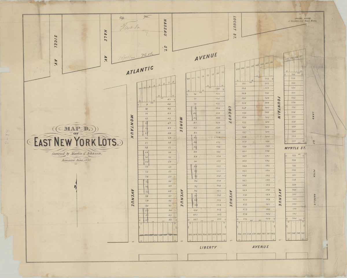
Map D of East New York lots: surveyed by Martin G. Johnson, Jamaica, June 1870
Map D of East New York lots: surveyed by Martin G. Johnson, Jamaica, June 1870
[1870]
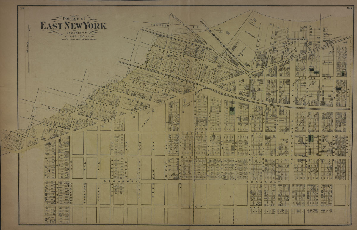
Portion of East New York, New Lots Tn., Kings Co., L.I.
Portion of East New York, New Lots Tn., Kings Co., L.I.
[1873]
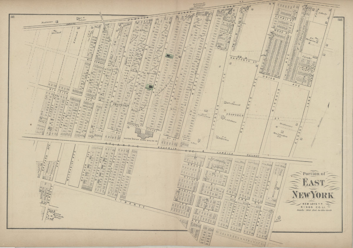
Portion of East New York, New Lots Tn., Kings Co., L.I.
Portion of East New York, New Lots Tn., Kings Co., L.I.
[1873]
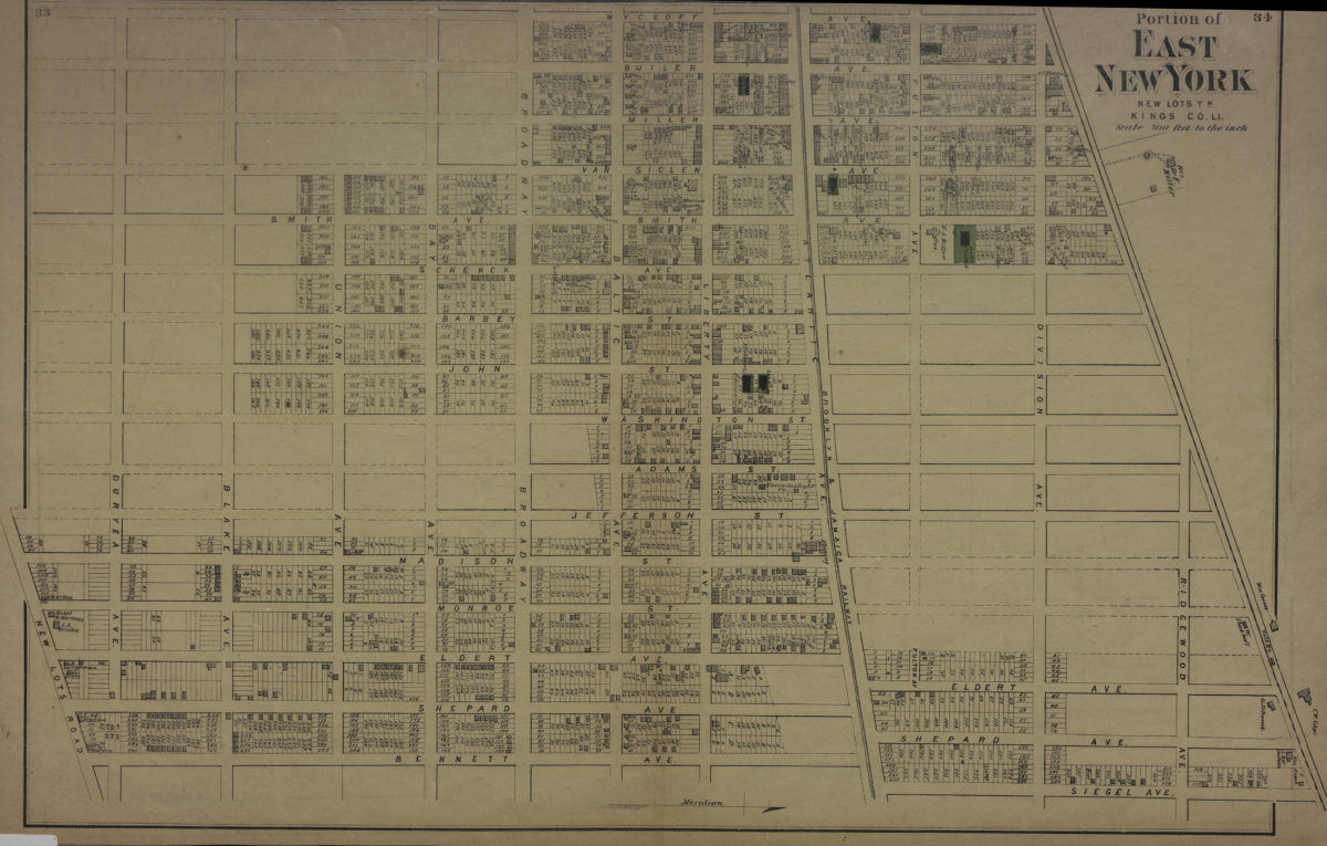
Portion of East New York, New Lots Tn., Kings Co., L.I.
Portion of East New York, New Lots Tn., Kings Co., L.I.
[1873]
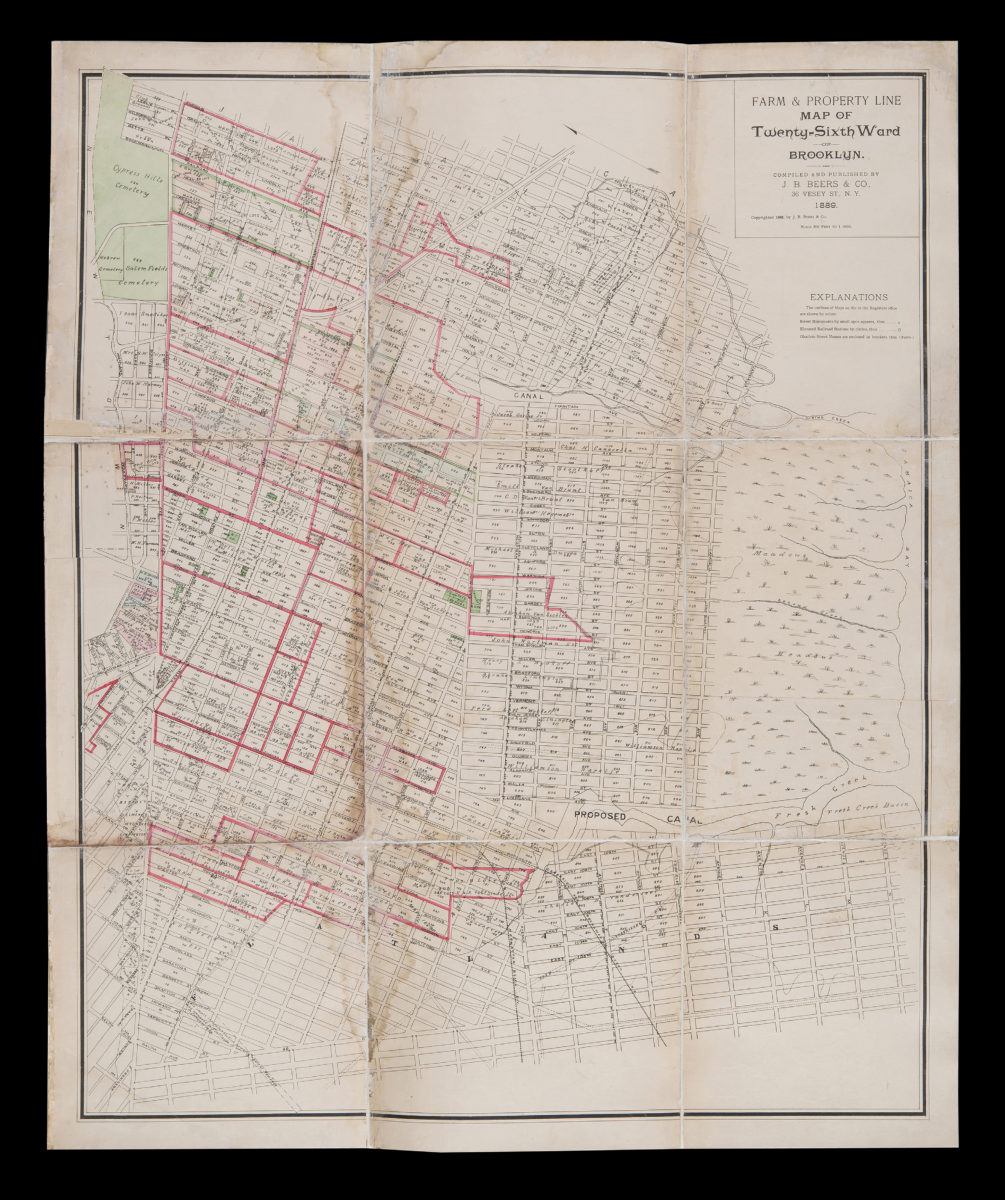
Farm & property line map of Twenty-sixth Ward of Brooklyn: compiled and published by J.H. Beers & Co
Farm & property line map of Twenty-sixth Ward of Brooklyn: compiled and published by J.H. Beers & Co
1889
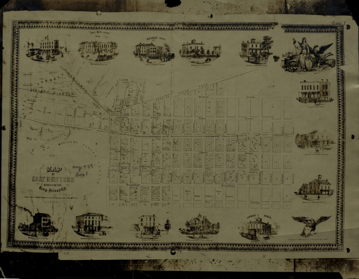
Map of East New York, Kings County, Long Island, N.Y.: compiled by C.W. Heftkamp from different surveys and maps made … by M.G. Johnson, Esqr
Map of East New York, Kings County, Long Island, N.Y.: compiled by C.W. Heftkamp from different surveys and maps made … by M.G. Johnson, Esqr
[19??]